Marmaris Pictures
Marmaris Castle: The castle, which is claimed to have been built by the Ionians, was repaired during the reign of Alexander the Great and was greatly expanded and repaired by Suleiman the Magnificent during the Rhodes campaign (1522). It is possible to watch an extraordinary panorama of Marmaris from the castle day and night.
Taşhan and Arched Bridge: Taşhan in İskelebaşı district (10 km. from Muğla road) was built by Suleiman the Magnificent, according to its inscription, together with its masonry arched bridge.
Ancient Cities
Physkos: It is possible to see the ruins of Physkos, an important port city of the ancient Caria region, on the Asar hill in the north of Marmaris. The city walls on these ruins (Acropolis) have preserved their existence until today.
Loryma (Bozukkale): The town of Loryma, which is connected to Kasara, one of the Rhodes demes, was founded in the Bozuk bay at the south-west end of the Bozburun peninsula, in the region previously known as Oplosika (tophane) buku. The most impressive structure in the settlement is the well-preserved fortification located on Burunbaşı overlooking the entrance of the bay. There are nine rectangular towers on the edges of this island of Rhodes, built with smooth cut stone masonry.
Today, only the cantilever tower in the north can be seen.
Amos: It is possible to reach the ancient Amos ruins from the northwest of Kumlubük Bay, from the hill called Asarcık in the south of the steep coast. Amos consists of a theatre, temple and some statue bases located on a hill.
Amos is surrounded by a city wall dating from the same period. The Amos Theatre, which is the second of the three theaters on the opposite bank of Rhodes, is in a very good condition today. It is possible to distinguish three rooms of the seat, side wall and stage house. Prof. During his excavations in the region (1948), E. Bean unearthed four inscription fragments dealing with the terms of three separate lease agreements dating back to around 200 BC.
Cedrae: (Cleopatra or city islands) Saray Island (Cleopatra Island), one of the City Islands consisting of three islands: Middle Island and Small Island. There is an old Cedrae ruins dating back to the Roman period on Saray Island. The ruins of the walls can be easily distinguished from afar.
In the small bay on the northwestern side of the island, there is a very interesting beach where it is rumored that Cleopatra swam. According to legend, this small bay is the place where Cleopatra and Mark Antony bathed, and the sand of this place was brought by Antonius from North Africa by ships. It is said that this type of sand can only be seen in Egypt today.
The ruins of buildings surrounded by walls in the eastern part of the palace island date from the Roman period. The Small Theater building is in the best condition. A Christian basilica was built in the following centuries on the foundations of the Dorian temple of Apollo. There is an Agora in the western part of the palace island. It is understood from some inscriptions that athletics festivals were held in honor of Apollo in this region.
The ruins of the necropolis on the small island, other findings and the reliefs of the column can be seen on the island.
Hydas: 35km from Marmaris on the Erine – Bybassios road route. There are city walls ruins in Hydas, located at a distance, and a square-planned tomb monument is located to the south of these ruins. 3 km from Hydas. In the distance, there is a lookout tower on the beach and a few graves on this tower. The ancient town of Hydas was founded in Selimiye Bay (Kamışlı Bay) in the north of the Bozburun peninsula.
Erine: When you turn south towards Bozburun at the 20th km of the road extending from Marmaris to Datça in the southwest, you can reach Hisarönü village via a 2 km asphalt road. The ancient ruins can be reached from here via a 3 km stabilized forest road. There are ruins from the Roman period in Erine.
Castabus (Pazarlık): This ancient ruin is located in Pazarlık locality near Hisarlık village. This sacred place on Mount Eren can be reached by a one-hour climb from the Hisarönü plain. The temple is located on the platform built for it. B.C. The building in the Ionic order, dating from the 4th century, also contains Doric elements. On the platform, the temple foundation can be seen.
The striking walls supporting the platform have survived to this day. The ruined theater located in the southern area is the only identifiable structure in the region, together with the temple.
Saranda (Söğüt): 45km from Marmaris. away, near today’s Söğüt village. Saranda, which continued to be a settlement throughout the Roman and Byzantine periods, has a few building ruins from the late Byzantine period.
Bybassios: On the Erine road, continuing in the direction of Bozburun, you come across the ruins of the ancient city of Bybassios. Today’s Orhaniye village was built on the slope of the hill where the ruins are located. The city’s city wall ruins are located in a scattered area within the forest.
Euthenna (Altınsivrisi): In the region west of the Cedrai-Marmaris line, there are two important towns connected to Rhodes in ancient times. The reinforced walls surrounding the settlement area are in very good condition. On the shore, an extension of the ancient pier built in the style of a borage cut stone wall is encountered. You can go to this ruins via the Karacasöğüt village road.
Tombs and Mosques
Sarıana Tomb: The tomb is located in the Sarıana neighborhood, overlooking the city from a bird’s eye view from the northeast. There is a new mosque next to it. Before setting off on his Rhodes expedition, Suleiman the Magnificent visits Mother Fatma (Sarıana), famous for her prophecies, here. After receiving a positive response, he begins the siege of Rhodes. Before departing from Marmaris, thousands of Ottoman soldiers set out on a campaign by having breakfast with milk milked from Sarıana’s cow.
İbrahim Ağa Mosque: It was built by İbrahim Ağa in 1789 in the Kemeraltı neighborhood. The large dome on it attracts attention in terms of architecture.
beaches
Paradise Island: The island, which can be reached with a 30-minute journey from Marmaris, is actually a peninsula and completely covered with forests. Paradise Island, where service units such as hostels and restaurants are available, is frequented by tour boats throughout the season and is a suitable area for swimming and entertainment.
Phosphorous Cave: This natural cave, which is frequented by tour boats to Turunç and Kumlubük, provides the opportunity to swim in green and turquoise waters that resemble an aquarium.
Icmeler: 10 km from the town. Located at a distance from Icmeler, it is one of the few tourist resorts with its touristic facilities, beaches and entertainment venues, and also attracts attention with its drinking water that is good for the digestive system.
Turunç: 21 km from Marmaris. It is possible to reach the village of Turunç, located at a distance, both by sea and by road. Known to be an old fishing town, the village today attracts great attention from local and foreign tourists with its touristic facilities with all kinds of comfort, hostels and arbor restaurants.
Kumlubük: It is possible to reach Kumlubük, which can be reached by a 6 km road from Turunç, by sea from Marmaris. The region, where green and blue intertwine, is one of the most popular beaches in the region with its clean sea and wonderful sand.
Çiftlik: It is possible to reach Çiftlik village, which can be reached by sea in a 2-hour journey, via Bakır village. It is a bay preferred especially by yachtsmen for accommodation, with its large sandy beach and gazebo restaurants. The village, which has a small island in the bay, is also preferred by those who go on safari tours with jeep type vehicles.
Günnücek: 2 km from Marmaris. In Günnücek, located 15 km away, there is a Liquidamber orientalis forest, which is very rare in the world. Frankincense oil obtained from these trees is used in the pharmaceutical and perfumery industries.
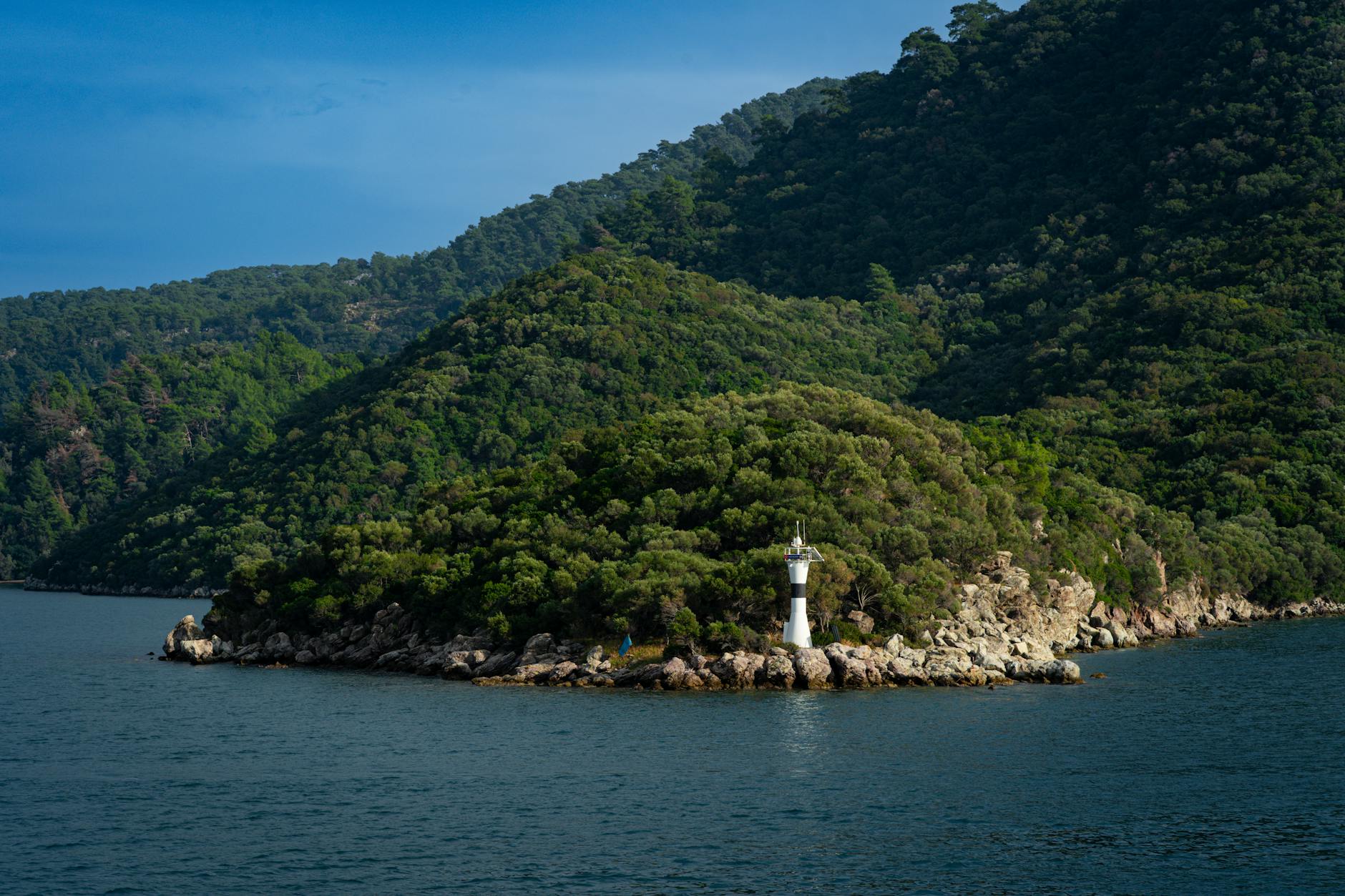
Yalancı Boğaz: 8 km from the town. This piece of land at a distance was named “The False Bosphorus” after a ship captain mistook it for the strait opening into the bay in a stormy weather and ran his ship aground. This region, where wood-made Gulet shipyards are located, is one of the must-see places.
Recreation Areas
Turgut (Waterfall): 35 km from Marmaris. The water of the waterfall, which can be reached with a 15-minute walk from the road to Turgut village, flows from a height of 10 meters.
Bozburun: 50 km from Marmaris. The village to the west is a village where buses always stop and is famous for its pine, flowers and thyme honey. There is a majestic tree, approximately 1000 years old, which is one of the monumental trees of our country. The International Bozburun Gulet Festival is celebrated in the village between 26 October and 28 October.
Yachting
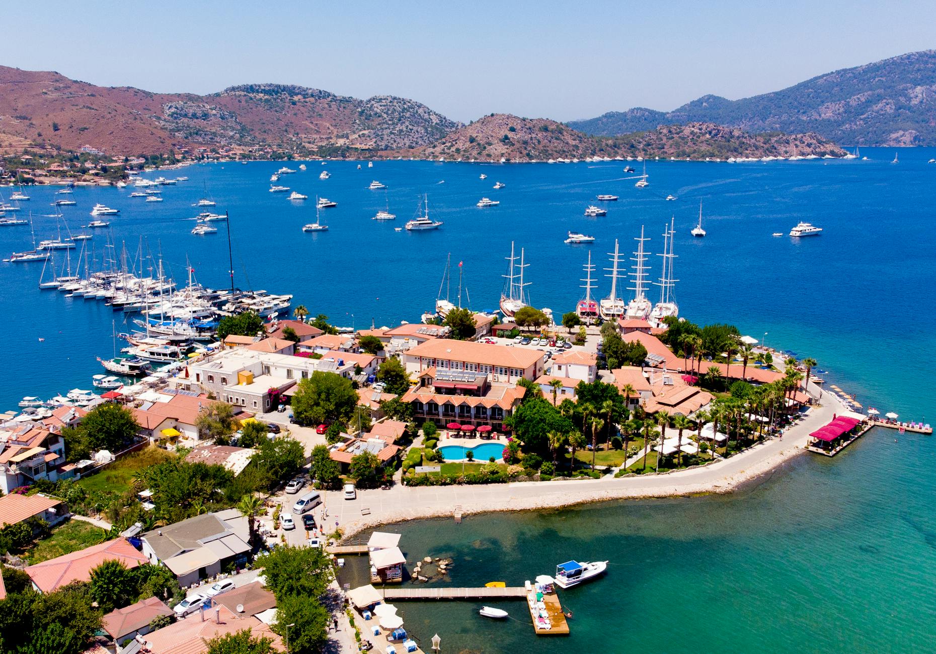
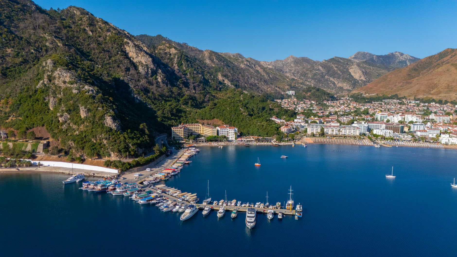
Marmaris Bay, which is a natural harbour, has three marinas with a capacity of 1100 and 9 yacht docks with a capacity of 1200 yachts. Various festivals are organized to develop yacht tourism in the region, which is at the focal point of the blue voyage. We can count the International Yacht Festival and the International Marmaris Yacht Races among the main events of the region.
You May Like

Aspendos Ancient Theater Travel Guide