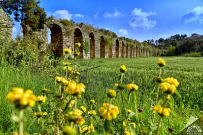
Arykanda Ancient City is located within the borders of Arif village in Finike district of Antalya. “Ary-ka-wanda” means “place next to the high cliff” in Lycian language. The fact that the name of the city philologically reflects the native Anatolian language shows that it is one of the oldest settlements in the Lycia region.
Late Chalcolithic-Early Bronze age axes unearthed in Limyra and Patara, as well as Arykanda, generally indicate that this region was densely inhabited. However, BC. Based on the findings other than the stone ax dating back to the 2nd millennium BC, it is difficult to date the city before the 5th century BC. While the coins of the local lords Kuprili and Aquwami, dating back to the 5th century BC, reflect Arykanda during the Persian rule, this is followed by the coins of Limyra Lord Pericles, dating back to the 4th century BC. According to this situation, Arykanda must have remained under the rule of Limyra for a while and changed hands with Alexander. It is known that after the death of Alexander, Arykanda, like other cities of the region, fell into the hands of the Ptolemies and then the Seleucids, and after the Peace of Apemea (Dinar) it came under the control of Rhodes.
General Directorate of Promotion Archive
In the 2nd century BC, Arykanda minted coins as a city included in the Lycian League. In 43 AD, when Emperor Claudius ended the Lycian Union, the Lycian region became a province along with Pamphylia and was annexed to Rome. The 2nd century AD is a period when the name Arykanda is mentioned frequently by various sources. The city, which was partially repaired after the great earthquake in 240, was called “Akalanda” or “Orykanda” during the Byzantine rule. It is possible that Arykanda, which we know existed until the 11th century based on ruins and Byzantine sources, changed location after this date and moved to the south of today’s highway.
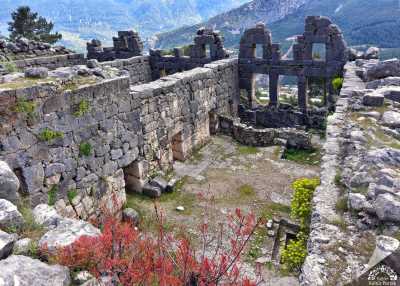
The city of Arykanda is located on a land sloping towards the south, starting from the bottom of a steep rock surface known as Şahinkaya. The building at the highest level in the city is the watchtower at the southwestern foot of Şahinkaya. The triangular acropolis to the south of the tower is thought to be the first settlement of the city. To the east of this area is the bouleuterion (parliament building) and to the north of the three shops to the east is the Helios Temple, built in the name of the Sun God in the 4th century BC.
General Directorate of Promotion Archive
After the watchtower, the other highest-level structure of the city is the stadium built in the 1st century AD. There are rows of seats on one long side, and the other long side opens onto the hillside. On the terrace below is the small but best preserved theater of the region. On the lowest terrace, you can see the odeon, which also functions as an agora and a parliament building. The gymnasium, located in the southeast of the city, is located right next to the bath and gives the appearance of a bath-gymnasium.
The burial area, called the “Eastern Necropolis” of the city, attracts attention with its monumental graves, many of which have survived. All of the mausoleums that serve as terraces date back to the 2nd century AD, and the bathhouse that has survived up to the roof level on the terrace below them is one of the well-preserved structures of the city. The city’s water needs were met by facilities that showed great skill and water engineering. The channels at four different levels carved into the steep rock surfaces where Aykırıçay originates form the outlines of the system that brings water to the city.
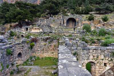
The ruins, which are arranged in gradual terraces due to their location, have a panoramic view of the entire valley as well as historical buildings. Arykanda is among the “Ancient Cities of the Lycian Civilization” (2009) recommended to the UNESCO World Heritage List.
Source: Arykanda Ruins, Antalya Museum Directorate.
Places to Visit in Antalya
Source: Antalya Provincial Culture and Tourism Directorate