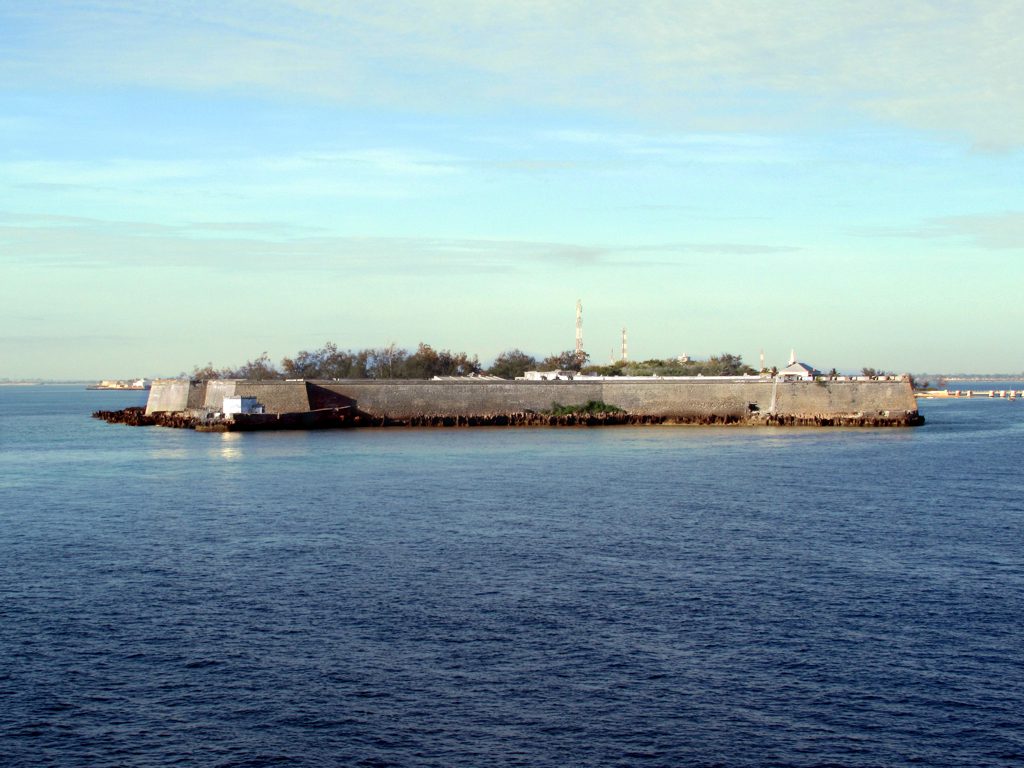
Imagine a long, narrow sliver of coral and stone, barely three kilometres from end to end, lying in the warm blue water off the coast of northern Mozambique. It is so small you can walk its length in an afternoon, and yet for nearly four centuries this speck of land was the capital of a Portuguese empire that stretched across the Indian Ocean. At its northern tip stands the reason it mattered so much: the vast, weather-beaten bulk of Fort São Sebastião, the oldest complete fort still standing anywhere in sub-Saharan Africa.
The Island of Mozambique gave a whole country its name, and the fort gave the island its spine. When you stand on the fort’s ramparts today, with the ocean stretching away on three sides, you are standing on the hinge of a global trade route. Ships bound for India, Arabia, and the spice ports of the East all needed a safe harbour on the long haul around Africa, and this island was it. Whoever held the fort held the sea road.
In this guide you will walk through the whole story: how a Swahili trading island became the linchpin of Portugal’s eastern empire, why it took half a century to build the fort, how it survived ferocious Dutch sieges, what the extraordinary little chapel beside it represents, and how the island faded into a hauntingly preserved museum of stone. It is one of the great forgotten places of the Indian Ocean, and it repays a slow, curious visit.
Keep one image in your mind as you read on. This is a place where a five-hundred-year-old Portuguese chapel, a colossal coral-stone fort, a mosque, a Hindu temple, and grand Indian and Arab merchant houses all stand within a few minutes’ walk of one another, on an island so small it barely registers on a map. That density of history, layered and tangled and remarkably intact, is what makes the Island of Mozambique unlike almost anywhere else on earth.
In This Article
- The Island Before the Portuguese
- Why This Speck of Land Mattered So Much
- Fifty Years to Build a Fortress
- Walking the Ramparts: The Anatomy of the Fort
- The Oldest European Building South of the Equator
- Holding Off the Dutch
- The Secret of Survival: Water
- The Stone Town and the Capital of an Empire
- Gold, Ivory, and the Shadow of Slavery
- Life Inside the Walls
- The Slow Fade of a Once-Vital Port
- A Museum Island and World Heritage Site
- Visiting the Island of Mozambique Today
The Island Before the Portuguese
Long before any European sail appeared on the horizon, the Island of Mozambique was already a working part of the Swahili trading world. Settled by the fourteenth century by people connected to the great coastal cities further north, including Kilwa, it was a modest but well-placed harbour in the network of monsoon-driven commerce that bound the East African coast to Arabia, Persia, and India. Its inhabitants were Muslim, seafaring, and thoroughly plugged into the ocean economy.
The island even lent its name to a whole nation. The commonly repeated account holds that the Portuguese named the place after a local ruler, an Arab sultan called Ali Musa Mbiki, whose name was gradually reshaped by Portuguese tongues into Moçambique. From that one small island, the label eventually spread to the entire territory that became the modern country of Mozambique, a striking legacy for such a tiny piece of land.
When the Portuguese arrived at the very end of the fifteenth century, they were not discovering an empty rock. They were muscling their way into an existing, sophisticated commercial system that had functioned for centuries without them. Understanding that is essential, because the fort you visit today was not built to tame a wilderness. It was built to seize and hold a prize that was already valuable, already busy, and already claimed.
It is worth lingering on how deep this pre-Portuguese history runs. The island’s Muslim, Swahili-speaking community was part of a coastal civilisation that had been trading across the Indian Ocean for the better part of a thousand years, exchanging African gold, ivory, and other goods for cloth, ceramics, and beads from Arabia, Persia, India, and beyond. The Portuguese did not bring the island into world trade; they found it already there and forced their way to the head of the table.
Why This Speck of Land Mattered So Much
To understand the fort, you have to understand the problem it solved. When Vasco da Gama opened the sea route from Europe to India around the tip of Africa, he created a lifeline that was thousands of miles long. A ship leaving Lisbon for the spice ports of the East faced a brutal, months-long voyage, and somewhere along the East African coast it desperately needed a secure place to take on fresh water, repair storm damage, and wait out the seasons of the monsoon.
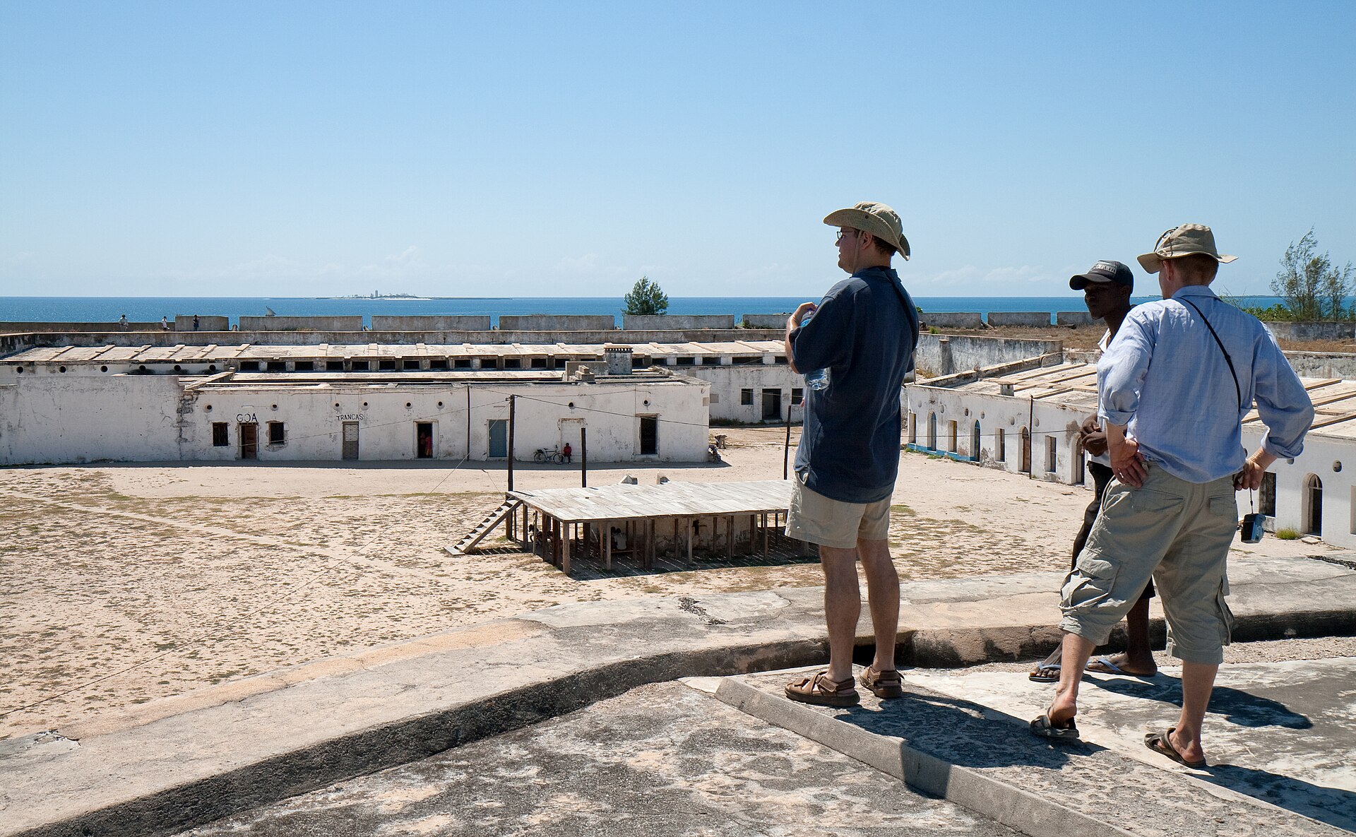
The Island of Mozambique was almost perfectly positioned for this role. It offered a sheltered harbour, it sat at a natural pause point on the long haul between the Cape and India, and being an island it was far easier to defend than a mainland port exposed to hostile neighbours. For the Portuguese crown, controlling this one anchorage meant controlling the rhythm of the entire eastern trade.
So the island became a naval base, a provisioning station, a hospital for scurvy-ridden crews, and a fortress guarding the whole system. The fort was not a vanity project or a mere colonial flag-planting. It was the strongpoint on which an ocean-spanning trade network depended, and its sheer size reflects exactly how much the Portuguese believed was at stake.
The seasonal rhythm of the monsoon made a secure mid-route harbour even more essential. Ships could only sail in certain directions at certain times of year, which meant crews often had to wait weeks or months for the winds to turn. A fortified island where they could shelter, resupply, and repair in relative safety during that enforced pause was worth almost any investment, and the Portuguese crown was prepared to make it.
There is a neat symmetry in the island’s role. Just as the Swahili towns had thrived by serving as intermediaries between the African interior and the ocean trade, the Portuguese now made the island the intermediary between Europe and the East. The middleman logic was the same; only the players had changed. The fort was the physical expression of Portugal’s determination to insert itself, by force if necessary, into a system that had run smoothly without any European involvement for centuries.
Fifty Years to Build a Fortress
Construction of Fort São Sebastião began in 1558, and it did not finish quickly. It took roughly half a century to complete, a testament both to the ambition of the design and to the sheer difficulty of building something this massive on a remote island at the far end of a supply line that ran all the way back to Portugal. Every specialist, every tool, and much of the know-how had to travel across oceans to get there.
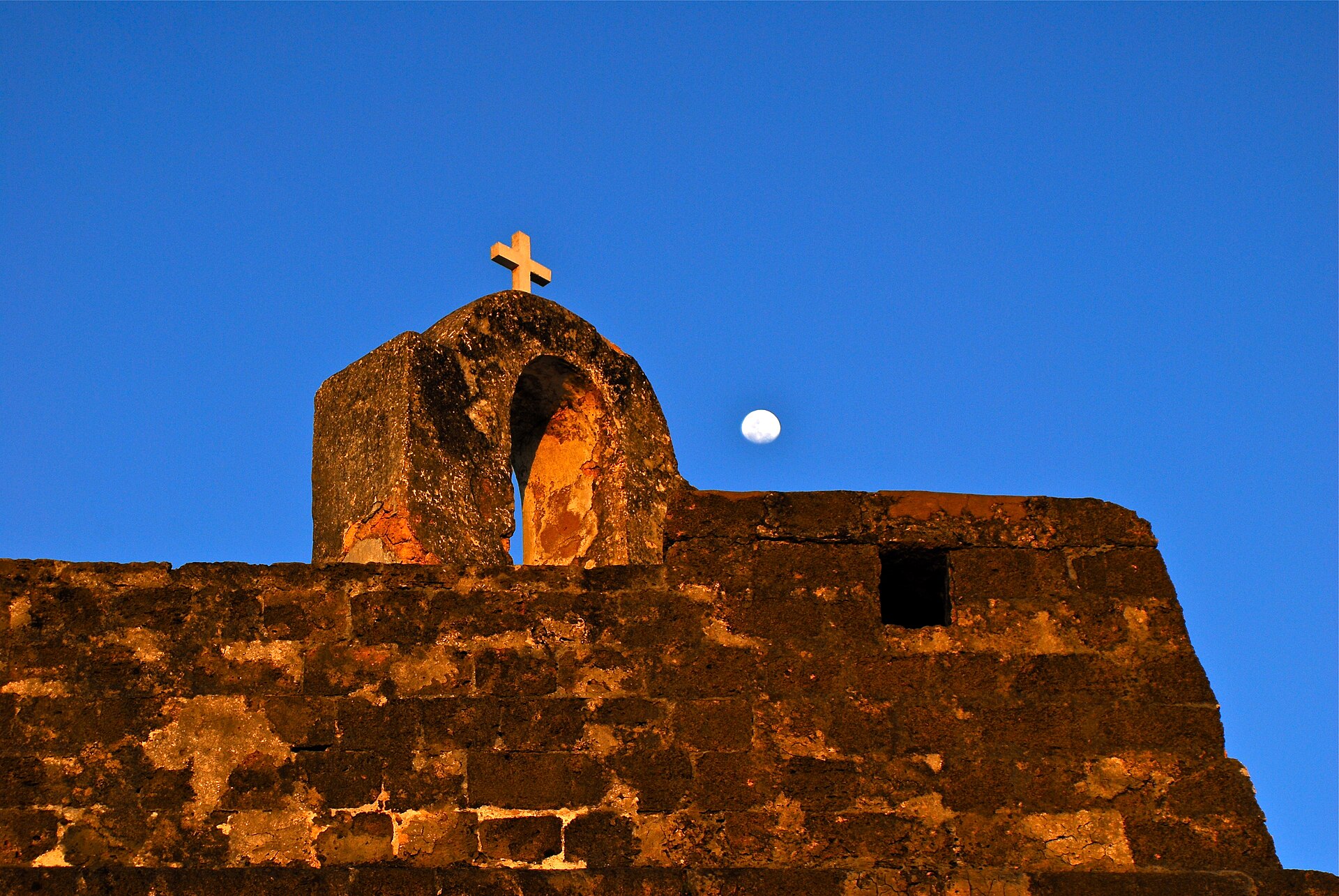
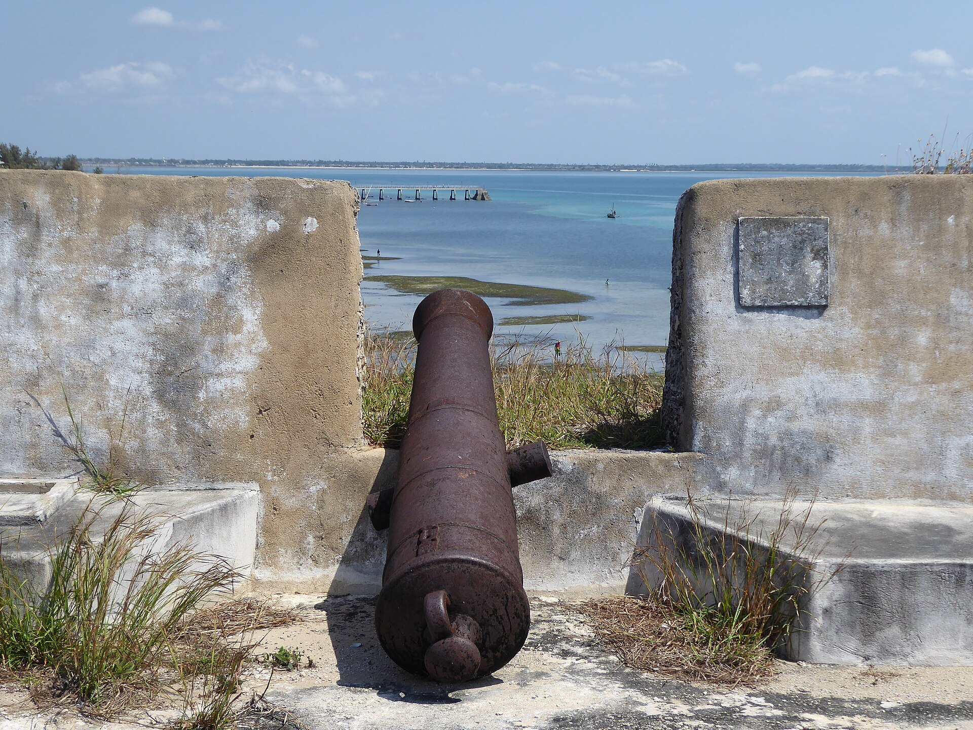
The fort was built largely of coral stone, quarried from the surrounding reefs and set into thick, sloping walls designed to absorb cannon fire. This was the era when European fortification was being revolutionised by the threat of gunpowder artillery, and São Sebastião reflects the new thinking: low, massive, angular walls rather than the tall thin curtains of a medieval castle, shaped to deflect shot and to allow defenders to sweep every approach with their own guns.
The result was the largest fortification the Portuguese built south of the Sahara, and it remains the oldest complete fort still standing in sub-Saharan Africa. That superlative is worth pausing on. Across a vast region and five centuries of turbulent history, this is the one that endured intact, and its survival is a large part of what makes the Island of Mozambique such an extraordinary place to visit.
The long construction period also meant the fort evolved as it was built, incorporating the latest ideas in military engineering as they arrived from Europe over the decades. What began under one set of assumptions was completed under another, and the finished structure reflects the accumulated experience of half a century of Portuguese fortress-building across their sprawling network of overseas bases, from Morocco to India.
To grasp the scale of the achievement, picture the logistics. Master masons and military engineers had to be recruited and shipped out, iron tools and specialist materials carried across the sea, and a workforce organised and fed on a small island year after year, all while the ordinary business of a busy trading port carried on around the building site. The fort is not just a monument to Portuguese ambition but to the extraordinary reach of their maritime organisation.
Walking the Ramparts: The Anatomy of the Fort
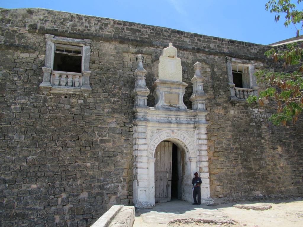
Spend some time actually walking Fort São Sebastião and its logic starts to reveal itself. The design belongs to the family of the bastioned fort, the cutting-edge military architecture of the gunpowder age, in which projecting corner bastions let defenders fire along the length of the walls and catch any attacker in a deadly crossfire. There are no blind spots for an enemy to shelter in, which is exactly the point.
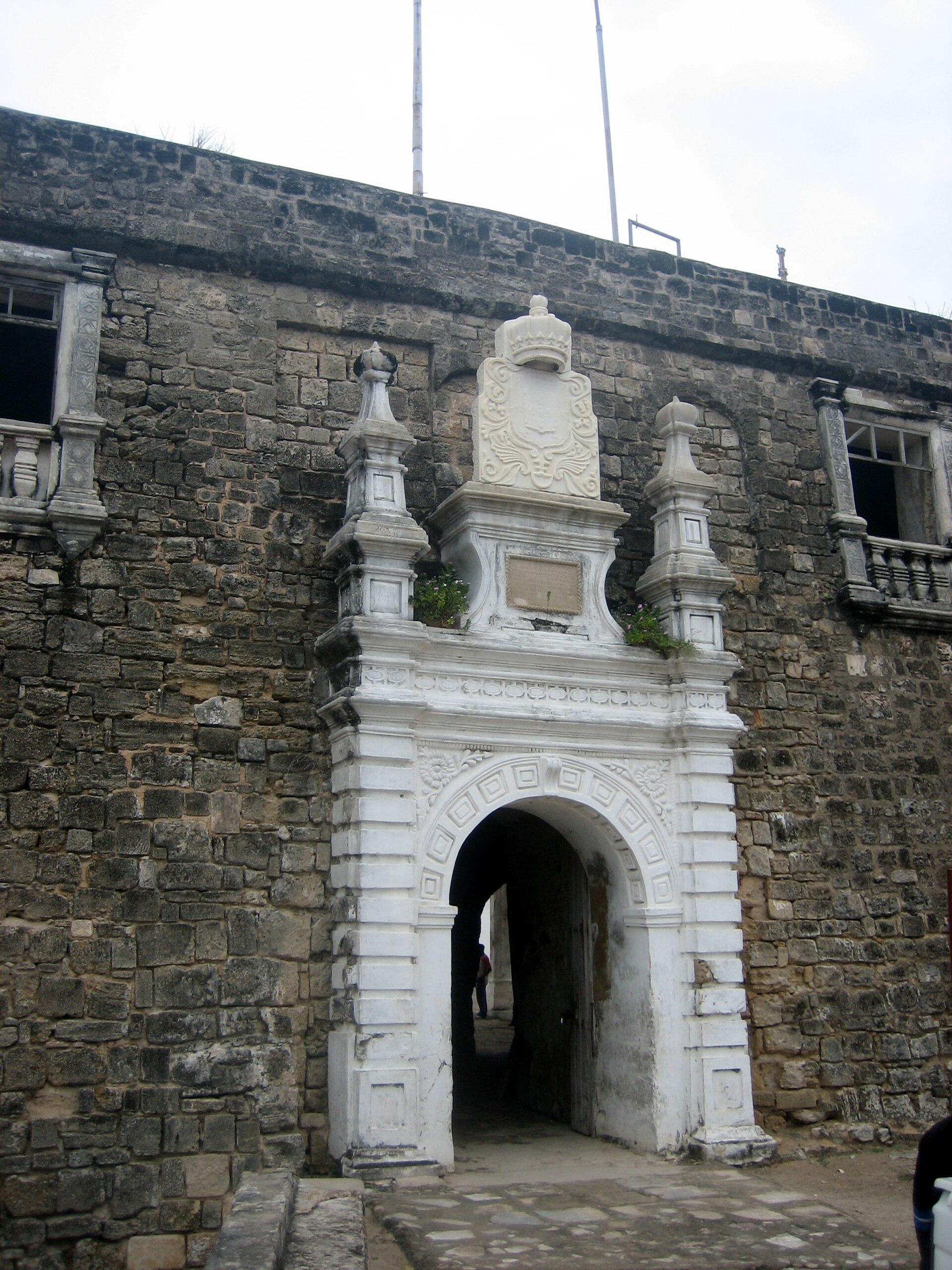
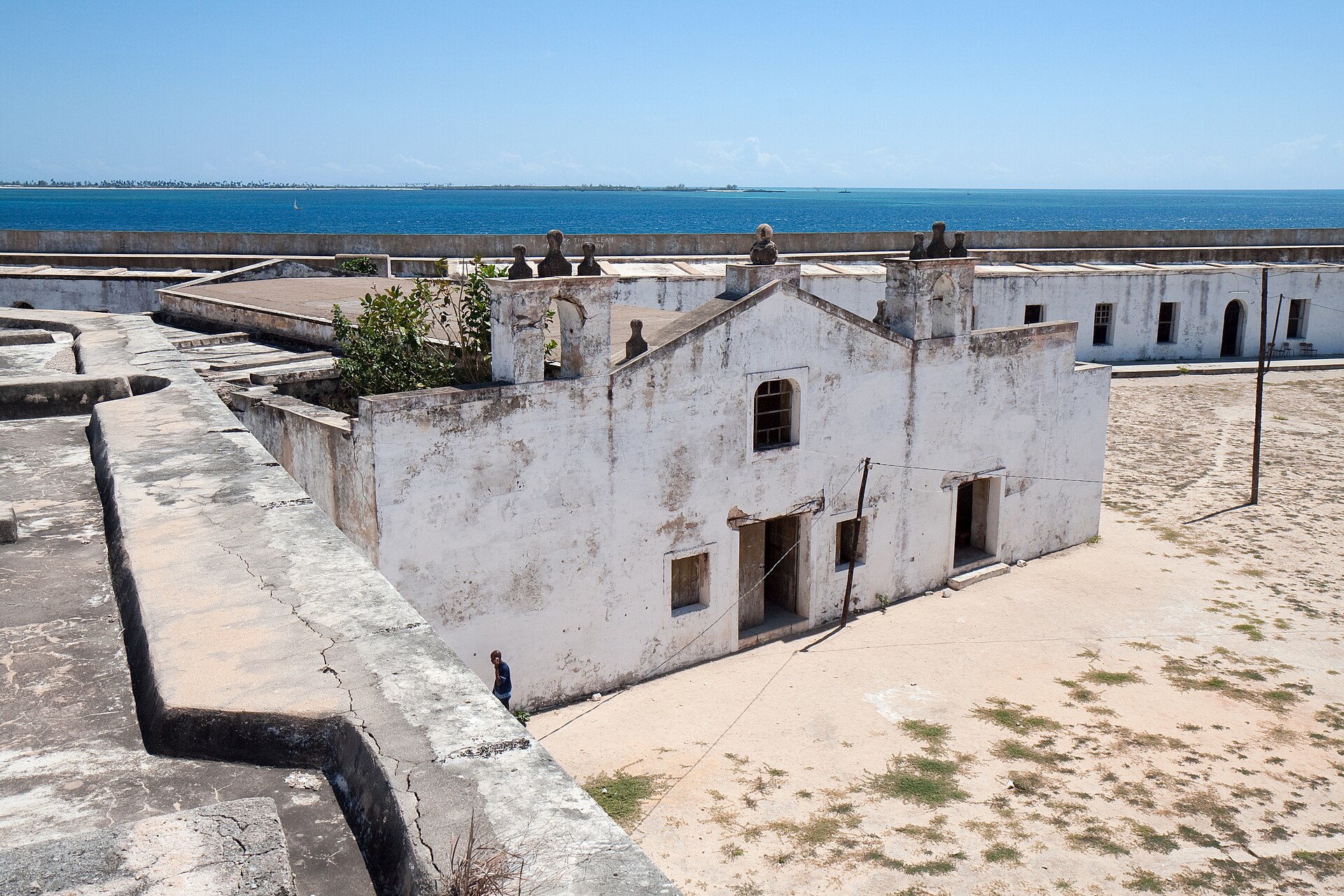
The walls themselves are thick and built to endure, their coral stone shaped to soak up bombardment rather than shatter. Inside the enclosure the fort was a self-contained world, with barracks, storerooms, a chapel, a garrison church, and the all-important cisterns, everything a defending force needed to live and fight without stepping outside the gates. It was designed to be a community that could seal itself off and survive.
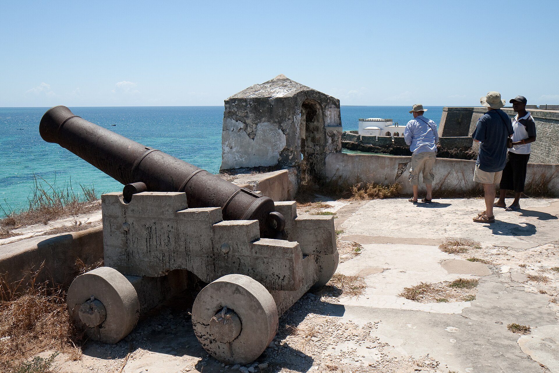
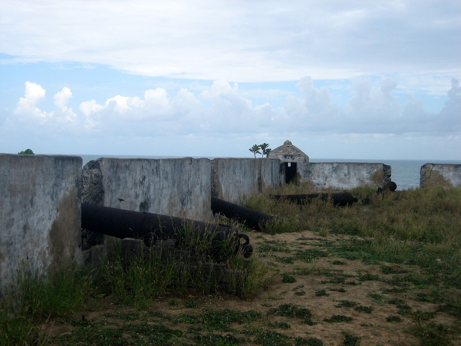
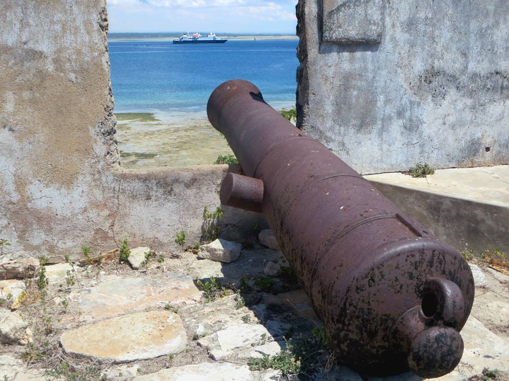
From the ramparts the strategic genius of the location becomes obvious. The sea stretches away on almost every side, the harbour lies within the fort’s protective reach, and any approaching ship would have to run a gauntlet of cannon fire. Standing there with the wind off the Indian Ocean, you can read the whole purpose of the place in a single sweeping glance: this was a lock on the door of an ocean, and the door stayed shut.
Restoration and study continue to reveal how carefully the whole thing was thought through. In recent years detailed three-dimensional laser scanning has recorded the fort in extraordinary precision, capturing every wall and bastion for research and conservation. That modern documentation confirms what the eye suspects on the ramparts: this was a sophisticated, deliberately engineered machine for controlling a stretch of ocean, not a rough improvisation.
The Oldest European Building South of the Equator
Just beyond the walls of the fort, at the very tip of the island, stands something even older and, in its quiet way, even more remarkable: the Chapel of Nossa Senhora do Baluarte. Built in 1522, decades before the fort itself, this small whitewashed structure is widely described as the oldest European building still standing in the southern hemisphere. It is a genuinely startling claim to encounter on a tiny African island.
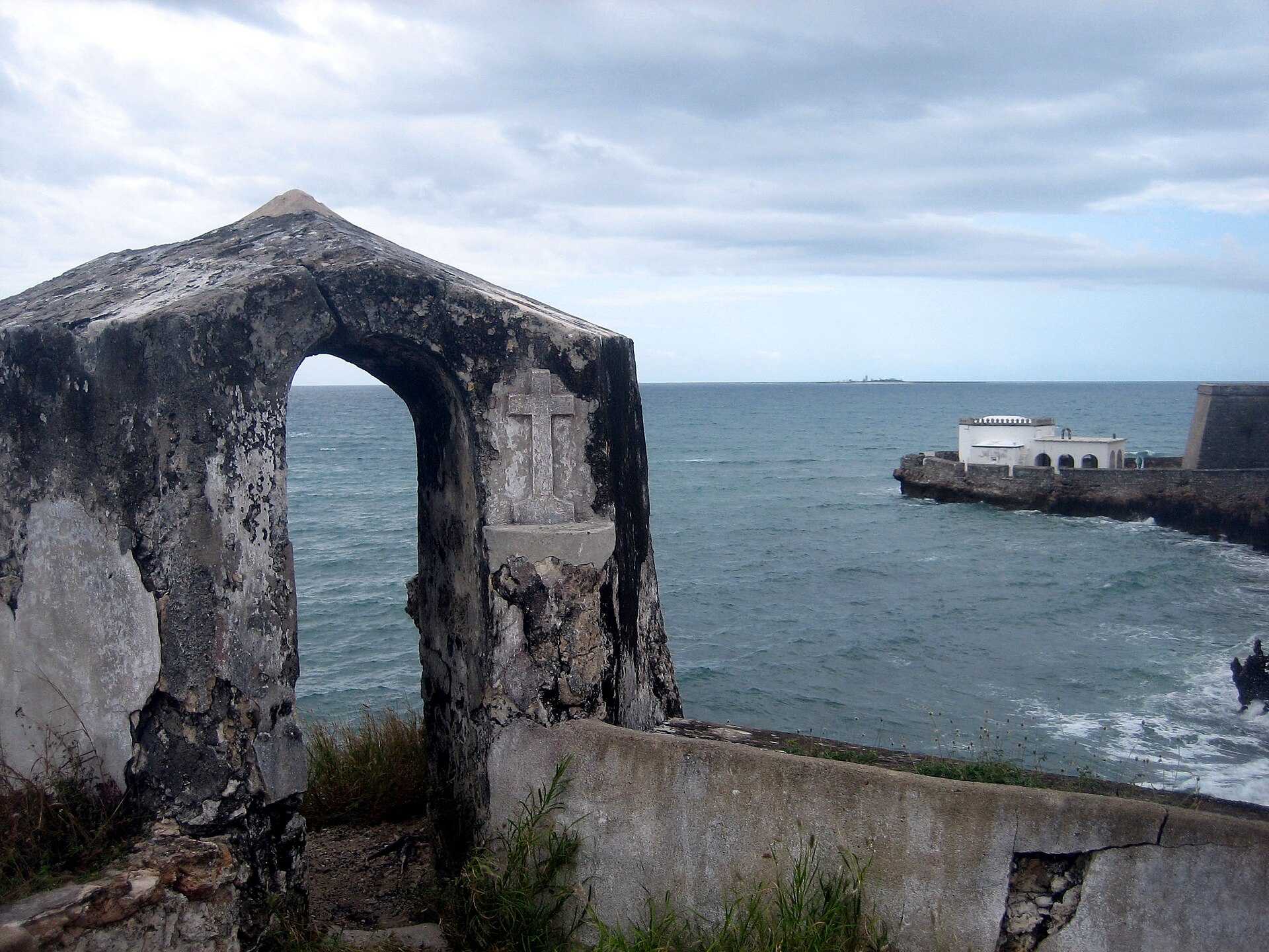
The chapel is built in the Manueline style, the distinctive late-Gothic architecture of Portugal’s age of discovery, with vaulted stonework that would not look out of place in a village church back in Europe. Small, sturdy, and set against the endless ocean, it has weathered five hundred years of sun, salt, and storm, outlasting empires and surviving into an age its builders could never have imagined.
There is a powerful sense of continuity in standing before it. This is where the whole European presence in the region began, a modest chapel raised by sailors and soldiers far from home, before the great fort, before the stone city, before Mozambique was even a country. If you visit only one thing beyond the fort itself, make it this unassuming little building at the water’s edge.
The survival of the chapel through five centuries is little short of miraculous when you consider what it has endured. Cyclones, salt spray, blazing tropical sun, the rise and fall of an empire, wars, and long decades of neglect have all passed over it, and still it stands. Few buildings anywhere carry so much history in so small and humble a form, which is exactly what gives the little chapel its quiet power.
Holding Off the Dutch
A fortress this important was bound to be tested, and the fiercest test came from a rival European power hungry for the same trade. In the early seventeenth century the Dutch, then expanding aggressively into the Indian Ocean, twice tried to seize the island and its fort. In 1607 and again in 1608 Dutch fleets attacked, and both times the defenders, led by the Portuguese commander Dom Estêvão de Ataíde, held them off.
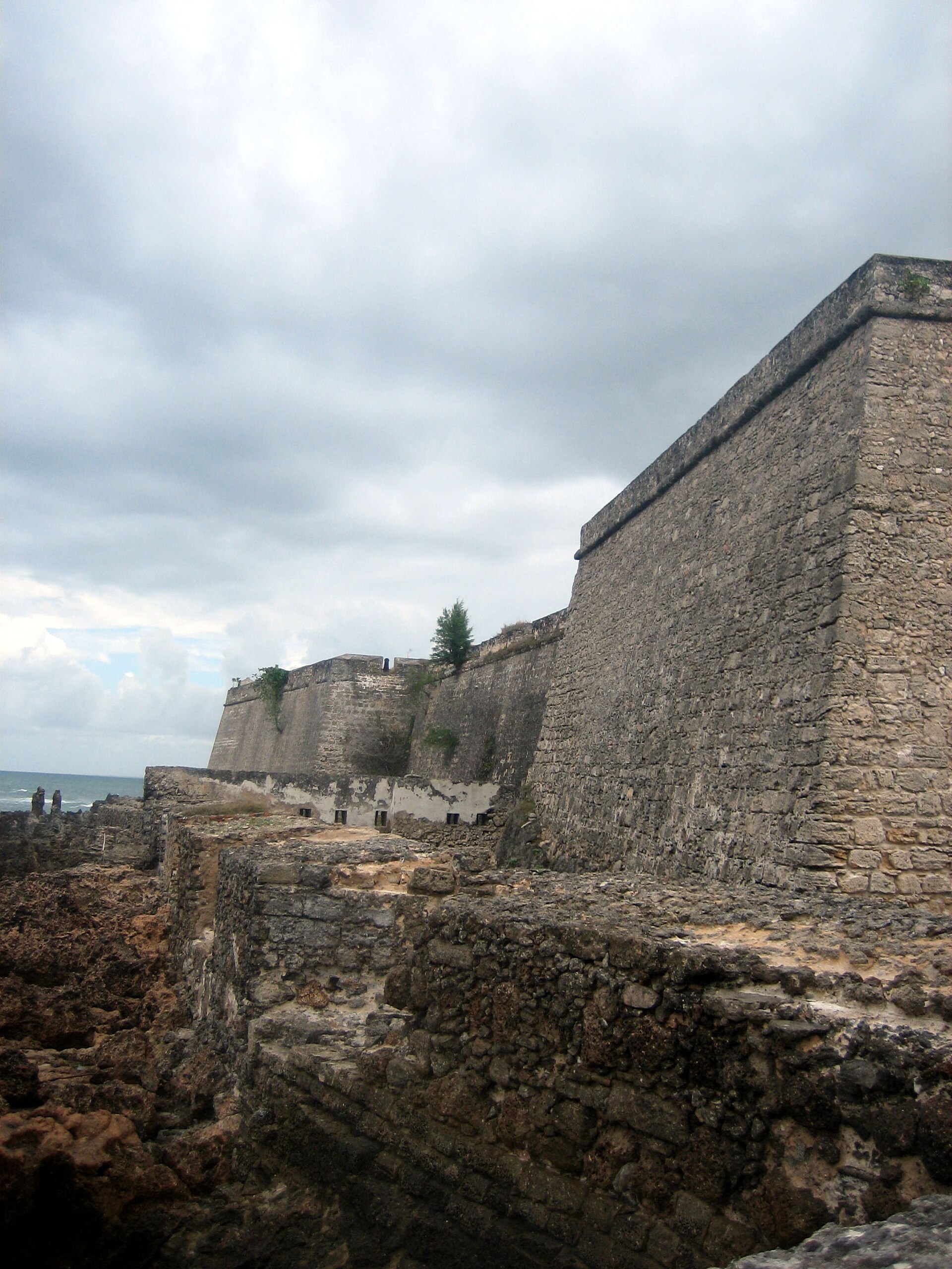
These sieges were the fort’s proving ground. The very features that had taken fifty years to build, the thick coral-stone walls, the angled bastions, the water cisterns that let the garrison outlast a blockade, now justified every year of effort. A fort that cannot withstand a determined enemy is just an expensive wall, but São Sebastião did exactly what it was designed to do, and it kept the island in Portuguese hands.
The failure of the Dutch attacks had consequences far beyond the island itself. Had Mozambique fallen, the entire Portuguese position in the western Indian Ocean would have been thrown into doubt. Instead, the successful defence confirmed the island as the secure eastern anchor of Portugal’s empire, a role it would keep for centuries. When you walk the ramparts, you are walking the ground where that outcome was decided.
The wider contest behind the sieges was a scramble among European powers for dominance of the fabulously lucrative eastern trade. The Dutch, Portuguese, and later others fought a long, sprawling struggle across the Indian Ocean, and control of key harbours like this one could tip the balance. That a relatively small garrison on a remote African island twice turned back a major power says a great deal about how well the fort was designed and defended.
The Secret of Survival: Water
For all the drama of walls and cannon, the single most important feature of a fort on a small, sun-baked island is something far less glamorous: fresh water. An island under siege can be cut off from the mainland in a matter of hours, and a garrison without water cannot fight for long. The builders of São Sebastião understood this perfectly, and they made water storage central to the fort’s design.
The fortress was equipped with large cisterns to collect and store rainwater, a lifeline that allowed the garrison and, in times of danger, much of the island’s population to hold out through a blockade. This unglamorous engineering was arguably as decisive as any bastion. In the Dutch sieges, the ability to endure was as much about the water in the cisterns as the powder in the guns.
It is a useful reminder, as you tour the impressive military architecture, that survival in these places came down to logistics as much as heroism. The people who dug and maintained the cisterns, who rationed the water and kept the supplies flowing, were as vital to the fort’s story as the soldiers on the walls. A fortress is a system, not just a structure, and water was the system’s beating heart.
The reliance on stored rainwater also shaped daily life in peacetime, not just during sieges. Water was precious and had to be managed with care on an island with no rivers and limited groundwater, so the discipline of collection and conservation was woven into the routine of the fort and the town alike. It is one of those quiet realities of premodern life that we easily forget amid the grander stories of empire and battle.
The Stone Town and the Capital of an Empire
The fort did not stand alone. Over the centuries a whole town of coral stone grew up in its shadow, a dense quarter of churches, mansions, warehouses, and administrative buildings that came to be known as the Stone Town, or Cidade de Pedra. This was the beating administrative heart of Portuguese East Africa, and for a long time the island served as its capital.
The architecture here is a fascinating blend. Portuguese colonial styles meet Swahili, Arab, and Indian influences, reflecting the astonishing mix of peoples who passed through and settled on this crossroads island. Grand houses with carved doors and cool interior courtyards sit along narrow streets, built to catch the sea breeze and to shelter their occupants from the tropical heat, a living record of a genuinely multicultural port.
Among the great buildings is the Palace and Chapel of São Paulo, dating from 1640, which began life as a Jesuit college before becoming the governor’s residence. Today it is a museum, and it preserves the furnishings and atmosphere of the island’s ruling class at the height of its power. Together, fort and Stone Town form a single, remarkably complete historic ensemble, which is precisely why the whole island is protected.
Walking the Stone Town today, you move through layer upon layer of this history. A Hindu temple, a mosque, Catholic churches, and grand merchant houses stand within a short walk of one another, physical proof of the many communities that shared this crossroads. The island was, in the fullest sense, a meeting point of worlds, and its architecture remains one of the most vivid records anywhere of that Indian Ocean cosmopolitanism.
The name Cidade de Pedra, city of stone, captures something essential about the place. In a region where most building was in perishable materials, the durable coral-stone architecture of the elite quarter was itself a statement of permanence and power. It is that stone construction, precisely because it lasted, that lets you walk through a near-complete historic town today rather than reading about one that has vanished.
Gold, Ivory, and the Shadow of Slavery
The wealth that flowed through the island came from several sources, and an honest account has to name all of them. In its earlier centuries the island was a conduit for gold from the interior and for ivory, both funnelled down to the coast and shipped out into the vast Indian Ocean trade. As with Kilwa before it, the island’s prosperity rested on sitting astride the routes that carried Africa’s riches to the wider world.
But the island’s later history is darkly bound up with the trade in human beings. As the Atlantic and Indian Ocean slave trades grew, Mozambique became a significant point of export, with enslaved people brought from the interior and shipped out through its harbour to plantations and markets across the ocean world. The same geographic advantages that made the island a fine trading post made it, too, a hub of this brutal commerce.
Confronting this is part of understanding the place fully. The beauty of the fort and the Stone Town coexists with the memory of profound human suffering that passed through the very same streets and quays. A thoughtful visit holds both truths at once: admiration for what survives, and honesty about how much of the island’s wealth was built on the exploitation and sale of other human lives.
The scale of the later slave trade through Mozambique was substantial, feeding demand in the plantations of the islands of the Indian Ocean and further afield. Remembering the individuals behind those numbers, torn from their homes in the interior and shipped out through this harbour, is a moral obligation that sits alongside any appreciation of the island’s beauty. History is not tidy, and the same stones can hold both wonder and sorrow.
Life Inside the Walls
What was it actually like to be stationed on this remote island fortress? For the Portuguese soldiers, officials, and clergy who lived here, life was a strange mix of strategic importance and grinding isolation. They sat at the centre of a great trade network, yet they were months of sailing from home, dependent on the monsoon fleets for news, supplies, and reinforcement.
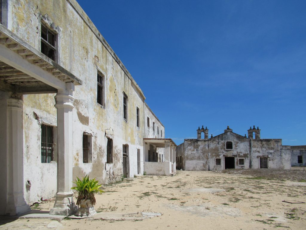
Disease was a constant companion. The tropical climate bred fevers, and crews arriving after long voyages were often wracked with scurvy and other ailments, so the island served as a crucial hospital and recovery station. For many Europeans, a posting here was a gamble with their health, and the graveyards of the island hold plenty who never made the voyage home.
Yet it was also a place of extraordinary human variety. Soldiers, sailors, merchants, missionaries, enslaved people, local Swahili families, Indian traders, and Arab seafarers all met and mixed on this small island. The result was a genuinely cosmopolitan community, its cultures visible today in the architecture, the cuisine, and the blended heritage of the island’s population. Behind the military hardware was a living, breathing, deeply mixed society.
Records and later accounts paint a picture of a society perpetually renewing itself through arrivals from across the ocean. Each monsoon season brought fresh faces, new goods, and news from distant ports, so the island was never static. It was a place of constant coming and going, a hinge between continents, and that restless flow of people is part of what gave the tiny island a cultural richness out of all proportion to its size.
For the enslaved and the local Swahili inhabitants, of course, the experience of the island was entirely different from that of the Portuguese elite, and far harsher. Any honest picture of life within and around the walls has to hold these unequal realities together: the officials and officers in their stone mansions, and the many others whose labour, freely given or brutally coerced, actually kept the island and its empire running day to day.
The Slow Fade of a Once-Vital Port
Nothing built on the logic of a trade route can survive the death of that route, and in the nineteenth century the world that had made the island indispensable began to dissolve. The opening of the Suez Canal in 1869 transformed the geography of global trade, offering a far shorter path between Europe and the East and stripping away much of the reason ships had once needed to pause on the long haul around Africa.
As the island’s strategic value fell, so did its status. In 1898 the capital of Portuguese Mozambique was moved south to Lourenço Marques, the city we now know as Maputo, which had a better harbour and a more useful position for the modern economy. The move was a quiet death sentence for the island as a centre of power, ending nearly four centuries as the capital of Portuguese East Africa.
Later, the rise of the modern deep-water port at Nacala on the mainland drained away what commercial life remained. The island slipped into a long, gentle decline, its grand stone buildings emptying out and its streets falling quiet. Paradoxically, this decline is exactly what preserved it, because there was never the money or the pressure to knock down the old and build anew.
There is a bittersweet quality to the island’s fall from importance. The very forces of modernity that built new fortunes elsewhere, the canal, the steamship, the deep-water port, drained the life from a place that had thrived for centuries on older patterns of trade. The island did not so much fail as become obsolete, overtaken by a world it had once helped to connect, and left to slumber with its monuments intact.
A Museum Island and World Heritage Site
Because the island was left behind by the modern economy, it survived almost frozen in time, and that accidental preservation eventually became its greatest asset. In 1991 the Island of Mozambique was inscribed on the UNESCO World Heritage List, recognised for its remarkable architectural unity and for its outstanding testimony to the establishment and development of the Portuguese maritime route between Western Europe and the East.
UNESCO recognition acknowledged what makes the island so special: it is not a single monument but a whole surviving historic town, fort and chapel and stone mansions and all, preserved together as an ensemble. Few places in the world let you walk through such a complete cross-section of the age of oceanic empire, with the military strongpoint, the seat of government, and the merchant town all still standing side by side.
Preservation, however, is an ongoing struggle. The coral-stone buildings are fragile, the tropical climate is relentless, and a poor island community cannot easily fund the upkeep of a vast heritage site. Conservation efforts, including detailed modern documentation of the fort itself, aim to keep this irreplaceable place standing, but its future depends on continued care and on the visitors whose interest helps justify the effort.
Tourism, handled thoughtfully, offers the island a possible path forward. Visitors who come to see the fort, the chapel, and the Stone Town bring income and attention that can support conservation and sustain the local community. The challenge is to welcome them without turning a living town into a mere spectacle, keeping the balance between preserving the past and respecting the people who call the island home today.
The recognition also placed a responsibility on the wider world, not just the local community, to help safeguard the site. Heritage of this significance belongs, in a sense, to all of humanity, and international attention and support have a real part to play in ensuring that the fort, the chapel, and the Stone Town survive for future generations to experience as directly and completely as visitors can today.
Visiting the Island of Mozambique Today
Getting to the island is part of the adventure. It lies off the coast of northern Mozambique and is connected to the mainland by a long, narrow single-lane causeway, a slightly nerve-wracking bridge that adds to the sense of crossing into a place apart. Most visitors reach the region via the town of Nampula and then travel out to the coast, so this is a destination for the traveller willing to go a little off the beaten track.
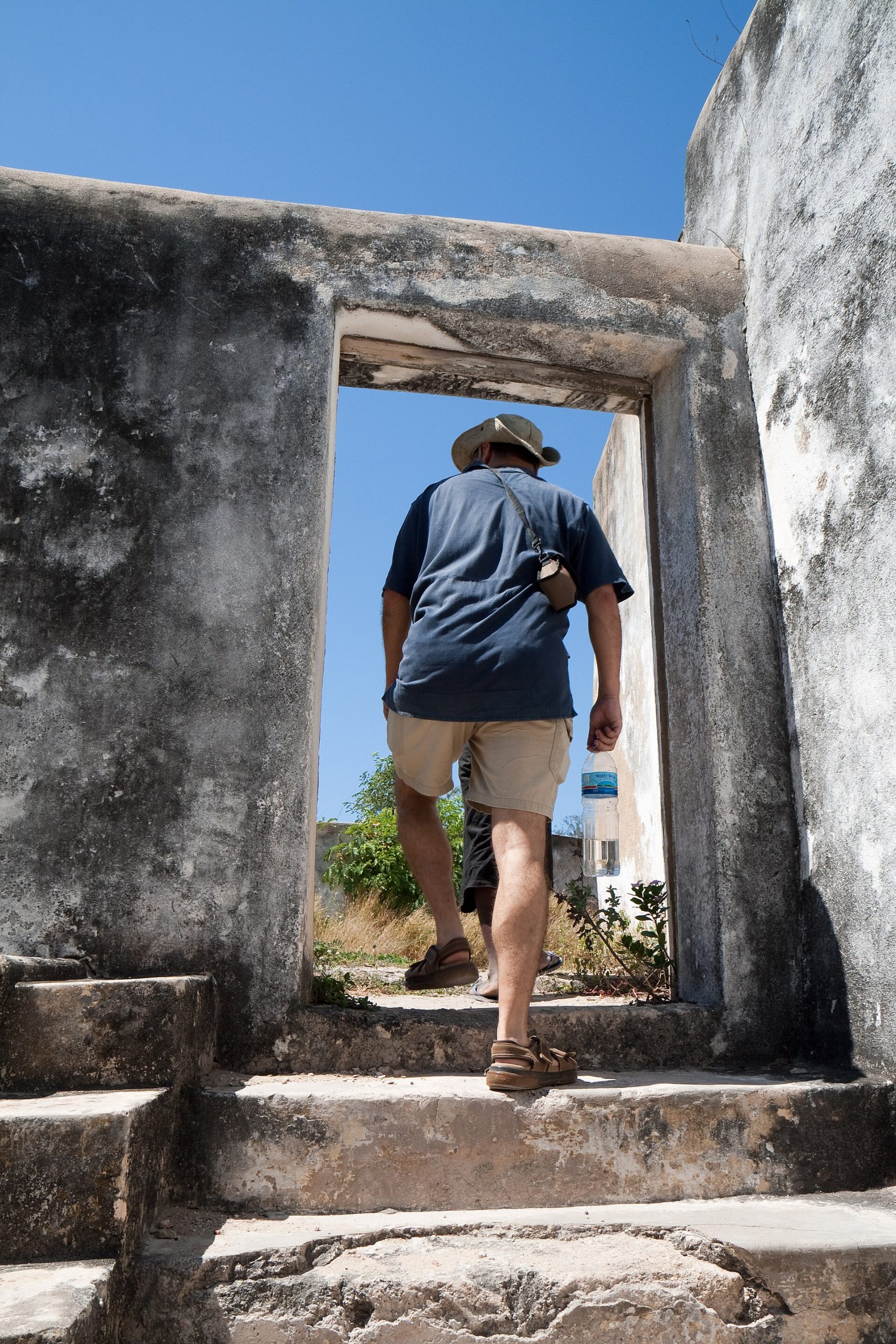
Once on the island, the great pleasure is simply to walk. Explore the fort at the northern tip, seek out the ancient chapel of Nossa Senhora do Baluarte at the water’s edge, wander the narrow streets of the Stone Town, and visit the Palace of São Paulo museum. The southern part of the island, by contrast, is a lively, densely populated area of reed-and-thatch houses, so you experience both the historic monuments and a working community.
View -15.0289, 40.7431 on Google Maps
Give yourself at least a full day, and ideally longer, to let the atmosphere sink in. Bring sun protection and comfortable shoes, respect that this is a living community and not just an open-air museum, and consider hiring a local guide to unlock the layers of history in the stones. Few places offer such a concentrated, walkable encounter with the age of Indian Ocean empire, and the Island of Mozambique rewards the effort of reaching it many times over.
A final thought as you plan: come with patience and curiosity rather than a checklist. The magic of the Island of Mozambique lies less in ticking off individual sights and more in absorbing the whole atmosphere of a place where centuries of history are compressed into a few walkable streets. Sit by the fort at sunset, watch the fishing boats come in, and let yourself feel the weight and wonder of everything that has passed through this small island.
If you can, time your wandering so that you reach the northern tip in the golden light of late afternoon, when the coral stone of the fort glows warm and the chapel throws a long shadow toward the sea. It is in moments like that, with the ocean breeze and the old walls and the sense of centuries pressing in, that the Island of Mozambique stops being a set of facts and becomes an experience you will carry with you long after you leave.
Castles Nearby
You May Like