Location: 12 km from Fethiye. Butterfly Valley, one of the bays on the east coast of Ölüdeniz-Belcekız Gulf in the south, is half an hour away from Ölüdeniz by sea. Belcekız beach faces south and the west-facing beach of the Valley cannot be seen from here.
Transportation: Butterfly Valley can be reached in about half an hour by private boats departing from Belcekız coast. The only connection to the road, other than sea transportation, is the goat path leading to Faralya Village above the Valley, which requires a difficult and dangerous half-hour climb. Considering an old stone inscription on the road, it is understood that this path has been used for a long time.
The dirt road we encounter in Faralya Village is 18 km long, starting from Ölüdeniz and ending at Kabak Bay. It is the only highway in its length. On this road, there are Kıdrak Bay (Lycian Worl), Faralya, Uzunyurt villages and Kabak neighborhood at the end of the road.
The old ruins around Faralya and in the Valley belong to the settlement area of Lycia called Perdikia and date back to B.C. It is dated to the 4th century. In the valley, the ruins of a building from the Byzantine period and a half-buried church are gradually disappearing. The region is woven like a network with old trails. These roads, which are used today for walking sports, were perhaps the only connection the people living here had with the world.
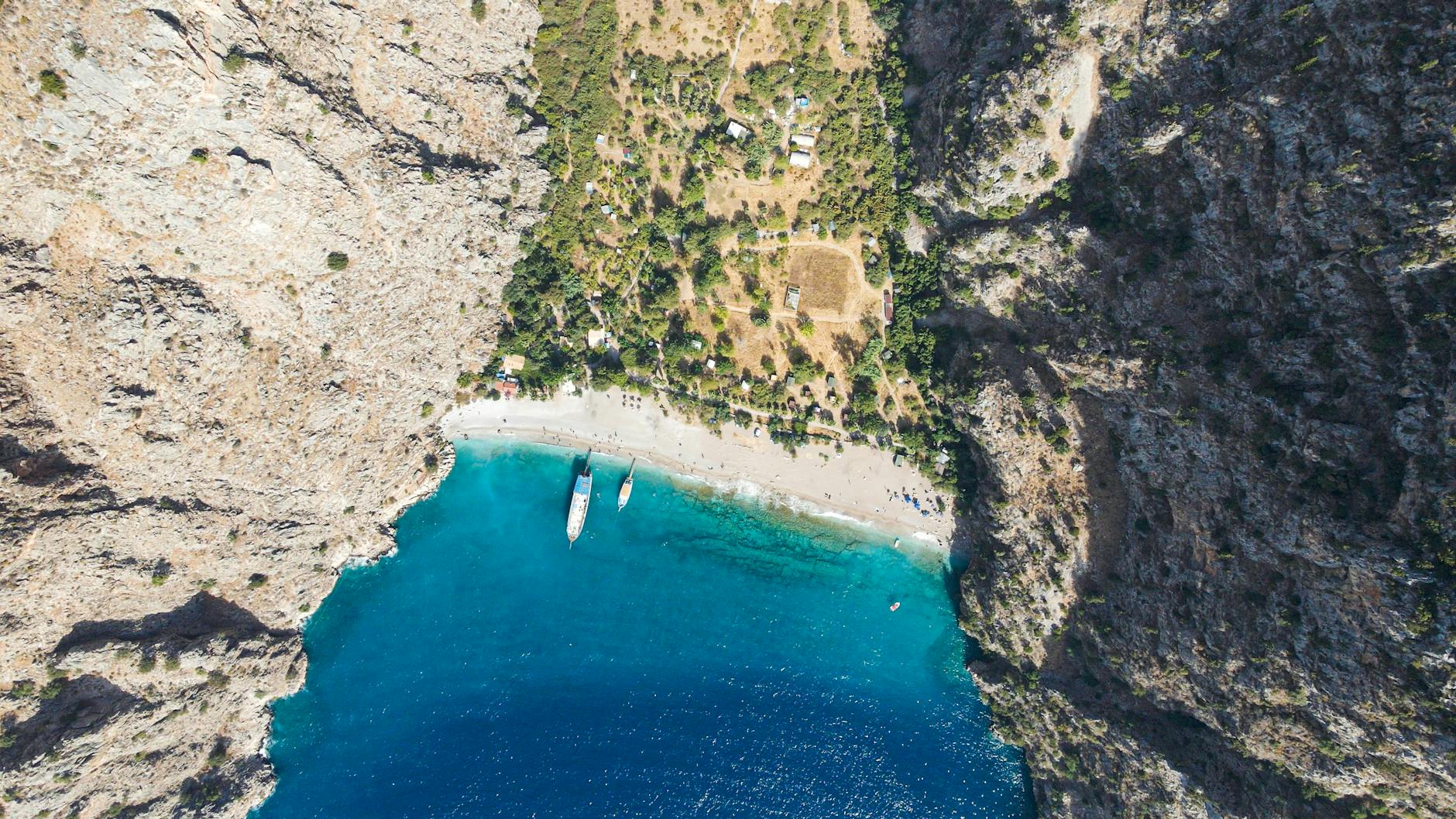
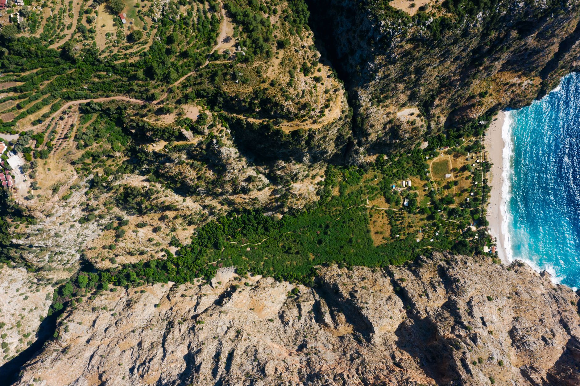
Physical structure: Kelebek Valley has the appearance of a large funnel with its wide mouth facing west and tapering towards the east. On the seashore, the sandy beach forming the wide side of the funnel is 250m. It is 1500 meters long and the flat land gradually narrows backwards. It has a length of approx. This triangular-shaped flat land is 300-400 m high. It is surrounded by steep canyon-like slopes varying between .
This high structure, consisting of old, folded and broken limestone, is 7-8 m high in places at the narrow throat of the funnel. It narrows and becomes curved and reaches a height of 20-25 m. It ends with a high-flowing waterfall. The real name of this water is “Güldürümsu Waterfall”. The waters of the waterfall come from Sarp Creek, which originates from the Devrent Gorge at the foothills of Babadağ.
During the rainy days of the winter months, the water of the stream increases to the maximum level and pours down as large waterfalls from many parts of the narrow canyon. At the end of May, this stream dries up and reaches the sea underground. Behind the valley, the steep foothills of Babadağ rise, and at the top of the mountain, this height reaches 1975 m.
Butterfly Valley Sketch
Climate: Although it has the typical characteristics of the Mediterranean climate, because it is surrounded by steep slopes, the sun begins to appear late and disappear early in October, and is not visible at all in December-January. For this reason, it is very humid and cool in winter, with the annual winter average being around 10oC. In mid-summer, the sea is generally wavy due to the westerly breeze and south winds.
In September, the light wind blowing from the east (from the direction of the waterfall) causes the nights to cool down. Since the valley is open to the west and southwest, it is under the influence of severe storms coming from this direction in winter; The sea swells, giant waves break over the beach and reach the land, and the eddies created by the wind cause trees to break and topple over.
Tourism: Butterfly Valley was purchased for 300,000 liras in 1974 from its real owner, who lived here and was engaged in agriculture, and became the registered property of a Tourism Cooperative with 107 partners. Later, on December 25, 1996, with the decision numbered 6361 of the Izmir Cultural and Natural Heritage Preservation Board No. 2, all kinds of construction was banned as it was declared a 1st degree natural site and 3rd degree archaeological site.
The region is also included in the natural habitat area of Babadağ and its surroundings, one of the 9 Natural Living Areas in Turkey, declared by the Association for the Protection of Natural Life.
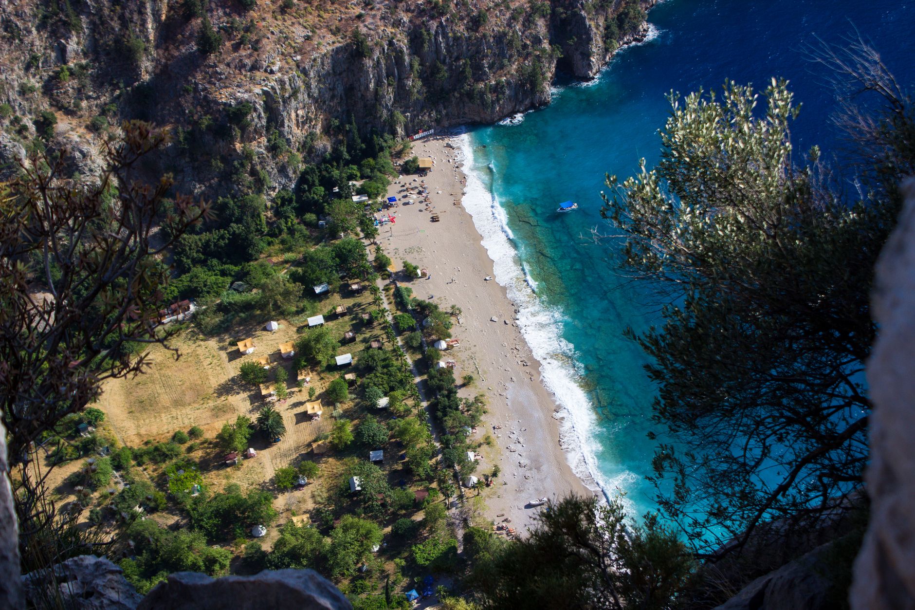
Of this area of 130 decares in total, 90 decares are used for touristic purposes. The use of the Valley for touristic purposes started after 1985. Apart from special visits, the first permanent residents are nature-loving backpackers. In later years, on the beach and 100 m.
The two abandoned stone buildings behind were repaired and turned into shelters; In the 90s, a makeshift camping facility was created by adding a pergola woven from vines, a kitchen, shower-toilet and a large pergola (roof) for sleeping next to the building on the beach. The operation of the facility is carried out by small-capital entrepreneurs who won the closed envelope tender of the cooperative.
Since there is no electricity in the Valley, the energy required for cooling and lighting is provided by a generator. You sleep in gazebos or tents at night, and the sounds of waves and insects mixing together create a mystical atmosphere. This is the first factor that attracts nature lovers here.
Butterfly Valley also has a legend that has spread from mouth to mouth: According to the old people who remember about a century ago, a Greek woman named Despina, who lived alone in the Valley at that time, died at the age of 120.
When Despina was 20, she fell in love with a young sailor in the Valley, a place where pirate ships were hidden; The young sailor, who went to sea promising to come back, never returned and Despina waited for him until the end of her life. According to the elderly, the spirit of Despina, whose body was not found after her death, still wanders here.
Butterfly Valley Pictures
You May Like

Aspendos Ancient Theater Travel Guide