Cahokia was the largest city in pre-Columbian North America, a Mississippian settlement near modern St. Louis that housed thousands of people around a massive earthen pyramid nearly a thousand years ago.
At its height around 1100 CE, Cahokia sprawled across roughly six square miles on the floodplain of the Mississippi River, filled with more than a hundred earthen mounds, a plaza large enough to host thousands of spectators, and a population that may have rivaled contemporary London. No other city north of central Mexico came close to its scale before European contact. Yet within a few centuries, the people who built it had dispersed, leaving behind silent mounds that later settlers, and eventually archaeologists, would spend generations trying to understand.

Contents
- The Largest City North of Mexico
- The Rise of a Mississippian Capital
- Monks Mound: A Pyramid of Packed Earth
- The Grand Plaza and Its Neighborhoods
- Woodhenge and the Cahokia Calendar
- The Birdman Tablet and Cahokian Belief
- Mound 72 and Its Startling Burials
- A Trade Network Spanning Half a Continent
- Decline and Abandonment
- Trappist Monks and a Borrowed Name
- Nearby Places to Explore
- Why Cahokia Still Matters
The Largest City North of Mexico
Cahokia sits in the American Bottom, a fertile floodplain across the Mississippi River from present-day St. Louis, Missouri, in what is now southwestern Illinois. At its peak, population estimates range from about ten thousand to as many as twenty thousand people living within the site’s core, with thousands more in surrounding satellite communities across the floodplain. These numbers made Cahokia the largest urban settlement north of the great cities of central Mexico, a distinction it held for centuries before any European city in North America approached a similar scale.
The city was never surrounded by a single defensive wall for most of its history, though a wooden palisade was built around its central precinct during part of its later occupation. Instead, Cahokia’s boundaries blurred into a broader landscape of smaller mound centers and farming communities spread across the American Bottom, all loosely connected to the central site through shared religious practice, trade, and, in some periods, political authority radiating outward from the great plaza and its surrounding mounds.
The American Bottom itself provided the agricultural foundation that made a city of this size possible. Its rich alluvial soil, replenished periodically by Mississippi River flooding, supported intensive maize cultivation alongside a range of native crops including squash and various starchy and oily seed plants domesticated in eastern North America well before maize became dominant. This combination of highly productive local agriculture and the river’s role as a transportation corridor gave Cahokia’s location a decisive economic advantage over other potential sites in the region.
Population density estimates for Cahokia’s core precinct rival those of many contemporary medieval European towns, a comparison that surprises many people unfamiliar with the scale of pre-Columbian North American urbanism. Unlike a walled medieval town, however, Cahokia’s built environment combined dense residential clusters with substantial open ceremonial spaces, reflecting a settlement pattern shaped as much by ritual and political needs as by simple practical considerations of housing density and defense.
The Rise of a Mississippian Capital
People had lived in the American Bottom for centuries before Cahokia became a major center, farming the rich floodplain soil and building smaller mound sites typical of the broader Woodland period cultures of eastern North America. Around 1050 CE, however, the settlement underwent a dramatic and rapid transformation that archaeologists sometimes call Cahokia’s big bang: construction of major mounds accelerated, the population surged, and the site’s layout was reorganized around a newly built central plaza, all within what appears to have been a remarkably short span of time by archaeological standards.
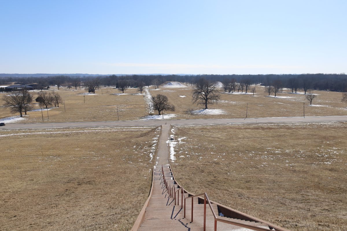
This sudden growth marks the emergence of what researchers call Mississippian culture, a broad tradition of mound-building, maize agriculture, and shared religious iconography that would eventually spread across much of the southeastern and midwestern United States. Cahokia appears to have functioned as the first and largest expression of this new cultural pattern, and many smaller Mississippian mound centers built in later centuries across the region show clear influence from, or direct connections to, practices first developed at Cahokia.
Archaeologists debate exactly what triggered the rapid reorganization around 1050 CE, with proposed explanations ranging from a charismatic new religious or political leadership able to mobilize labor on an unprecedented scale, to a gradual accumulation of population and resources that reached a tipping point enabling rapid, large-scale construction. Whatever the precise trigger, the speed and scale of the transformation remains one of the more remarkable events in the archaeological record of ancient North America, comparable in its suddenness to urban transformations documented at early cities in other parts of the world.
Population growth at Cahokia during this expansion phase appears to have drawn people in from surrounding areas rather than resulting purely from natural increase among the existing local population, suggesting the city exerted a genuine pull on people living across a wider region, whether through religious appeal, economic opportunity, or the prestige associated with participating in a rapidly growing center of political and ceremonial life. Determining the exact balance between voluntary migration, religious pilgrimage, and possible coercive elements in this population growth remains an active area of archaeological research.
Monks Mound: A Pyramid of Packed Earth
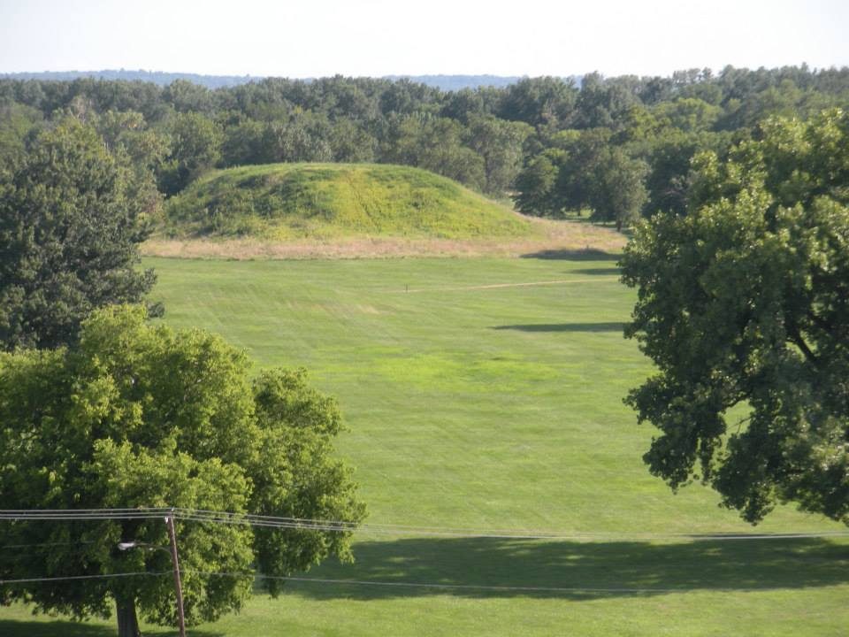
The largest structure at Cahokia, and the largest prehistoric earthwork anywhere in the Americas, is Monks Mound, a massive four-terraced platform standing roughly thirty meters tall with a base covering more area than the Great Pyramid of Giza. Built up gradually over several centuries through repeated additions of basket-loads of earth, the mound reached its final size through the coordinated labor of thousands of workers across many building episodes, making it one of the most impressive feats of earthen construction anywhere in the pre-industrial world.
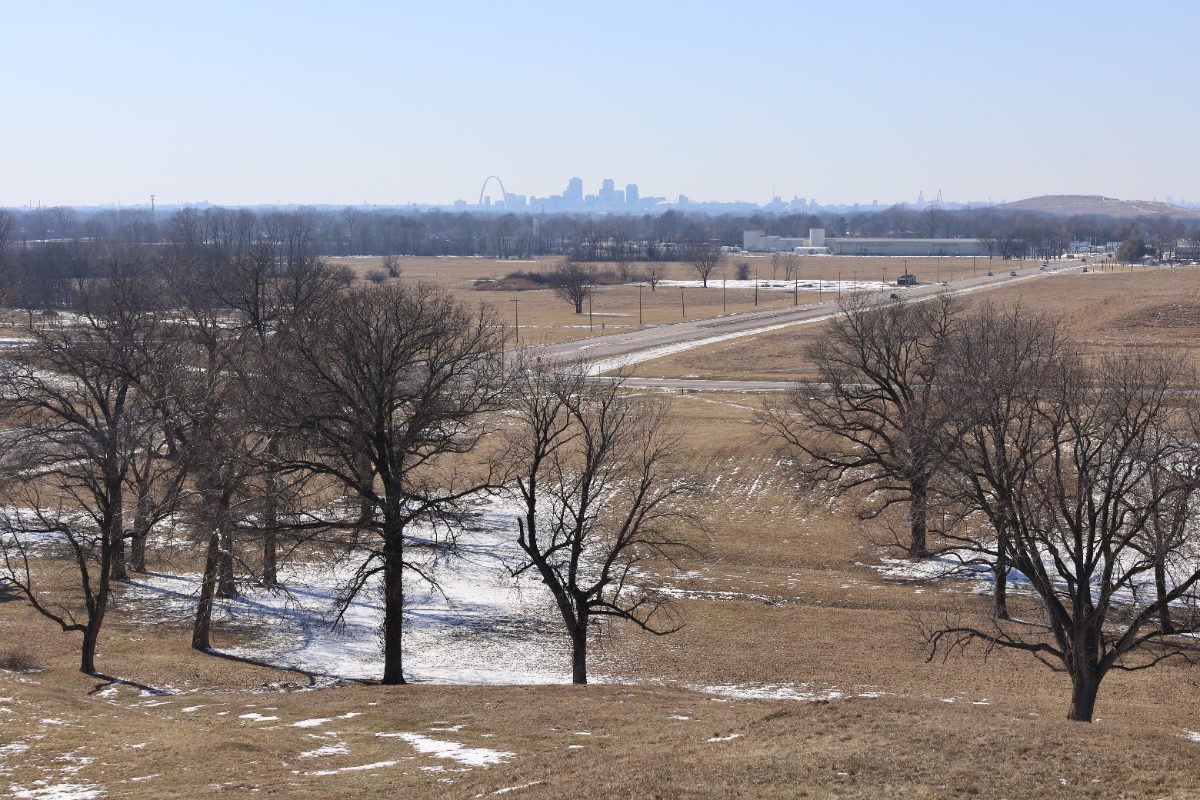
Excavations atop the summit terrace have revealed postholes consistent with a large wooden building, likely a temple or the residence of Cahokia’s paramount ruling authority, positioned to overlook the entire central plaza and the rest of the city spreading out below. Standing on top of Monks Mound today, visitors can still appreciate the commanding view its builders intended, a vantage point from which a ruler, priest, or assembled crowd could survey ceremonies taking place across the plaza and the broader ceremonial precinct.
Construction of Monks Mound proceeded in distinct stages over roughly two centuries, with each new layer of earth added on top of the last, sometimes capping older surfaces that had been used for buildings or activities before being buried under fresh construction. Soil composition studies show that builders sometimes selected specific types of earth for different structural purposes, using certain clays for stability in the mound’s core while reserving other soils for surface layers, indicating a sophisticated practical understanding of earthen engineering passed down and refined across multiple building generations.
The Grand Plaza and Its Neighborhoods
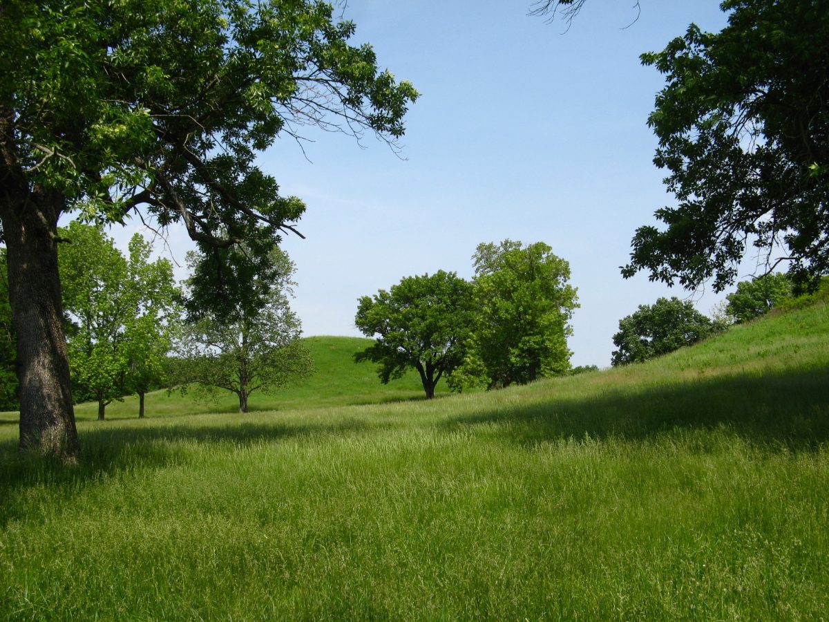
South of Monks Mound lies the Grand Plaza, a leveled, artificially flattened open space large enough to hold thousands of people at once. Archaeologists believe the plaza served as the stage for major public events, including religious ceremonies, feasts, and games, most notably chunkey, a competitive game played across much of Mississippian North America involving a rolled stone disc and thrown spears, evidenced by the discarded chunkey stones found in significant numbers throughout the site. The scale of the plaza alone indicates a society capable of organizing labor and resources on a scale unmatched by any neighboring community.
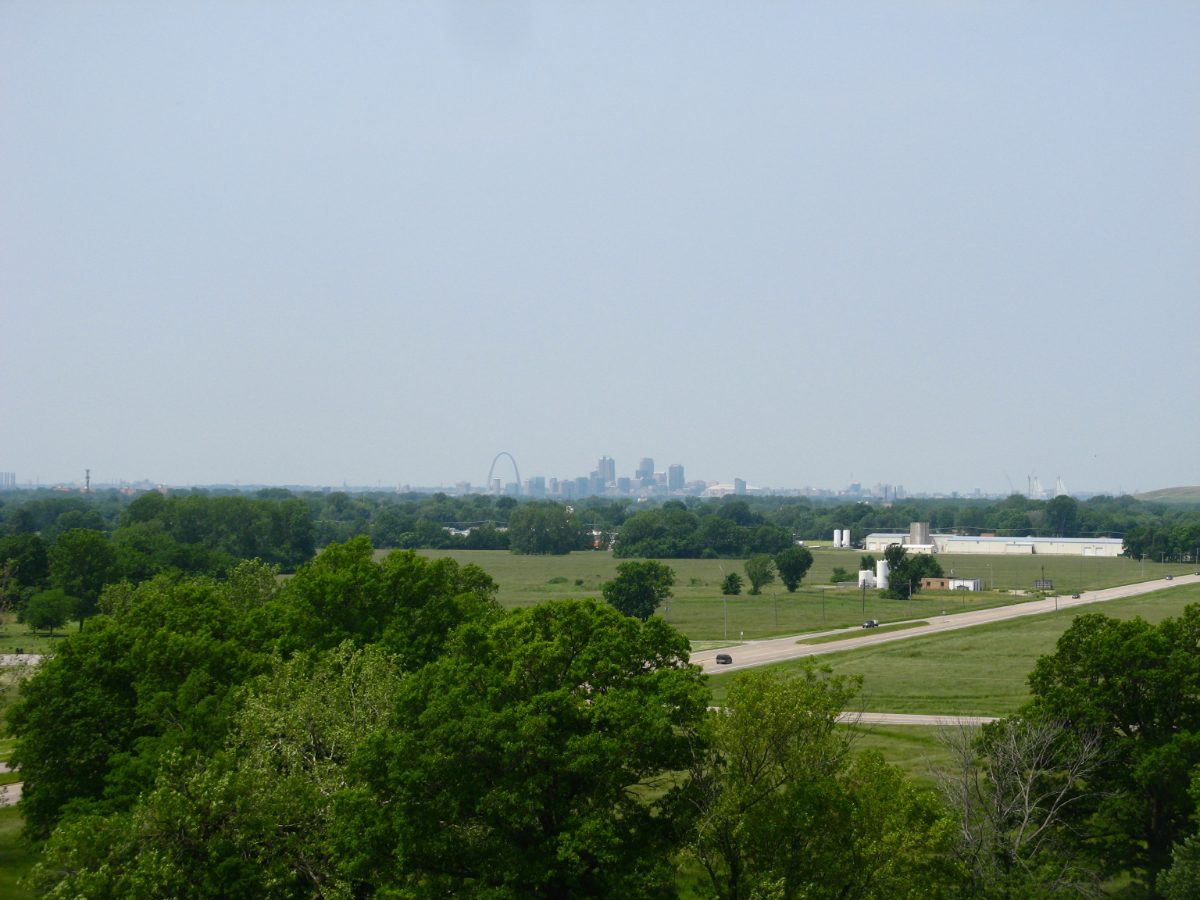
Beyond the central plaza and its surrounding major mounds, Cahokia’s broader footprint included distinct residential neighborhoods, each often organized around its own smaller mound and open courtyard, suggesting a settlement with internal social divisions, possibly reflecting kinship groups, occupational specialization, or differing social status. Excavated house remains show a mix of construction styles and sizes, further supporting the idea that Cahokian society was not uniformly organized but instead structured around multiple, somewhat autonomous community groups united under the authority radiating from the central precinct.
Excavations beneath the plaza’s surface have revealed that the area was not simply left as natural ground but was deliberately leveled and resurfaced, in some cases requiring the filling of natural depressions and the removal of earlier structures to create the flat, open expanse visitors and event-goers would have used. This level of intentional landscape modification, carried out well before the introduction of any mechanical earth-moving technology, underscores the extraordinary amount of coordinated communal labor Cahokia’s leadership was able to organize and direct toward large-scale public projects.
Chunkey stones recovered from across the site vary in size, material, and finish, and some scholars have suggested that the game itself may have carried ritual or gambling significance beyond simple recreation, with high-status individuals possibly wagering valuable goods on match outcomes. If accurate, this would place chunkey alongside other examples from around the ancient world where competitive games served simultaneously as entertainment, social bonding activity, and a venue for displaying or redistributing wealth among community members.
Woodhenge and the Cahokia Calendar
West of Monks Mound, archaeologists excavating in the 1960s discovered a series of large circles formed by evenly spaced wooden posts, quickly nicknamed Woodhenge for their resemblance in function, if not appearance, to the famous stone circle in England. Several successive woodhenges were built at the site over time, growing progressively larger, with the biggest version consisting of forty-eight posts arranged in a wide circle around a central observation post. Sightlines from the center align with the rising sun at the solstices and equinoxes, confirming the structure’s function as a solar calendar used to track the changing seasons.
A calendar of this kind would have carried enormous practical and religious significance for a society dependent on maize agriculture, helping determine planting and harvest timing while also anchoring important ceremonial dates tied to the solar year. The alignment of Woodhenge with Monks Mound itself, positioned so that the sun appeared to rise directly from the mound’s summit on the equinox as viewed from the central observation post, suggests the calendar was deliberately integrated into the city’s broader religious and political symbolism rather than functioning as a purely practical instrument.
Excavating and interpreting Woodhenge required careful attention to postholes left behind after the original wooden posts had long since rotted away, since none of the timbers themselves survived into the modern era. Archaeologists identified the circles by mapping the pattern of dark soil stains marking where posts had once stood, then used these patterns to reconstruct the circle’s diameter, post spacing, and, crucially, the sightlines that connected specific posts to key solar events throughout the year. A reconstructed version of the largest woodhenge now stands at the site, allowing visitors to experience the same solstice and equinox alignments that Cahokia’s original astronomer-priests would have observed nearly a thousand years ago.
Reconstructing an ancient astronomical monument from postholes alone requires cross-referencing excavation data with precise modern astronomical calculations of where the sun would have risen at the relevant latitude nearly a thousand years ago, since the exact positions of solstice and equinox sunrises shift slightly over long time periods due to gradual changes in Earth’s orbital tilt. Researchers at Cahokia carried out exactly this kind of cross-disciplinary work, combining careful archaeological survey with astronomical modeling to confirm that the alignments were deliberate rather than coincidental, a conclusion reinforced by the consistency of the alignments across the multiple successive woodhenges built at the site over time.
The Birdman Tablet and Cahokian Belief
Among the artifacts recovered from Cahokia, few have attracted as much scholarly attention as the Birdman Tablet, a small carved sandstone plaque found near the base of Monks Mound depicting a human figure wearing what appears to be a falcon or bird-of-prey costume, complete with a hooked beak-like nose and wing-like arm markings. This birdman imagery connects Cahokia to a much broader symbolic tradition archaeologists call the Southeastern Ceremonial Complex, a shared set of religious motifs, including raptors, weeping eyes, and warrior imagery, that appeared across Mississippian sites throughout the American Southeast in the centuries following Cahokia’s rise.
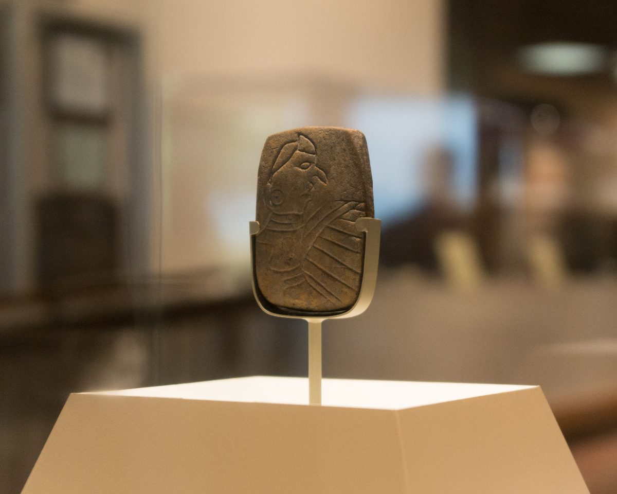
Interpretations of the birdman figure vary, with some researchers connecting it to later Southeastern mythological traditions involving a hero associated with falcons and the upper world, while others read it primarily as a symbol of elite warrior status or chiefly authority. Whatever its precise meaning, the tablet’s presence at Cahokia, alongside other similar iconography found throughout the site, indicates that the city was not merely a population and trade center but also a major hub for the religious ideas that would go on to shape Mississippian belief systems across a huge portion of eastern North America.
Similar birdman and raptor-themed imagery has since been identified at other Mississippian sites across the American Southeast, including engraved shell gorgets, copper plates, and pottery decorated with related motifs, suggesting that whatever religious or mythological tradition the Cahokia tablet represents, it spread widely and remained influential for generations after Cahokia’s own political power had waned. Some researchers have proposed connections between this iconography and stories recorded much later among Southeastern Native American oral traditions involving a hero associated with thunder, falcons, and the upper world, though drawing direct lines between archaeological artifacts separated by centuries and later oral histories requires considerable caution.
The tablet’s small size and portable nature also distinguish it from the monumental architecture that otherwise dominates discussion of Cahokia, reminding visitors that the city’s cultural achievements extended well beyond earth-moving into fine craftsmanship capable of conveying complex religious ideas within a single compact object small enough to hold in one hand.
Mound 72 and Its Startling Burials
One of Cahokia’s smaller mounds, known simply as Mound 72, produced some of the most striking and debated archaeological evidence found anywhere at the site. Excavations revealed a burial widely nicknamed the Beaded Burial, in which a man was laid on a platform covered with roughly twenty thousand shell beads arranged in the shape of a large falcon or bird, alongside the remains of a second individual and surrounded by an array of high-status grave goods, including finely worked arrow points and other prestige items.
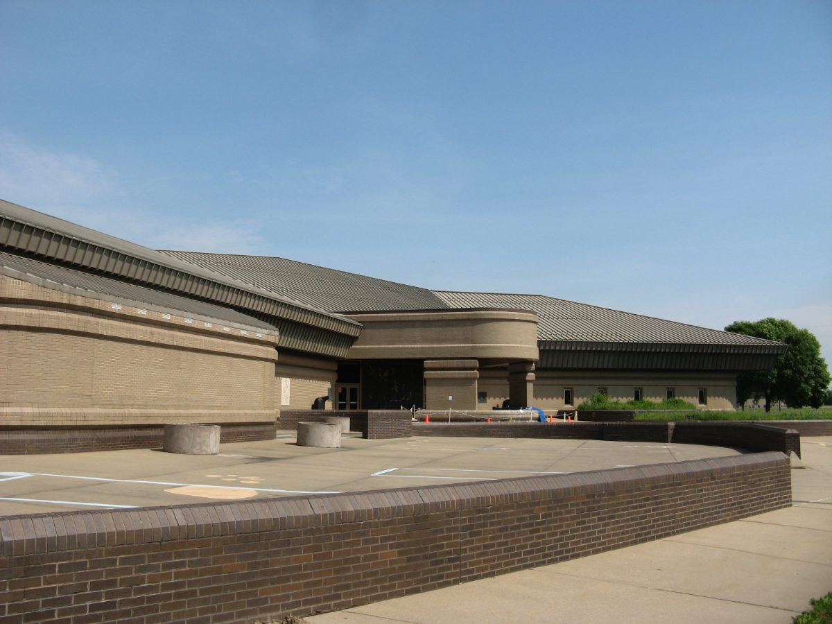
Nearby, excavators uncovered mass burial pits containing the remains of dozens of individuals, including one pit holding more than fifty young women, positioned in ways suggesting they were buried together at the same time rather than added gradually over years. Some pits also contained individuals showing signs of violent death, leading many archaeologists to interpret at least some of these burials as evidence of retainer sacrifice connected to elite funerary ritual, a practice known from other stratified societies around the world, though the exact social and religious meaning behind Cahokia’s version remains a subject of ongoing debate.
Analysis of the individuals buried in Mound 72 has continued for decades, with more recent studies applying updated osteological and isotopic techniques to reassess conclusions drawn from the original 1960s and 1970s excavations. Some later reanalysis has revised earlier assumptions about the sex and status of individuals within the beaded burial itself, illustrating how ongoing scientific study continues to refine, and sometimes overturn, interpretations that once seemed settled. This process of continual reassessment is typical of major archaeological sites where new methods repeatedly extract additional information from material excavated long before those techniques existed.
A Trade Network Spanning Half a Continent
Cahokia’s material culture reveals connections stretching across an enormous portion of North America. Marine shell used for beads and ornaments, including the tens of thousands of beads found in Mound 72, originated along the Gulf Coast, hundreds of miles to the south. Copper, worked into ornaments and ceremonial objects, came from sources around the Great Lakes to the north, while mica, used for decorative cutouts, was quarried from the southern Appalachian Mountains far to the east. No single trade route explains this pattern; instead, Cahokia appears to have sat at the center of overlapping exchange networks pulling in raw materials from nearly every direction.
This scale of long-distance exchange required organized production, transport, and redistribution systems capable of moving goods across vast distances using only human and canoe-based transport, since Mississippian societies had no draft animals or wheeled vehicles. The sheer volume and variety of nonlocal materials found at Cahokia suggests the city functioned as a major redistribution hub, drawing in raw materials and finished goods from across a huge portion of the eastern half of North America and likely exporting Cahokian-style religious objects and ideas back out along the same routes.
Craft production at Cahokia itself appears to have been substantial, with evidence of specialized workshop areas producing shell beads, chunkey stones, and other goods likely intended for both local use and export along the broader trade network. The presence of raw, unworked shell alongside finished beads at certain locations within the site suggests that at least some processing and manufacturing took place directly at Cahokia rather than the city simply importing already-finished prestige goods from distant production centers.
Some researchers have also proposed that Cahokia exported not just finished goods but agricultural techniques, architectural knowledge, and religious practices to emerging Mississippian centers elsewhere in the Southeast and Midwest, effectively seeding a broader cultural florescence that outlasted Cahokia’s own political dominance by centuries. Later Mississippian sites, while never matching Cahokia’s original scale, continued to build platform mounds, maintain central plazas, and produce artwork drawing on the same Southeastern Ceremonial Complex iconography first prominently expressed at Cahokia itself.
Decline and Abandonment
Cahokia’s population began declining in the twelfth and thirteenth centuries, and the site was largely abandoned by around 1350 to 1400 CE, several centuries before European contact reached the region. The causes behind this decline remain actively debated among archaeologists, with proposed explanations including environmental degradation from deforestation and overhunting around the city, soil exhaustion from intensive maize farming, periodic flooding of the American Bottom, and social or political instability that may have undermined the authority holding the sprawling settlement together.
Evidence for the construction of a defensive palisade around the central precinct during Cahokia’s later occupation has led some researchers to argue that increasing conflict, whether internal or with outside groups, played a role in the city’s eventual decline, though this remains one interpretation among several competing explanations. Whatever combination of factors was responsible, by the time French explorers arrived in the region in the late seventeenth century, Cahokia’s original Mississippian builders were long gone, and the mounds stood largely unexplained to the new arrivals who encountered them.
Climate research examining regional rainfall and river flooding patterns during the relevant centuries has identified periods of both drought and unusually severe flooding that would have stressed the intensive floodplain agriculture Cahokia depended on to feed its large population. A society this dependent on a single, geographically concentrated agricultural base may have been particularly vulnerable to exactly this kind of environmental variability, especially once population growth had already pushed local land and resources close to their practical limits, leaving little buffer against a run of unfavorable growing seasons.
Trappist Monks and a Borrowed Name
The name Cahokia does not come from the people who built the city at all. It instead derives from the Cahokia, a subgroup of the Illiniwek Confederation who lived in the region when French explorers arrived in the late 1600s, long after the original mound-building society had dispersed. The name Monks Mound has an equally indirect origin, referencing a small community of Trappist monks from France who briefly settled atop one of the site’s mounds in the early nineteenth century, farming its terraces for several years before moving on, leaving their name permanently attached to the largest earthwork in the Americas.
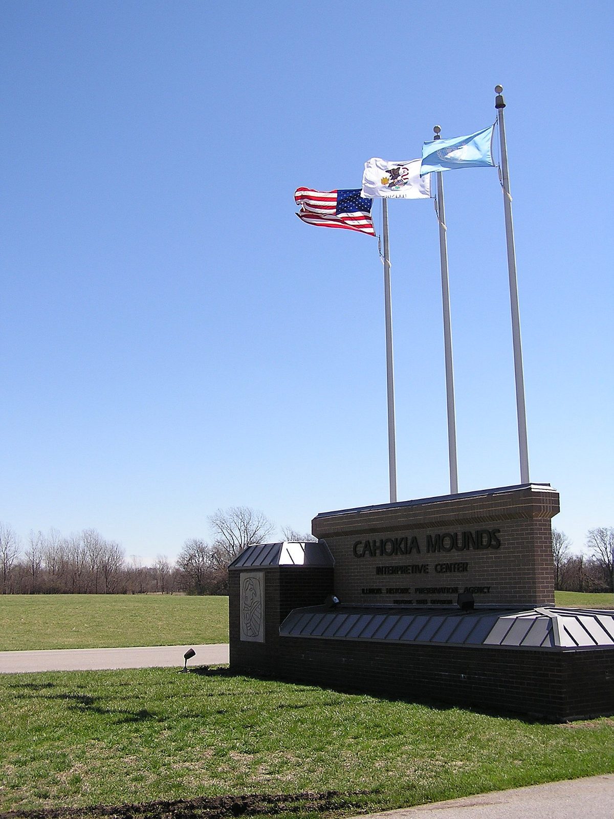
Serious archaeological investigation of the site did not begin until the twentieth century, and major excavations, including the discovery of Woodhenge and Mound 72’s remarkable burials, did not take place until the 1960s and 1970s. Cahokia Mounds is now preserved as a State Historic Site in Illinois and was designated a UNESCO World Heritage Site in 1982, recognition of its status as the most significant pre-Columbian archaeological site north of Mexico and a cornerstone for understanding Mississippian culture across eastern North America.
Long before professional archaeology arrived at the site, Cahokia’s mounds attracted the attention of nineteenth-century American travelers and early antiquarians, some of whom speculated, incorrectly, that the earthworks must have been built by a vanished, non-Indigenous civilization rather than the ancestors of Native American peoples still living in the region. This so-called Mound Builder myth persisted in popular imagination for decades before twentieth-century archaeology firmly established that Cahokia and similar sites were built by Indigenous North American societies, part of a long, continuous, and sophisticated tradition of monumental earthen architecture stretching back thousands of years across the continent.
Nearby Places to Explore
Cahokia belongs to a wider story of pre-Columbian mound-building and monumental construction across the Americas, and readers interested in this broader tradition may want to explore the following related ancient sites.
- Poverty Point: The 3,700-Year-Old Earthworks Built by Hunter-Gatherers, Not Farmers
- The Oldest Colossal Heads in the Americas Were Carved Here: The Story of San Lorenzo
- Teotihuacán: The Pyramid of the Sun and the Lost City of the Gods
Why Cahokia Still Matters
Cahokia stands as clear evidence that complex, large-scale urban society developed independently in North America centuries before European contact, challenging older assumptions that dense cities and monumental architecture only arrived on the continent with colonization. Its earthen mounds, built entirely by hand without metal tools, draft animals, or the wheel, rival the scale of monumental construction seen anywhere else in the ancient world, while its trade connections and shared religious iconography demonstrate a level of interconnection across eastern North America that many visitors do not expect from a pre-Columbian society north of Mexico.
Walking across the Grand Plaza today, or climbing the long staircase to the summit of Monks Mound, offers a direct physical connection to a civilization that thrived, then dispersed, leaving behind earthworks that still dominate the landscape of the American Bottom nearly a thousand years after they were built. Cahokia’s story continues to be rewritten as new excavations and analytical techniques uncover fresh details about daily life, belief, and the eventual decline of what was, for several centuries, the largest city in North America.
You May Like
Mafra, the Palace a King Built From a Vow


4 thoughts on “Cahokia: The Largest Ancient City North of Mexico”