Wari rose on a dry plateau above the modern city of Ayacucho, Peru, sometime around 600 CE, and within a few centuries it had grown into the first true empire the Andes had ever seen. Long before the Inca laid their famous roads, the Wari had already built a state that stretched from the northern highlands to the southern coast.
Today the ruins sit largely unrestored, a maze of collapsed stone walls, sunken plazas, and looted tombs spread across several square kilometers of scrubland. Archaeologists are still working out how a society without writing organized farmland, labor, and loyalty across such a vast and mountainous territory.
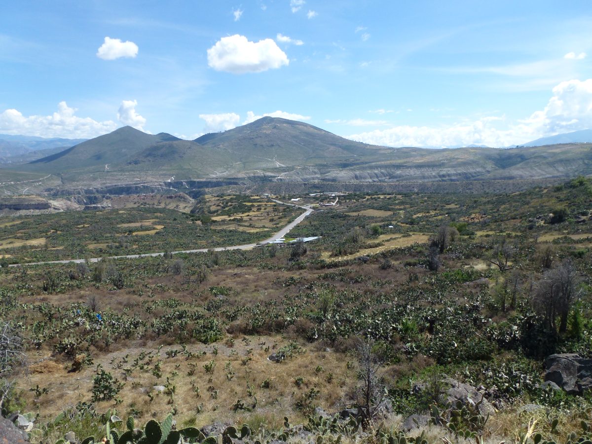
Table of Contents
- An Empire Before the Inca
- The City at Huari: Planning a Capital in the Andes
- Roads, Terraces, and the Machinery of Empire
- Pikillacta and the Wari Provincial Centers
- What Language Did the Wari Speak?
- Gods, Ancestors, and the Dead
- Weavers, Potters, and the Art of Wari
- Trade, Tribute, and the Wari Economy
- Collapse and Legacy
- Wari and the Making of the Andean World
- Nearby Places to Explore
An Empire Before the Inca
For much of the twentieth century, textbooks credited the Inca with inventing the idea of Andean empire: the roads, the terraces, the resettlement of conquered peoples, the state storehouses. Excavations at Wari and its provincial outposts overturned that picture. Radiocarbon dates now show that many of these same tools of statecraft were already in use five hundred years before Cusco existed as anything more than a village.
The Wari heartland lay in the Ayacucho basin, a fertile but seasonally dry valley system where earlier cultures like Huarpa had already experimented with irrigation and terracing. Around 600 CE, something changed. Settlement patterns shifted, populations concentrated at the site now called Huari, and construction began on a scale unlike anything the valley had seen before.
Historians still argue over what triggered the transformation. Some point to a prolonged drought that pushed farming communities to cooperate on large irrigation projects, concentrating power in the hands of whoever organized the labor. Others emphasize contact with Tiwanaku, the rival highland state around Lake Titicaca, whose religious imagery Wari artisans borrowed and reworked into something distinctly their own.
The Huarpa culture that preceded Wari in the Ayacucho valley had already domesticated the basic toolkit of Andean farming: canal irrigation, sunken agricultural terraces, and llama herding. Wari did not invent these techniques so much as scale them up dramatically, applying valley-level know-how to an entire empire’s worth of territory.
The shift from village life to imperial capital happened remarkably fast by archaeological standards, within perhaps two or three generations, a pace that suggests a decisive change in political organization rather than a slow, incremental drift toward urbanism.
The City at Huari: Planning a Capital in the Andes
The capital itself, also called Huari, sprawled across roughly 300 hectares at its peak, making it one of the largest urban centers in the Americas before the year 1000. Unlike the carefully planned grid of later Inca cities, Huari grew in dense, walled compounds, each enclosed by towering stone perimeter walls that could reach ten meters high.
Within these compounds, narrow corridors connected multi-story buildings, patios, and subterranean galleries used for storage and burial. The layout has struck many archaeologists as almost defensive or secretive, a city built to control access and visibility rather than to impress visitors with open plazas, the way later Andean capitals would.
Population estimates for Huari at its height range from 20,000 to as many as 70,000 residents, though the true figure remains debated because so much of the site has never been systematically excavated. Looting over the past century has destroyed entire sectors before archaeologists could record what stood there.
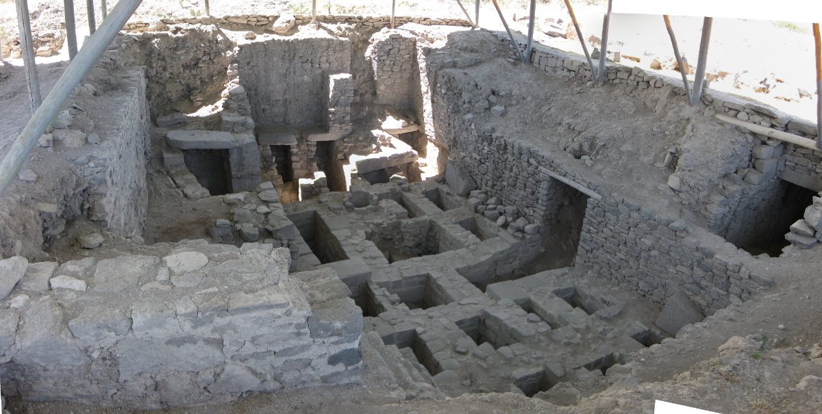
Construction techniques varied by neighborhood. Elite compounds used finely fitted fieldstone set in mud mortar and finished with white plaster, while outlying residential areas relied on simpler fieldstone and adobe. This unevenness suggests a society with sharp distinctions in status, wealth, and access to skilled labor concentrated at the center of power.
Archaeologists divide the capital into distinct sectors with names like Vegachayoq Moqo, Moraduchayoq, and Cheqo Wasi, each associated with different functions ranging from elite residence to craft production to mortuary ritual. This internal zoning suggests a level of urban planning that, while less visually obvious than Pikillacta’s grid, was nonetheless deliberate and sophisticated.
Water management within the capital itself was surprisingly sophisticated, with stone-lined canals channeling both drinking water and rainfall runoff through the dense compounds, a necessity in a city built on a plateau without any natural river running directly through it.
Roads, Terraces, and the Machinery of Empire
What truly set Wari apart from its highland predecessors was infrastructure built to project power across distance. Long before the famous Qhapaq Nan of the Inca, Wari engineers were already laying stretches of road connecting the capital to distant provincial centers, cutting travel time across some of the most difficult terrain on Earth.
Agricultural terracing expanded dramatically under Wari administration. Steep hillsides across the central Andes were reshaped into stepped fields that trapped water, reduced erosion, and extended cultivable land far beyond what valley floors alone could support. Many of these terraces remained in use for centuries after Wari itself had collapsed, quietly absorbed into later Inca farming systems.
Storage was another hallmark of Wari statecraft. Excavators have found rows of qollqa, cylindrical or rectangular storehouses, at provincial sites, holding maize, potatoes, and other staples that could be redistributed during shortages or used to provision labor gangs and soldiers. This capacity to store and move surplus food was, in many ways, the real engine of Wari expansion, allowing the state to sustain armies and construction crews far from their home fields.
Some scholars describe Wari’s approach as a form of soft empire, relying more on trade networks, shared religious ideology, and selective military force than on outright conquest of every valley it touched. Other regions, particularly along the north coast, appear to have retained local rulers who adopted Wari styles and administrative practices voluntarily, drawn by the prestige and trade access that association with the highland power provided.
Some stretches of Wari road were cut directly into rock faces or reinforced with retaining walls to survive the seasonal rains that regularly wash out unpaved mountain paths. Later Inca engineers, rather than starting from nothing, frequently chose to follow and formalize these existing Wari routes when building the Qhapaq Nan.
Pikillacta and the Wari Provincial Centers
Nowhere is Wari’s provincial strategy clearer than at Pikillacta, a planned administrative center near modern Cusco, roughly 600 kilometers from the capital. Built on a rigid grid of rectangular compounds, Pikillacta looks almost nothing like organic, winding Huari. Its uniformity suggests it was constructed quickly, by state planners working from a single blueprint rather than by generations of organic growth.
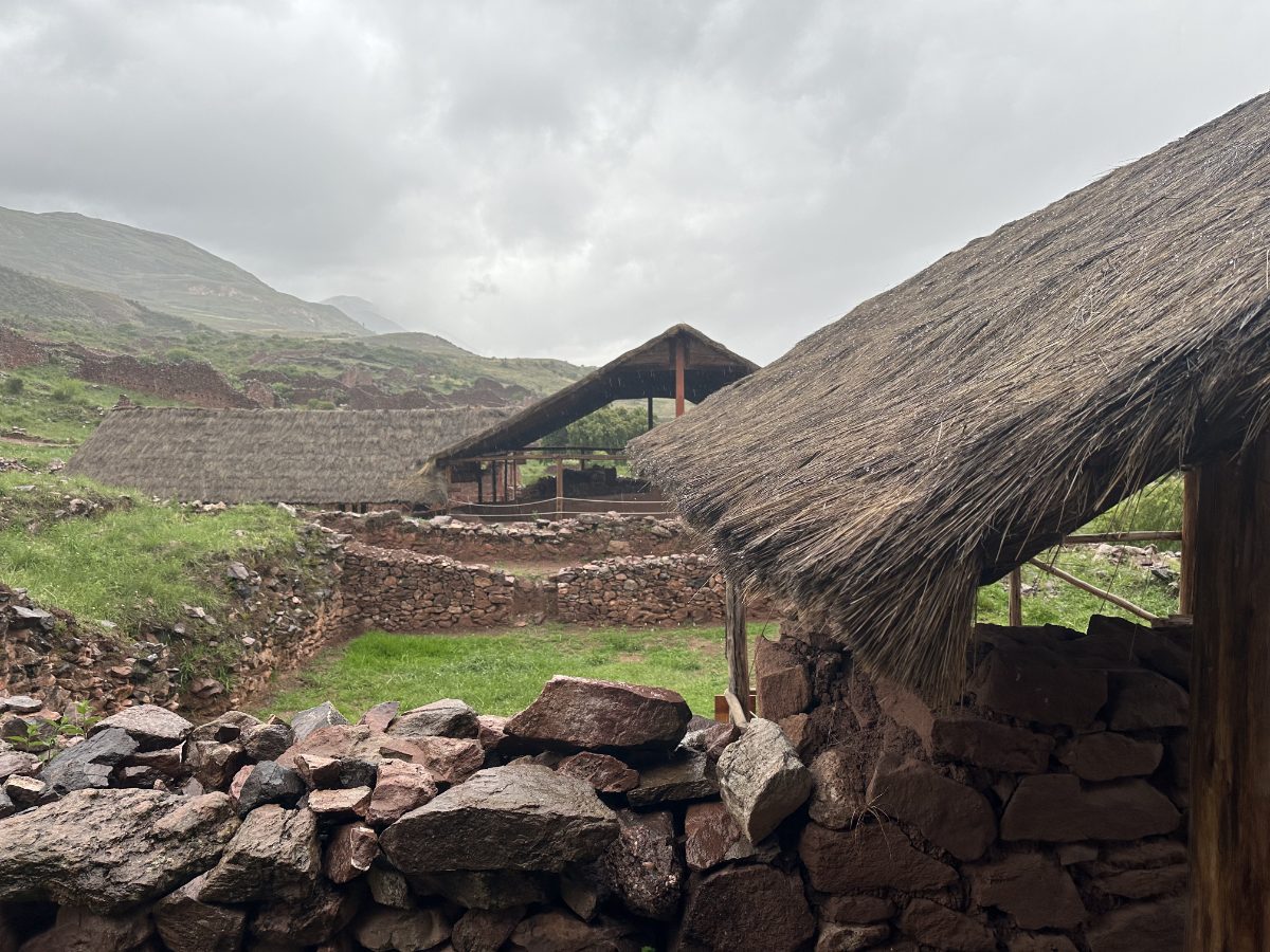
Pikillacta’s high perimeter walls, narrow doorways, and sealed storage rooms point to a site built primarily for control: controlling grain, controlling labor, and controlling the flow of people and goods between the Cusco basin and the Wari heartland further south. Remarkably little evidence of large-scale residential occupation has been found there, leading some archaeologists to argue it functioned more as a warehouse and ceremonial waystation than a true city.
Similar provincial centers appeared at Viracochapampa in the north and Cerro Baul far to the south, each adapted to local geography but sharing the same architectural vocabulary of rectangular compounds, high walls, and centralized storage. Together they formed a network binding together ecological zones as different as coastal desert, highland puna, and eastern jungle margins.
Cerro Baul deserves particular mention: a fortress-like Wari outpost built atop a steep-sided mesa in the Moquegua Valley, deliberately placed at the frontier with Tiwanaku territory. Excavations there uncovered a brewery producing chicha, maize beer, apparently for large ceremonial feasts meant to cement alliances with local elites, a reminder that Wari power rested as much on hospitality and shared ritual as on force.
Excavators at Pikillacta have puzzled over hundreds of small rooms that appear to have been sealed shut almost as soon as they were built, their doorways filled in with stone rather than left open for use. One proposed explanation is that these sealed chambers were symbolic storerooms, built to represent abundance and state control rather than to hold any actual goods.
The scale of Pikillacta, with an estimated 700 individual structures enclosed within its outer walls, rivaled the capital itself in sheer built area, even though far fewer people appear to have lived there day to day, reinforcing its likely role as a specialized administrative and storage hub rather than an ordinary city.
What Language Did the Wari Speak?
Wari left no deciphered writing system, so the language its people spoke cannot be read directly from any inscription the way Maya or Egyptian texts can. What survives instead is circumstantial: place names, later chronicles, and the historical linguistics of Quechua and Aymara, the two great language families that still dominate the Andes today.
A prominent theory, associated with linguist Alfredo Torero and later refined by others, holds that Wari expansion was the vehicle that first spread an early form of Quechua far beyond its original homeland, seeding the dialect chains that Inca conquest would later knit into an imperial lingua franca. Under this view, Wari administrators and colonists carried proto-Quechua speech into regions as distant as the northern and southern highlands, explaining why Quechua dialects today are more diverse and deeply rooted outside Cusco than within it.
Other researchers argue instead for an Aymara-speaking elite at Wari, pointing to close ties with Tiwanaku, a state generally associated with the Aymara-Puquina linguistic sphere around Lake Titicaca. Under this reading, Quechua’s later spread owes more to the Inca than to Wari, and Wari’s own tongue may have been an early form of Aymara or a now-vanished language entirely separate from both surviving families.
Honesty requires admitting that neither position can be proven with the evidence currently available. No Wari document names its own language, and the state may in any case have been multilingual, ruling over Quechua, Aymara, and now-extinct local languages simultaneously through the same provincial administrators found at Pikillacta and Cerro Baul. What can be said with confidence is that Wari’s road network and colonial outposts were almost certainly one of the key mechanisms by which some ancestral Andean language, whichever it was, first became a shared tongue across a fragmented, mountainous landscape.
Modern place names across Peru and Bolivia preserve a tangled mix of Quechua, Aymara, and older substrate words whose origins linguists still cannot fully untangle, a linguistic landscape that likely reflects centuries of Wari and later Inca administration layered on top of even older, now-vanished local languages.
Gods, Ancestors, and the Dead
Wari religion centered on ancestor veneration, a practice visible in the elaborate mortuary architecture found throughout the capital. Elite dead were not simply buried and forgotten. They were wrapped into seated funerary bundles, called fardos, sometimes accompanied by fine textiles, ceramics, and personal ornaments, then placed in subterranean chambers that could be reopened and revisited by descendants.
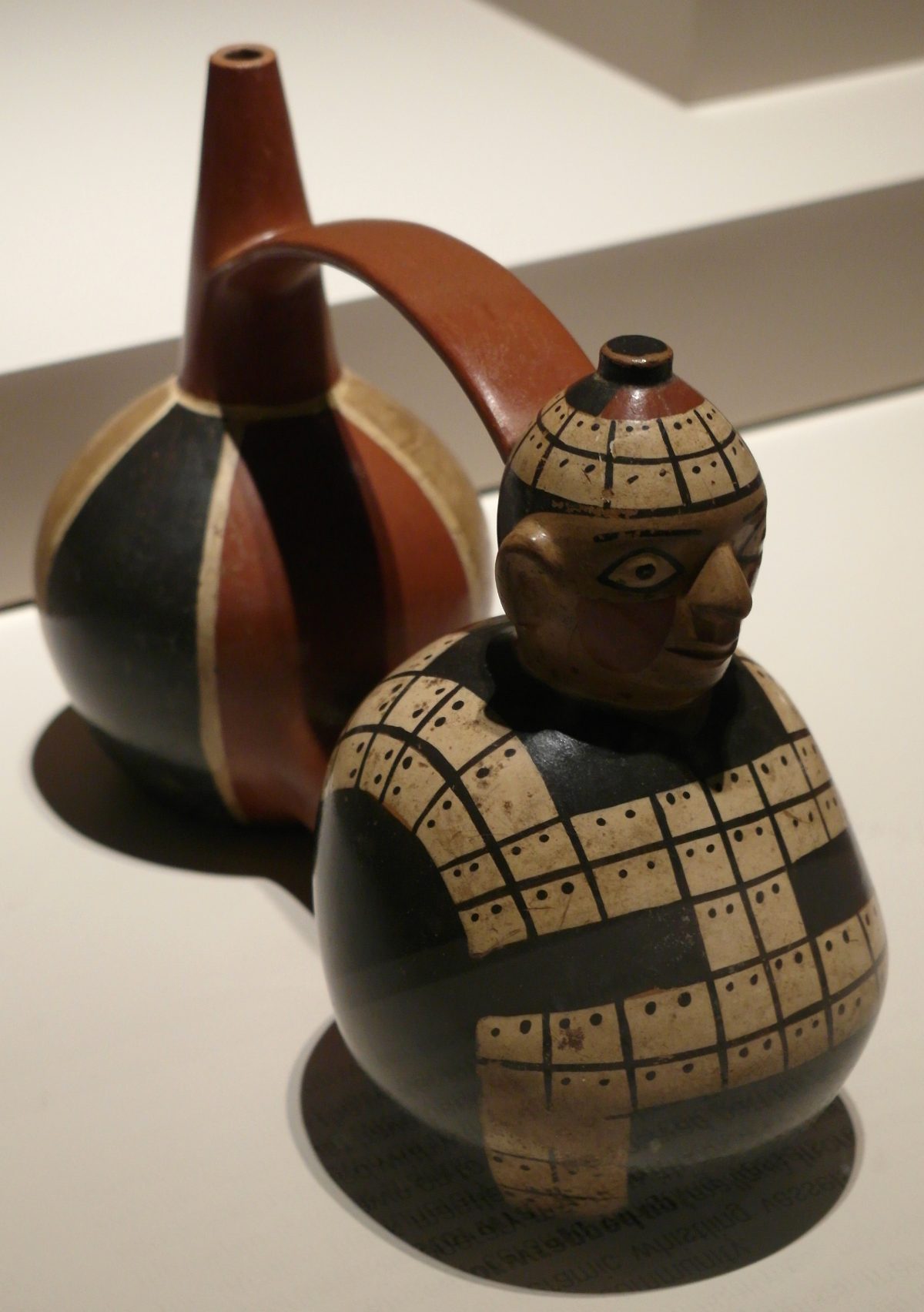
These chambers, cut directly into bedrock beneath residential compounds, suggest that the ancestors were kept close and consulted, not banished to a separate city of the dead. Some galleries show signs of repeated reuse over generations, with older remains pushed aside to make room for newly deceased kin, a pattern that speaks to ongoing ritual relationships between the living and their forebears rather than a single funeral event.
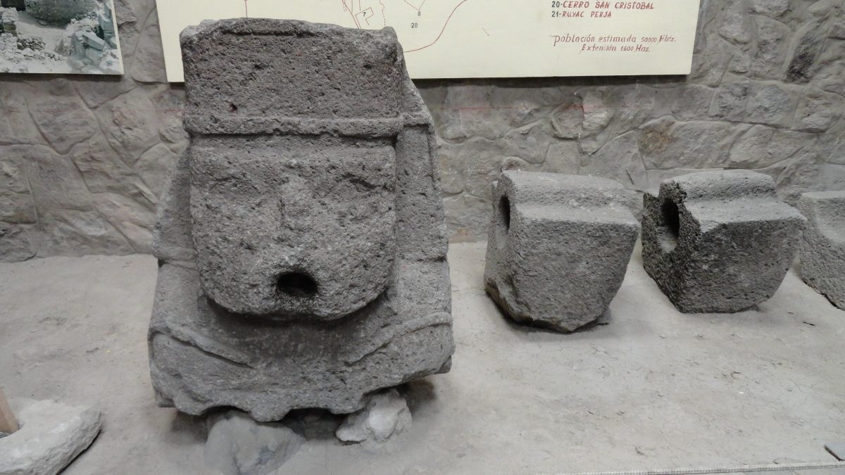
Wari iconography borrowed heavily from Tiwanaku’s Staff God imagery, a front-facing deity holding two staffs and radiating sunburst rays, appearing on textiles, ceramics, and carved stone monoliths like the one now displayed in Ayacucho. Yet Wari artists reworked this shared religious vocabulary into their own regional styles, suggesting a common highland belief system that both states drew from rather than a simple case of one culture copying the other.
Feasting was itself a religious and political act. The chicha breweries found at outposts like Cerro Baul were not merely practical; drinking maize beer in ceremonial quantities alongside local elites was a way of building obligation and alliance, binding distant communities into the Wari sphere through shared ritual intoxication rather than through garrisons alone.
Grave goods found alongside Wari funerary bundles often include miniature versions of everyday tools and vessels, suggesting a belief that the dead required scaled-down equivalents of the objects they had used in life, a practice hinting at a continued, active existence for ancestors within the household compound itself.
Later colonial Spanish chroniclers recorded Andean beliefs describing mountains, springs, and boulders as living beings called huacas deserving of offerings, a worldview archaeologists suspect already existed in some form during Wari times, given the careful placement of shrines and ritual deposits at prominent natural features near the capital.
Weavers, Potters, and the Art of Wari
Wari textiles rank among the finest ever produced in the ancient Americas. Weavers achieved thread counts and color saturation that took modern researchers decades to fully appreciate, using cotton and camelid fiber dyed in brilliant reds, yellows, and blues to create tunics covered in interlocking geometric patterns derived from religious iconography.
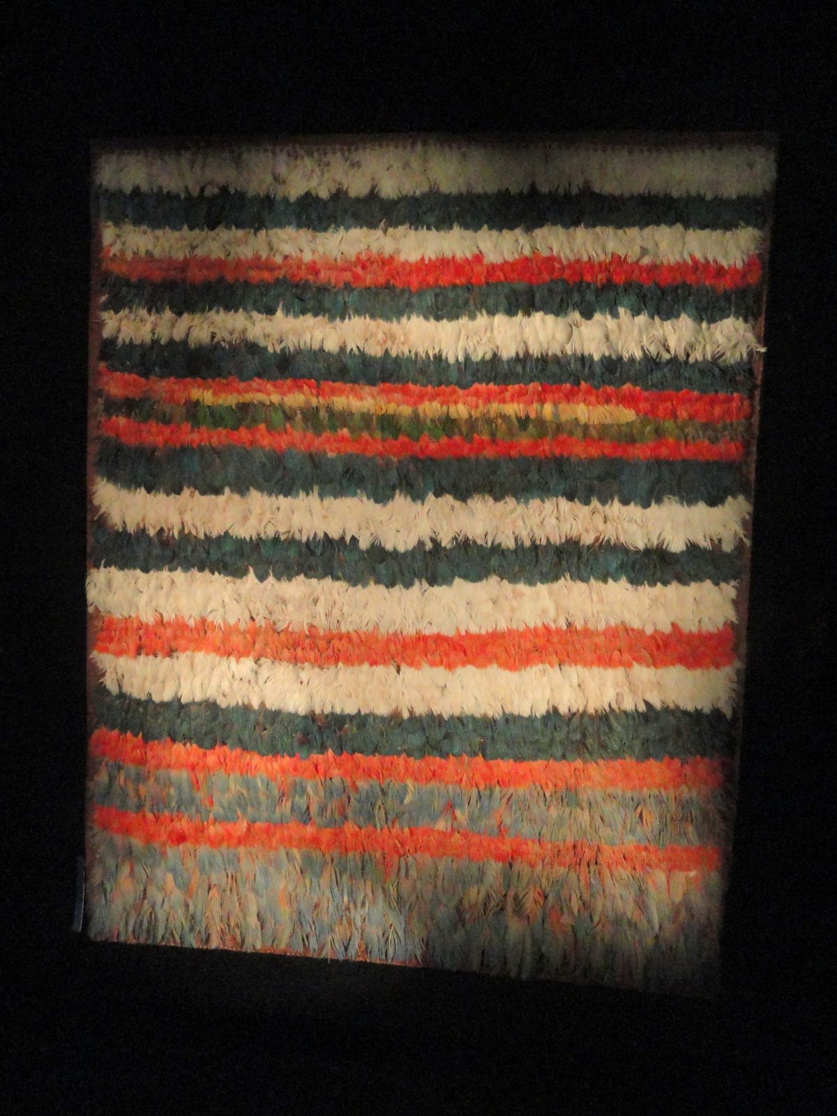
Feather work reached similar heights. Artisans stitched thousands of tropical bird feathers, sourced through long-distance exchange with Amazonian lowland communities, onto cotton backing to create panels and garments of shimmering color reserved for the highest elites. The labor and trade networks required to acquire so many feathers from distant, ecologically different regions hint at just how far Wari’s economic reach extended beyond its highland core.
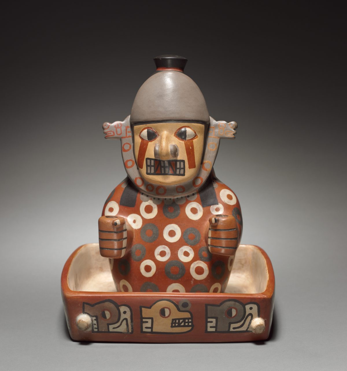
Wari potters favored polychrome designs fired in a distinctive palette, producing double-spout-and-bridge bottles, face-neck jars, and effigy vessels that combined Tiwanaku-derived religious motifs with distinctly Wari craftsmanship. These ceramics, along with textiles, traveled along the same road and exchange networks that moved food and labor, functioning as prestige goods that marked their owners as connected to the imperial center.
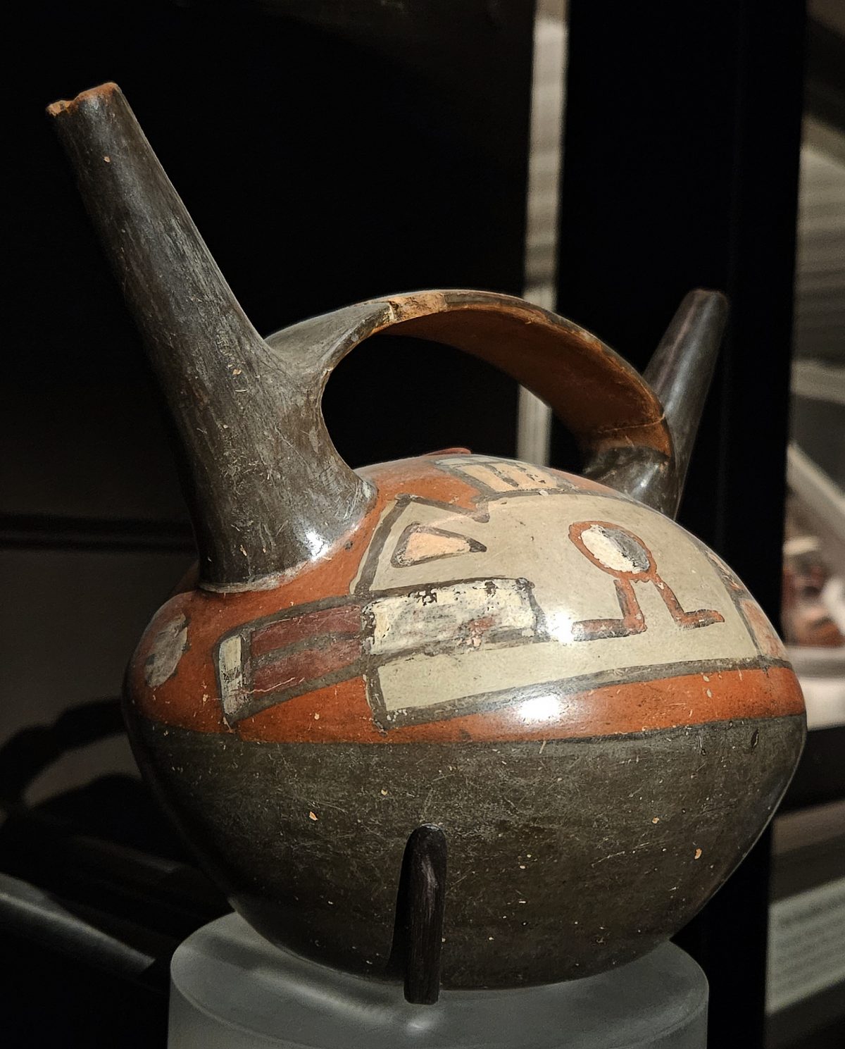
Some vessels were made specifically to be broken. Archaeologists have found smashed ceremonial pottery in what appear to be deliberate offering deposits, suggesting ritual destruction was itself part of Wari religious practice, perhaps marking the closing of a building, the death of an important person, or the sealing of a ceremonial event.
Some Wari tunics contain so many interlocking color changes per square inch that modern weavers using traditional backstrap looms have struggled to replicate them, and analysis of thread counts suggests the finest examples could take a single weaver more than a year of dedicated labor to complete.
Trade, Tribute, and the Wari Economy
Wari’s economy rested on what archaeologists call vertical archipelago exchange, the Andean strategy of maintaining access to multiple ecological zones, coast, valley, highland, and puna grassland, simultaneously, rather than relying on trade alone to bring in goods a single zone could not produce. Colonies and outposts planted in distant valleys let the state draw directly on maize from warm lowlands, potatoes from the cold puna, and marine resources from the Pacific coast all at once.
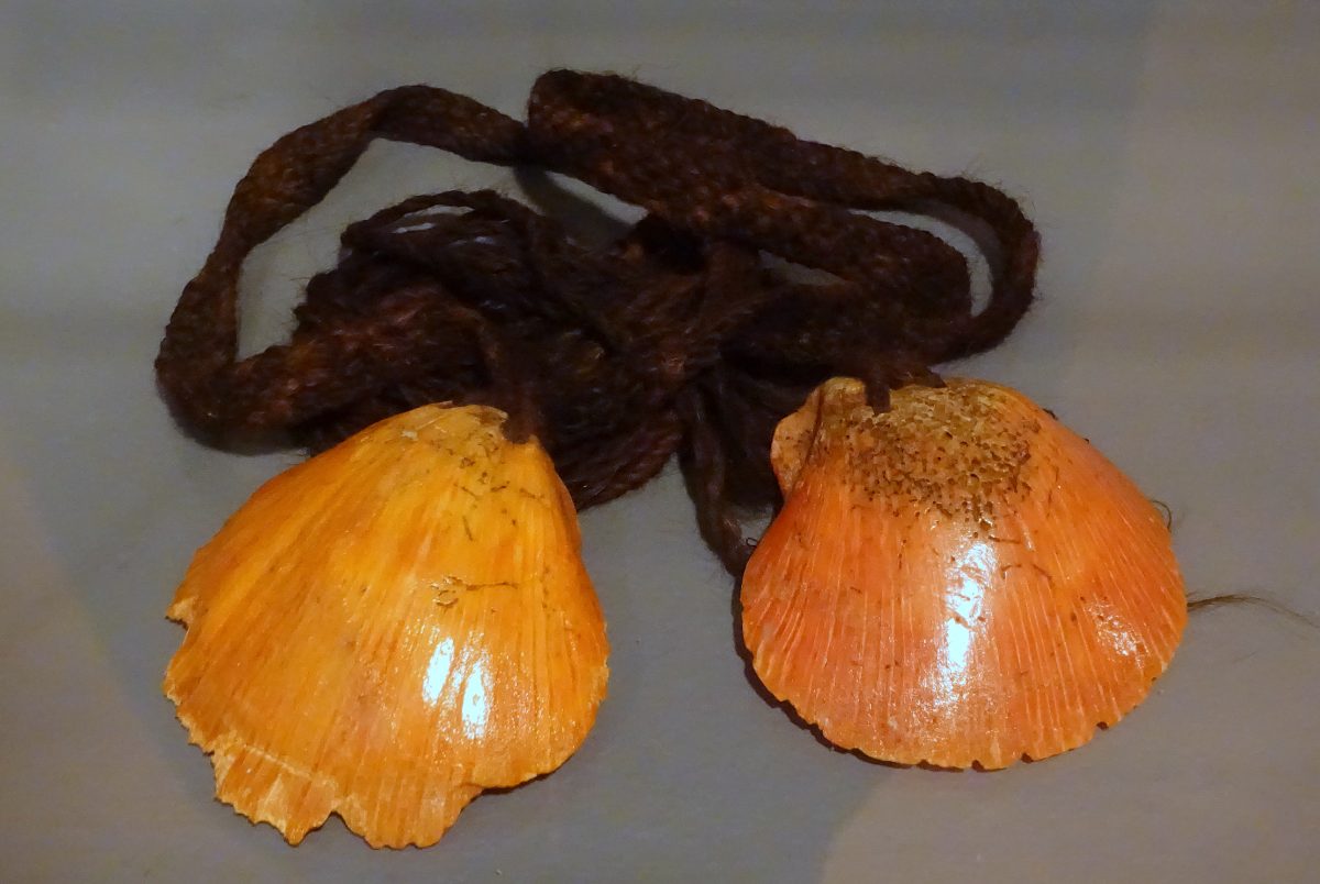
Llama caravans moved goods along the road network linking these zones, carrying maize, dried fish, coca leaf, textiles, and ceramics between the capital and its provinces. Obsidian for tools and weapons, spondylus shell from warm Ecuadorian waters for ritual use, and feathers from Amazonian lowlands all show up far from their points of origin at Wari sites, testament to trade connections stretching well beyond the empire’s direct political control.
Labor, not currency, was the real unit of the Wari economy. Communities owed work obligations to the state, whether building terraces and roads, weaving textiles, or serving in provincial garrisons, and the state in turn owed reciprocal feasting, chicha, and redistributed goods in return. This mutual, if unequal, exchange of labor for hospitality and protection would become a defining feature of Andean statecraft for centuries afterward, adopted almost wholesale by the later Inca.
Isotope analysis of skeletal remains from Wari sites shows individuals who grew up eating diets heavy in coastal marine protein later buried at highland sites, and vice versa, direct biological evidence of the population movement and resettlement policies that bound Wari’s scattered ecological zones into a single functioning economy.
Coca leaf, chewed for its mild stimulant effect and used widely in ritual offerings, traveled from warm eastern valleys to the highland capital along the same routes as maize and textiles, and its presence at Wari sites far from where it grows underscores just how tightly the empire’s ecological zones were woven together.
Collapse and Legacy
Wari’s decline unfolded gradually across the tenth century rather than in a single dramatic collapse. Ice core and lake sediment records from the region point to a severe, prolonged drought beginning around 800 CE that likely strained the agricultural terraces and storage systems the empire depended on to feed its cities and provincial garrisons.
As drought pressure mounted, evidence suggests the capital itself was deliberately abandoned rather than destroyed by outside invaders. Excavators have found sealed doorways and rooms filled with rubble in an orderly fashion, as though residents closed off sections of the city in a controlled, ritualized withdrawal rather than fleeing in panic from an attacking army.
Provincial centers like Pikillacta and Cerro Baul were likewise abandoned around the same period, with some showing signs of deliberate burning of their own storerooms, possibly a closing ritual performed by the departing Wari administrators themselves rather than an act of enemy destruction. By roughly 1000 CE, the empire that had once linked the coast and highlands across a thousand kilometers had fragmented back into competing regional polities.
Not every region experienced Wari’s decline the same way. Some former provincial centers saw local elites simply step into the administrative vacuum left behind, continuing to use Wari-style storehouses and terraces for generations even after the capital itself had emptied out.
Wari and the Making of the Andean World
When the Inca began building their own empire some four centuries later, they inherited a landscape already shaped by Wari. Terraces still climbed hillsides across the highlands, sections of Wari road still crossed valleys the Inca would later widen and formalize into the Qhapaq Nan, and the very idea that a highland state could administer coast, valley, and mountain simultaneously had already been demonstrated once before.
Inca oral tradition barely mentions Wari by name, a silence some scholars read as a form of selective forgetting, an empire builder erasing a predecessor to appear as the sole inventor of Andean statecraft. Archaeology has restored some of what that silence obscured, showing modern visitors that the roads, terraces, and storehouses long credited entirely to the Inca had Wari, and its city above Ayacucho, as a genuine and largely forgotten forerunner.
Modern hydrological engineers studying Andean terracing have found that many Wari-era systems still function as designed today, quietly preventing erosion and managing water on hillsides that farmers continue to cultivate more than a thousand years after the empire that built them disappeared.
Spanish colonial administrators, centuries later, would even reuse some former Wari and Inca storage and road infrastructure for their own tribute and mining economy, an unbroken thread of engineering running from the pre-Inca Andes into the colonial period and, in the case of some terraces and paths, into the present day.
Nearby Places to Explore
Wari’s story connects directly to other Andean sites that InKend has already explored in depth.
- Tiwanaku: The Bolivian City Behind the Gate of the Sun
- Chan Chan: The Largest Adobe City in the World
- Cerro Sechin: The 3,600-Year-Old Peruvian Temple Carved With Warriors and Their Victims
closing
Wari rarely gets the recognition given to the Inca or the Maya, yet its road network, storage systems, and administrative playbook quietly shaped how every later Andean state, including the Inca, would govern a landscape of deserts, valleys, and mountains all at once.
Visitors who make the trip to the ruins above Ayacucho today find no restored palaces or crowds of tourists, only wind-worn stone walls and a scatter of chambers hinting at an empire whose true scale archaeologists are still working to measure.
You May Like
Mafra, the Palace a King Built From a Vow


4 thoughts on “How the Wari Empire Ruled the Andes Long Before the Inca”