Deep in the rainforest of northern Guatemala, in the region known as the Petén, six great temples pierce the jungle canopy like stone mountains. This is Tikal, one of the largest and most powerful cities of the Classic Maya world. For over a thousand years it rose and flourished here, its plazas, palaces, and pyramids the seat of a dynasty of kings who warred, traded, and built across the Maya lowlands. Then, like so many Maya cities, it was abandoned to the forest, its towers left to be swallowed by green.
What makes Tikal so extraordinary is the way its grandeur and its wildness coexist. Howler monkeys roar in the trees around temples where kings were once entombed with jade and obsidian; toucans fly past carved stelae recording ancient dates. Rediscovered and gradually cleared over the past century and a half, Tikal offers one of the most complete pictures we have of a great Maya capital at its height, a place where the achievements of one of the ancient Americas’ most sophisticated civilizations stand amid the living jungle.
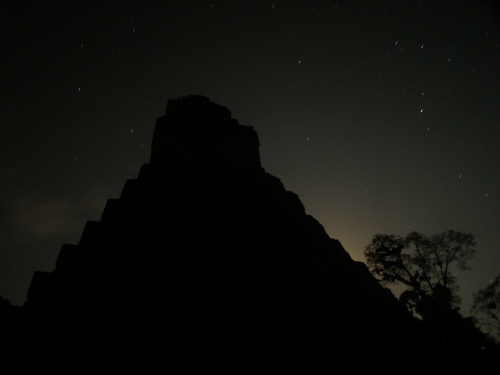
Table of Contents
- The Classic Maya World
- The Great Plaza
- Temple of the Great Jaguar
- Temple of the Masks
- The North Acropolis
- Temple IV and the Canopy
- Stelae and Kings
- War, Trade, and Rivalry
- Collapse and the Forest
- Getting There
- Nearby Places
- Closing Thoughts
The Classic Maya World
Tikal belonged to the Classic period of Maya civilization, roughly the third to ninth centuries, when dozens of independent city-states flourished across the lowlands of what are now Guatemala, Mexico, Belize, and Honduras. Each was ruled by a divine king and competed with its neighbours through warfare, alliance, and displays of monumental building.
Among these cities Tikal was a giant, at times the most powerful of all. It commanded a large population, controlled trade routes, and projected its influence over rivals near and far. Its history, recorded in carved inscriptions, is one of the best documented of any Maya city.

The Great Plaza
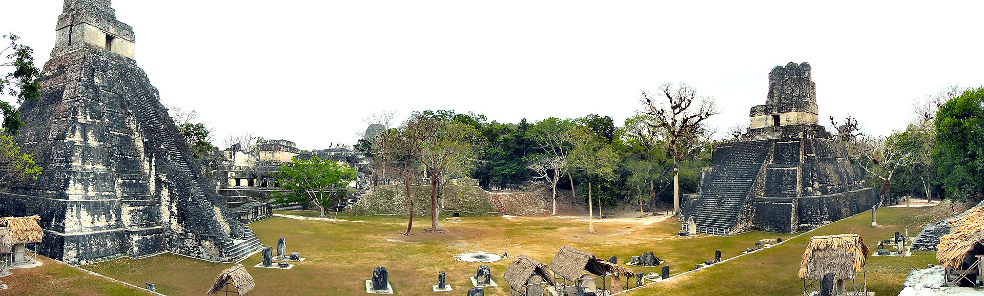
The heart of Tikal is the Great Plaza, a broad open space flanked by two soaring temples and bordered by the North Acropolis and a royal palace complex. This was the ceremonial and political centre of the city, where rituals were performed and monuments to the kings were raised.
Standing in the plaza, surrounded on all sides by monumental architecture, one senses the deliberate theatre of Maya kingship. Every structure was designed to impress, to awe, and to proclaim the power of the ruling dynasty and its connection to the gods.

Temple of the Great Jaguar
On the eastern side of the plaza rises Temple I, the Temple of the Great Jaguar, a steep pyramid climbing some forty-seven metres to a small temple crowned by an ornate roof-comb. It was built in the eighth century as the funerary monument of one of Tikal’s greatest kings, Jasaw Chan K’awiil I, who was buried in a rich tomb beneath it.
The temple’s dramatic silhouette has become the emblem of Tikal and of Maya civilization itself. Its discovery, with the king’s jade-laden burial intact, was one of the great archaeological finds of the Maya world.
Temple of the Masks
Facing Temple I across the plaza stands Temple II, the Temple of the Masks, slightly lower but no less imposing. It is thought to have been dedicated to the king’s wife, and the two temples together frame the plaza in a deliberate architectural dialogue.
From the top of Temple II, the view across the plaza to Temple I and the North Acropolis captures the essence of Tikal’s design. The paired temples embody the balance and symmetry that Maya architects prized.
The North Acropolis
Bordering the plaza is the North Acropolis, one of the most complex structures in the Maya world. Built and rebuilt over more than a thousand years, it is a dense accumulation of temples and tombs, layer upon layer, in which generations of Tikal’s rulers were buried.
Excavations here have peeled back these layers, revealing earlier buildings, painted masks, and royal graves hidden within the mass. The acropolis is effectively a stratified history of the dynasty, written in stone and stucco.

Temple IV and the Canopy
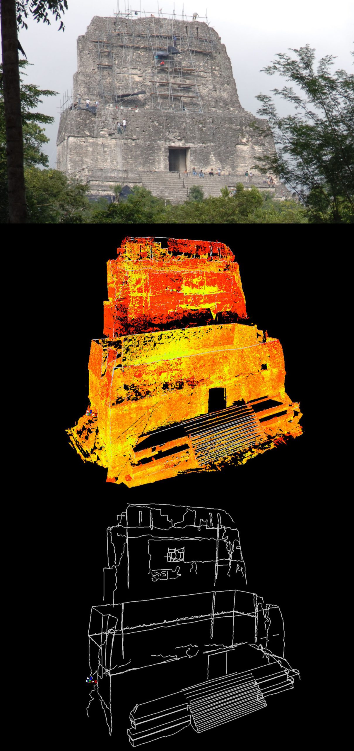
To the west rises Temple IV, the tallest structure at Tikal and one of the tallest known in the pre-Columbian Americas, reaching some sixty-five metres. From its summit, visitors emerge above the forest canopy to a sea of green broken only by the roof-combs of other temples in the distance.
This view, of ancient towers rising from endless jungle, is among the most memorable in the archaeological world. It captures both the ambition of the builders and the power of the forest that reclaimed their city.
Stelae and Kings
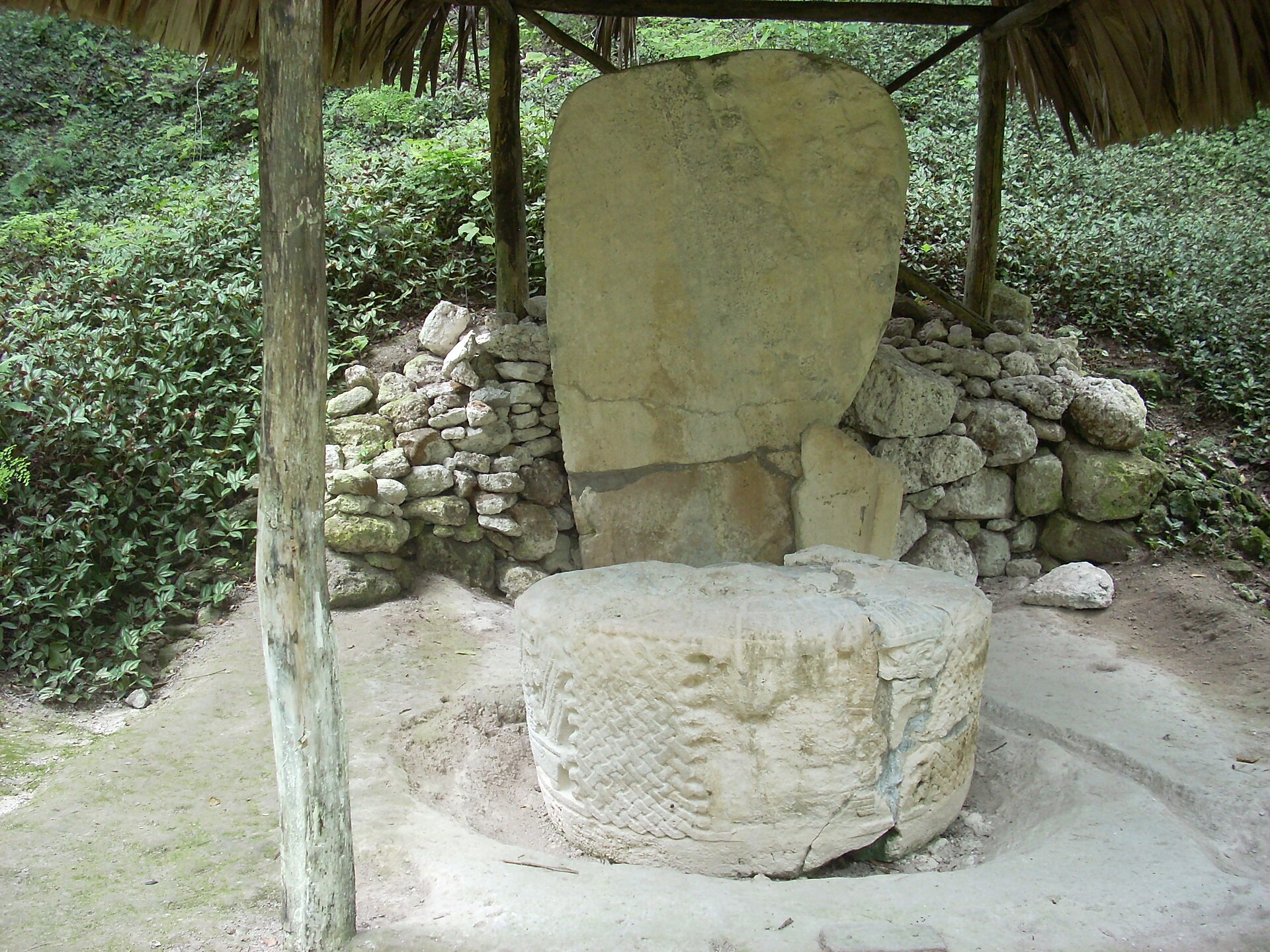
Throughout Tikal stand stelae, tall carved stone slabs, often paired with round altars, erected to commemorate kings and important dates. Their inscriptions, written in Maya hieroglyphs, record the accessions, victories, rituals, and deaths of rulers, anchored to the precise Maya calendar.
These monuments have allowed scholars to reconstruct the dynastic history of Tikal in remarkable detail, naming its kings and dating their reigns. They are a vivid reminder that the Maya were a fully literate civilization with a deep sense of history.
War, Trade, and Rivalry
Tikal’s history was shaped by rivalry, above all with the distant city of Calakmul, with which it fought a long struggle for supremacy over the lowlands. Tikal suffered defeats and periods of eclipse, but repeatedly recovered, and its greatest monuments celebrate victories in these wars.
The city also had far-reaching contacts, including with distant Teotihuacan in central Mexico, whose influence appears in Tikal’s art and dynastic history. Tikal was a node in a wide web of Mesoamerican politics and exchange.
Collapse and the Forest
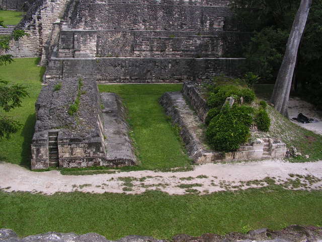
In the ninth century Tikal, like the other great cities of the southern lowlands, went into decline. The reasons remain debated, involving some combination of drought, warfare, overpopulation, and environmental stress. Monument-building ceased, the population fell, and the city was gradually abandoned.
The forest moved back in, burying the temples for a thousand years until explorers and archaeologists began to clear them in the nineteenth and twentieth centuries. Today Tikal sits within a vast national park that protects both the ruins and the rich rainforest around them.

Getting There
Tikal lies in the Petén region of northern Guatemala, most easily reached from the nearby town of Flores, which has an airport with connections to Guatemala City. The site is large and set in tropical forest, so an early start, good footwear, and water are advisable, and staying overnight nearby allows visits at dawn and dusk when wildlife is most active.
The site stands at approximately 17.2220, -89.6237. You can open the exact location on Google Maps for directions to the ruins of Tikal.
Nearby Places
Closing Thoughts
Tikal is the Maya world at its most complete and most evocative: a great city of temples and palaces, ruled by kings whose deeds are still legible on carved stone, set within the living forest that once reclaimed it.
To climb its temples and look out over the canopy, or to stand in the Great Plaza between the towering pyramids, is to grasp both the height of Maya achievement and the mystery of its passing. Tikal endures as one of the supreme monuments of the ancient Americas.
You May Like


2 thoughts on “Tikal: The Maya Metropolis That Rose Above the Guatemalan Jungle”