Konya province is the largest province in Turkey by surface area, located in the Central Anatolia Region of Turkey and surrounded by the provinces of Ankara, Eskişehir, Afyon, Isparta, Antalya, Karaman, Mersin, Niğde and Aksaray.
It is claimed that the name of the city of Konya is related to the word “Icon” meaning Sacred Image. There are different rumors about this subject in mythology. As told in one of these stories, a monument is built as an expression of gratitude to the person who killed the dragon that haunted the city, and a picture depicting the event is drawn on it. The name given to this monument is Ikonion. The name Ikonion turns into Icconium over time.
During the Roman period, it received new names such as Claudiconium, Colonia Selie, Augusta Iconium, which changed with the names of the Emperors. Other names given to the city and the region, referred to as Tokonion in Byzantine sources, are as follows: Ycconium, Conium, Stancona, Conia, Cogne, Cogna, Konien, Konia… Konya, which the Arabs call Kuniya, remained unchanged during the Seljuk and Ottoman periods and acquired its name that has survived to this day.
Konya Lakes
Salt Lake: Salt Lake was formed in the center of the Salt Lake closed basin. It is at the intersection of the borders of Ankara, Konya and Aksaray and a part of it is located within the borders of Konya. Tuz Lake is the second largest lake in Turkey. Depth 12 m. is around. In summer, its area becomes quite small due to evaporation. Salt deposits form in dry areas. Some of Turkey’s salt needs are supplied from here.
It is not used for irrigation and aquaculture.
Beyşehir Lake: It is located on the Konya-Isparta border in the west of Konya province. Beyşehir Lake is the third largest lake in our country. It is also the largest freshwater lake. It was formed by tectonic-karst events. It is also one of Turkey’s most important national parks. It is possible to do water tanks, mountain sports and hunting sports at the same time within the national park area. It has high economic value in terms of aquatic products.
The lake has two beaches, 22 islands and many cliffs. The lake is an ornithologically important bird breeding, sheltering, feeding and accommodation center. In this respect, it is important for tourism.
Akşehir Lake: It is located in the northwest of Konya province, on the Konya-Afyonkarahisar provincial border. Its water is sweet. It was formed by tectonic events. It shows economic value in terms of aquatic products. It is used as irrigation water and cane production is also carried out.
Suğla Lake: It is located in the southwest of Konya province. Its formation is tectonic. In rainy years, its area expands, and in dry years, the lake dries out and the alluvial lake bottom emerges, creating a good agricultural area. Its water is sweet. It is of great importance in terms of aquaculture and irrigation.
Ilgın (Çavuşçu) Lake: It is located in the northwest of Konya province. Its formation is tectonic. Its waters are sweet. It is important for aquatic products. In addition, the Atlantic plains are irrigated with one of its channels.
Ereğli Akgöl: It is in the west of Ereğli district. It is the old lake bottom. It has a very shallow feature. Its waters are sweet. It is fed by the waters coming from the Ivriz stream. More than 200 bird species live in Akgöl reeds. That’s why it has been accepted as a nature conservation area.
Yunak Akgöl: It is a small lake near Yunak district. Its water is sweet. Most of it is in swamp condition. The lake empties into the Sakarya River via the Gökpınar stream.
Places to Visit in Konya
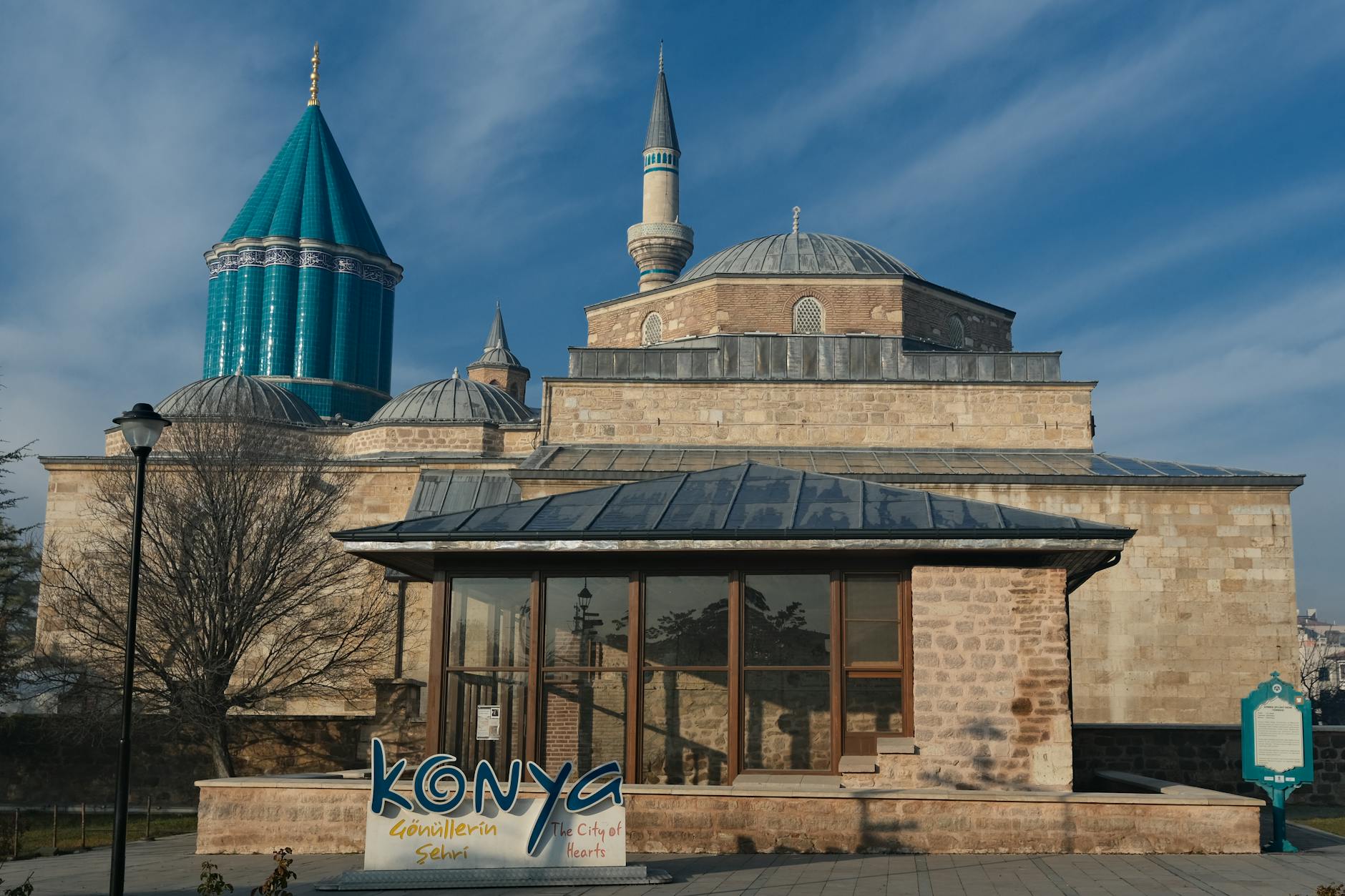
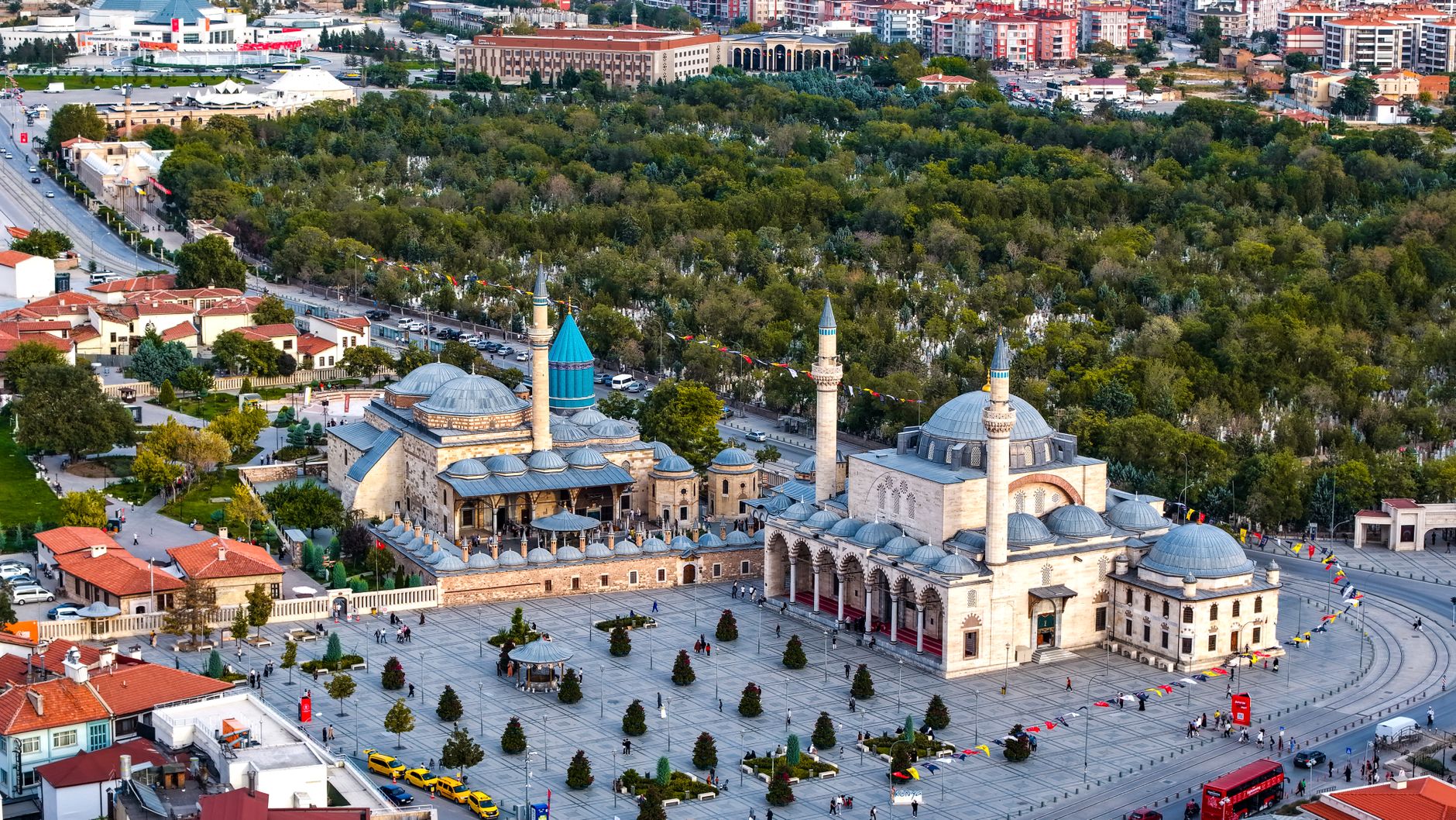
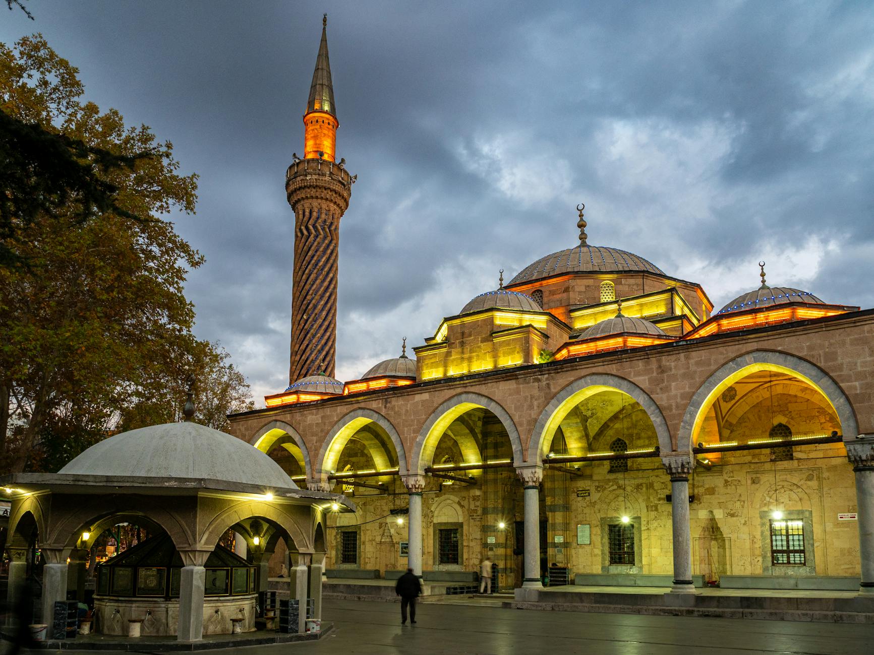
There is no doubt that the first thing that comes to mind in Konya is the Mevlana Museum, whirling dervish shows, Karatay Madrasa, İnce Minare, Alaaddin Mosque, Atatürk Museum, Koyunoğlu Museum, Archeology, Ethnography Museums, Ladik carpets, meatballs, wooden spoons, etc. But of course Konya is not that much.
If we look at the nature of Konya, the grain warehouse of Turkey, the first things that stand out within the provincial borders are the Yerköprü Waterfall near Hadim, then Lake Meke, which has a pastoral flavor despite its eerie loneliness, straight roads full of inns and caravanserais, ancient sites and many more. You have to start somewhere… I’m starting from Yerköprü Waterfall.
Yerköprü Waterfall: You come to the Hadim sign from the rope-like straight and wide road stretching across the plain from Konya towards Karaman. Before reaching Hadim, continue 29 km towards Aladağ and reach Bademli and Şelale, 7 km after Yağcılar, which stands out with its earth-coloured houses in harmony with the environment.
When you get out of the vehicle and take a very short walk towards the direction where the sound of water comes from, you find yourself among caves, limestone pools, mossy travertines, various formations and local plants. Flowing wildly from a height of 20 meters, the Waterfall continues on its way, sometimes underground and sometimes above ground, to reach the Mediterranean. Göksu River fascinates viewers with its effect on the formation of astonishing travertines.
If you are interested in taking photos and finding different angles around the waterfall, you need to pay special attention to the wet, mossy, slippery parts of the rocks and the places you step on. The roaring sound of the raging waters pouring down, the water particles dispersed around, and the violent currents that form, cause all the fatigue and accumulation on you to disappear in a short time.
In the place where you can picnic and camp accompanied by the chorus of happy birds mixed with the sound of roaring water, you can discover different colors with the lighting effects that change according to the season, see the rainbow and take interesting photographs. The earth-coloured water caused by rains turns bluer and clearer in summer.
After your waterfall visit, you can either go back the way you came or cross the winding and time-consuming Taurus Mountains and go down to Silifke from Mut via Ermenek. Now we are heading to nature’s surprise, Meke Tuzlası crater lake, on the Konya-Ereğli road.
Meke LakeMeke Lake is located 1 km from the road near Karapınar. There is an abandoned house at the entrance of the lake. The ramp in front of it brings you to the lake shore. The road resembling coal dust, which continues from the east and west of the house, not only makes you believe that you are at the mouth of the crater, but also takes you to the back surface of the lake, where the best view can be seen, and allows you to wander around it.
The dust-free exterior of the road, which resembles cracked coal, also offers the opportunity to travel among stunted grass on a rugged terrain that will satisfy the “off-road” taste. The islets, which are examples of volcano vents formed within the Meke Tuzlası crater lake, which has a perimeter of approximately 4 km, offer a different visual pleasure to nature lovers.
Although the hills at the end of the road at the entrance to Karapınar from Meke Lake and a little inside do not attract attention from the road, they are called “Ketirlik” and contain an interesting rock mass. Natural wildflowers and moss-faced rocks in the region, where nature is very generous, will attract the attention of those who are interested in macro photography.
İvriz rock relief monument While you are in Konya Ereğli, you should definitely see İvriz, which is 21 km away. Ereğli Municipality has placed signs on the most suitable sections of the İvriz road. Thus, you can reach Ivriz and the magnificent rock monument without asking anyone. The most important relief from the Tuwana kingdom to our time belongs to the late Hittite period and was created by the Tuwana king Warpulowas in B.C. It was built in the 8th century.
Figures of Tarhundas, the god of fertility, and King Warpulowas worshiping in front of him, and the Hittite hieroglyphic writing on the back; “I am Warpulovas, king of Tuwana, the judge and hero. When I was a prince in the palace, I planted these vines. May Tarhundas grant them abundance and abundance.” It is said. In addition to Hittite art, Assyrian and Phrygian art influences are also seen in the relief.
Ivriz, which has incredibly cold water in summer, is famous for its walnuts, walnut-sized cherries, hazelnuts and grapes. The surroundings of the dam lake welcome guests with delightful countryside restaurants.
kilistra
Kilistra Ancient City is 34 km from Konya. 16 km southwest of Hatunsaray Sub-district. It is located within the borders of Gökyurt Village in the northwest. The first thing that attracts attention in Kilistra, which can be reached via a 12 km asphalt road after leaving the main road, are the churches carved into the rocks.
While the churches within the majestic rocks, which resemble the fairy chimneys seen in the Cappadocia region, offer the opportunity to be visited comfortably, it seems that efforts have been made to protect them with cleaning works and iron-barred doors. It is noteworthy that some of the rock-carved rooms have two floors and there are no paintings or reliefs on the walls. The hill overlooking the surroundings, which can be climbed by steps, gives the opportunity to view the entire Kilistra. According to the studies carried out in Kilistra, B.C.
III. y.y. It was understood that there were as many settlements as The ancient city, located on the historical royal road (Vig Seboste) coming from Lystra (Hatunsaray) and continuing towards Mistiya and Beyşehir, was founded in the 1st century AD. 7th century Many rock settlements have been created by carving soft rocks.
During the rescue excavations carried out in 1998 on behalf of the Konya Museum Directorate, the expenses of which were covered by the Provincial Special Administration Directorate, cleaning, restoration and landscaping were carried out in the Cross Planned Chapel, Hyacinth Church, Great Water Cistern and Sirahanes. M.S. It is stated that the Cross Planned Chapel, which dates back to the 8th century, is unique because its interior and exterior are a monolithic rock cavity.
Hittite Water Monument
For those who are interested in environmental trips, my last stop on my tour near Konya is the Eflatun Spring “Hittite Water Monument” located near Lake Beyşehir. The spring, located within the 8th km of the road running parallel to Beyşehir Lake, can be reached by entering from the Sadıkhacı sign and turning left from the hill before entering the village. Since there are no signs or signs, you need to pay attention to the crossroads.
There are various figures in the monument and the surrounding ruins, where the reliefs are made on the local rock on the shores of Pınar Lake. One of the most important buildings remaining from the Anatolian Seljuks on the Konya-Beyşehir road is Kızılören Inn. The inn, which is 41 km away from Konya, is the oldest Seljuk Inn built around the province. Most of the inn, which was built with yellow and red stones and consisted of two parts, was demolished.
But there are still remains that indicate that it was two-storey. Wheat Warehouse: The most common sight you will see during your trip to Konya and its surroundings, especially in the autumn season, is the harvesting work. Combine harvesters and tractors process the wheat and straw separately, collect them from the field in bales and deliver them to their destinations.
You May Like

Aspendos Ancient Theater Travel Guide