Deep in the Chiquibul Forest of western Belize, jaguars still move between stone platforms that once supported one of the largest cities the ancient Maya world ever built. Caracol is not a household name the way Tikal or Chichen Itza are, yet at its height it may have housed more people than either of them, spread across a sprawling network of causeways, reservoirs, and farmed terraces cut into the limestone hills.
The ruins we call Caracol were never given that name by the people who lived there. Spanish-speaking chicleros and loggers who stumbled across the site in the twentieth century called it ‘the snail,’ a nod to the winding forest roads or the shells scattered nearby. Hieroglyphic texts recovered from the site suggest its own rulers called it Oxwitza, or something close to it, a name tied to the springs and hills that supplied its water.
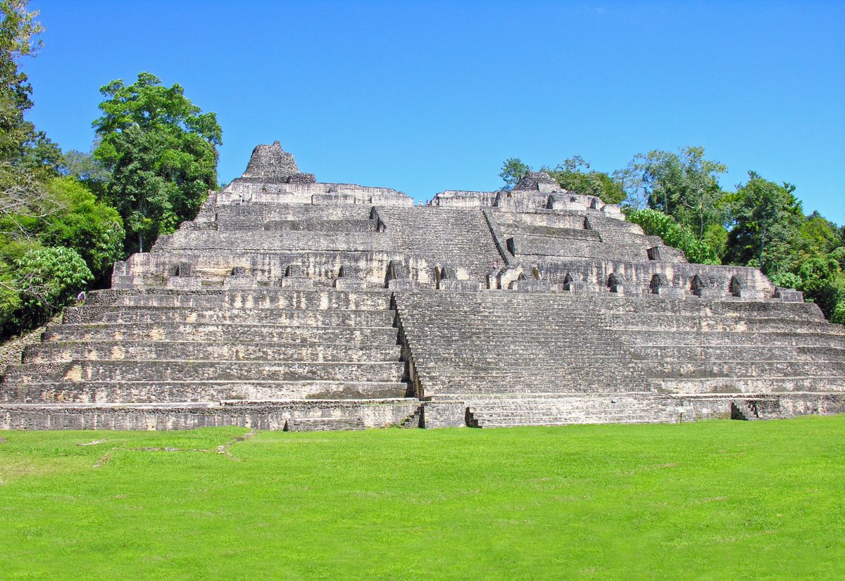
Table of Contents
- Arriving at the Place of the Caves
- A City Bigger Than Tikal
- The Caana Pyramid
- The War With Tikal
- What Language Did Caracol Speak?
- Terraces, Reservoirs, and Feeding a City
- Ancestors, Tombs, and Ritual Life
- Stelae and the Written Record
- Collapse and Abandonment
- Rediscovery and Visiting Caracol Today
- Nearby Places to Explore
Arriving at the Place of the Caves
Caracol sits on the Vaca Plateau in the Cayo District, close enough to the Guatemalan border that the site’s ancient rulers were never far from their rivals in the Peten. The terrain is rugged limestone karst, pocked with sinkholes and caves, which is likely the origin of whatever name its builders actually used, since several Mayan place names elsewhere reference caves and water sources in similar ways.
Getting there today still requires patience. The road from San Ignacio climbs for roughly two hours through the Chiquibul Forest Reserve, one of the largest remaining tracts of broadleaf rainforest in Central America, before reaching the visitor center. That isolation, inconvenient for tourists, is exactly why the site survived so well underneath the tree cover for centuries.
When Belizean logger Rosa Mai reported the ruins to colonial authorities in 1937, he was really reporting one small piece of a city whose true scale would not be understood for another fifty years. Early visitors saw looted stelae and overgrown mounds; they had no way of knowing they were standing at the edge of a metropolis.
The forest cover that once hid Caracol from outside eyes also preserved it. Unlike sites closer to modern towns and highways, Caracol escaped the worst of nineteenth and early twentieth century looting simply because reaching it was so difficult, a stroke of geographic luck that left many of its tombs and monuments intact for professional excavation decades later.
A City Bigger Than Tikal
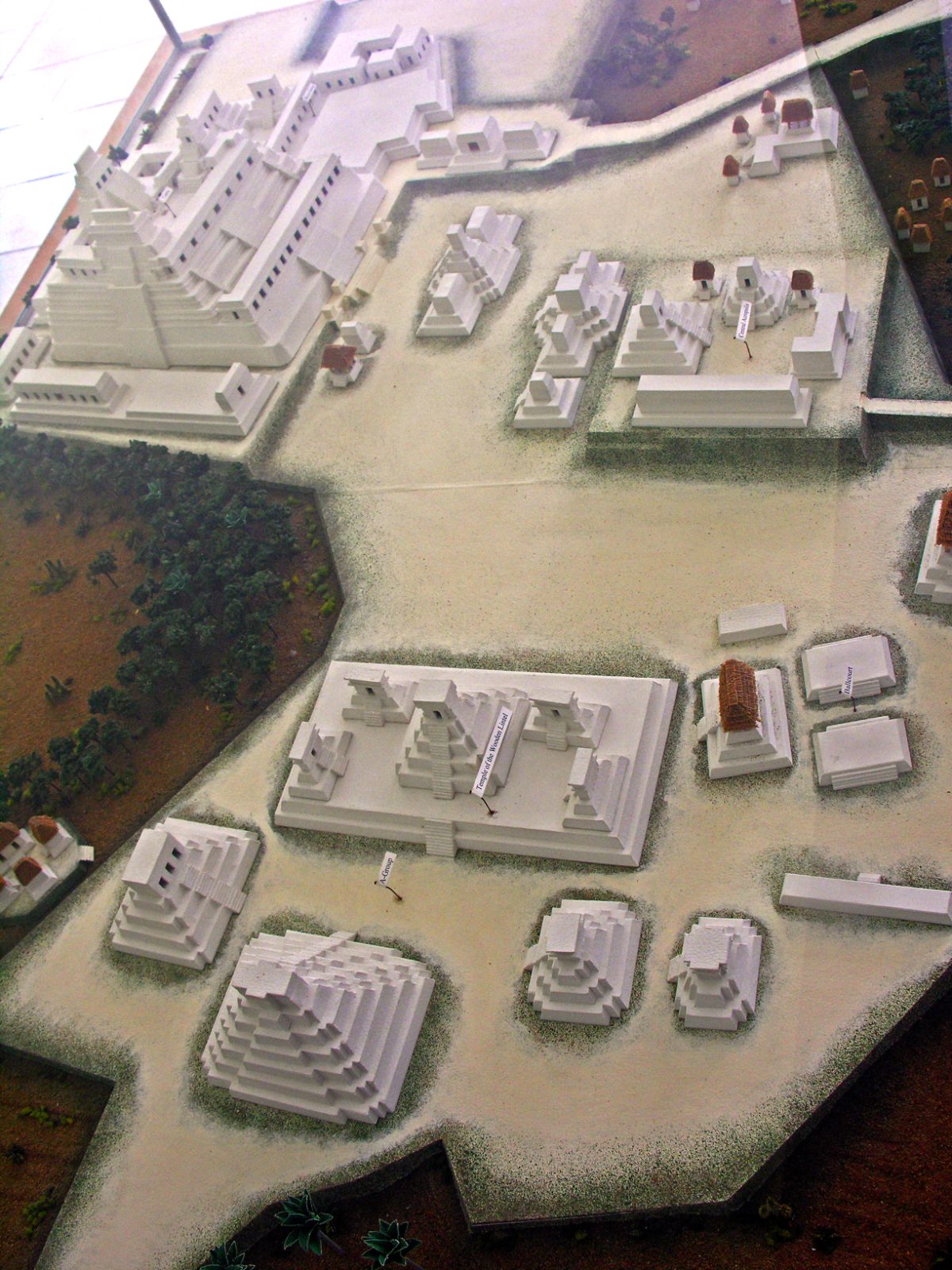
Modern LiDAR and decades of ground survey, led since 1985 by archaeologists Arlen Chase and Diane Chase, have mapped an urban footprint covering roughly 200 square kilometers. Causeways, known to the Maya as sacbeob, radiate outward from the site core to outlying residential and administrative plazas, binding a scattered population into a single functioning city rather than a compact downtown surrounded by empty land.
Population estimates for Caracol at its Late Classic peak run as high as 100,000 to 150,000 people, a figure that rivals or exceeds contemporary estimates for Tikal itself. That number surprised researchers precisely because Caracol lacks a major river or lake system; the city had to invent other ways to keep that many mouths fed.
The answer turned out to be terracing on a scale rarely documented elsewhere in the Maya lowlands, discussed in more detail further down. For now, it is worth pausing on the basic point: this was not a ceremonial center with a small supporting population, but a genuine dispersed metropolis, one of the largest urban experiments the pre-Columbian Americas produced.
This dispersed model changes how the term ‘city’ should be understood in a Classic Maya context. Rather than a walled downtown with clear edges, Caracol looked more like a constellation of plazas, temples, and farmsteads bound together by causeways, spreading across the plateau in a pattern closer to modern suburban sprawl than to a European medieval town.
Comparing Caracol to Tikal is almost irresistible given their shared history, but the comparison also highlights how differently Classic Maya cities could organize themselves even while competing for the same resources and prestige. Tikal built upward around a comparatively compact core; Caracol built outward across an entire plateau.
The Caana Pyramid
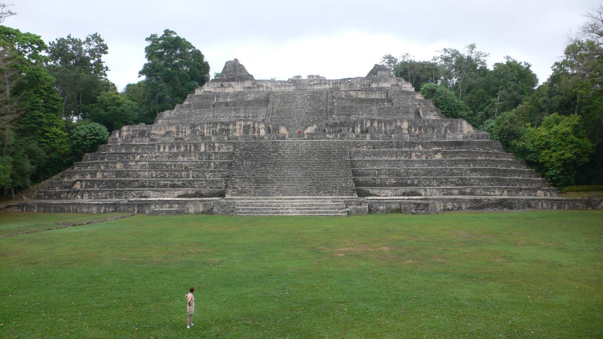
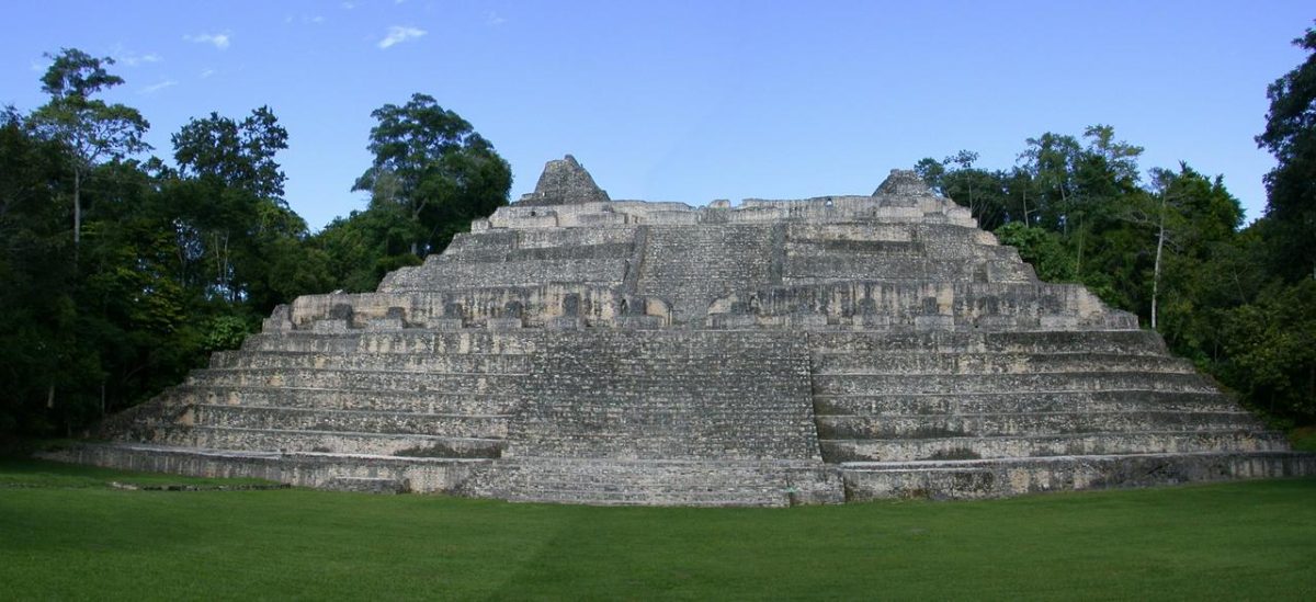
At the heart of the site rises Caana, meaning Sky Palace, a stepped pyramid complex that still stands around 43 meters tall. It remains the tallest man-made structure in Belize today, a claim that includes every modern building in the country, which says as much about Belize’s modest skylines as it does about Caana’s original ambition.
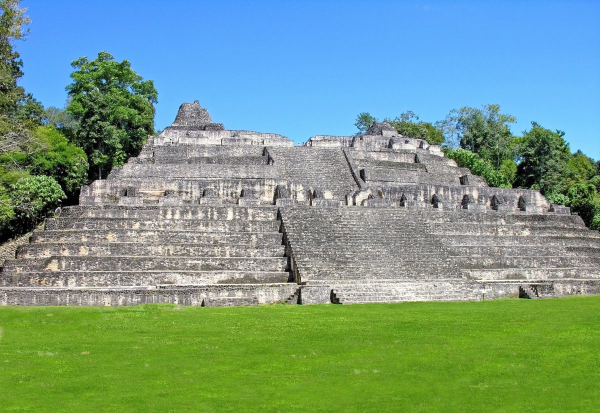
Caana is less a single pyramid than a mountain of connected temples, palaces, and residential rooms built up over centuries, with royal tombs sealed inside its core. Excavators have found multiple elite burials within Caana’s structures, accompanied by jade, shell ornaments, and painted ceramic vessels, suggesting the building functioned simultaneously as temple, palace, and mausoleum for Caracol’s ruling dynasty.

Later construction phases show rulers building directly atop earlier versions of Caana rather than starting fresh elsewhere, a common Maya practice that treated a sacred or politically charged location as something to be renewed rather than replaced. Each new layer buried the last, which is part of why the tombs inside remained sealed and largely undisturbed until modern excavation.
Archaeologists have also found evidence that Caana’s builders reused and incorporated older architectural fragments into newer construction phases, a common Maya practice that treated earlier buildings less as things to be erased than as foundations, both literal and symbolic, for renewed royal authority.
Standing atop Caana today, visitors look out over a sea of unbroken forest canopy that gives little hint of the plazas, causeways, and farmland that once stretched to the horizon in every direction, all of it now reclaimed by the same jungle that helped protect the ruins from destruction after the city was abandoned.
The War With Tikal
Caracol’s most famous moment in the historical record has nothing to do with architecture. Altar 21, a carved monument recovered from the site’s ballcourt, records that in 562 CE Caracol’s ruler, known by the name Yajaw Te K’inich II, oversaw a ‘star war’ event against Tikal, then the dominant power of the central Peten.
Star wars, named for their association with the planet Venus in Maya astronomical texts, describe a particularly destructive form of conflict rather than a routine raid. Whatever happened in 562 CE, Tikal’s own monument-carving essentially stopped for more than a century afterward, a silence long interpreted by epigraphers as evidence of genuine political collapse rather than coincidence.
Many researchers believe Caracol did not act alone, and that the distant superpower of Calakmul, far to the north in what is now Mexico, backed Caracol’s move against their shared rival. If true, the episode reflects a chessboard of Classic Maya politics where Caracol briefly held the upper hand over a city more than twice its later population.
Whatever combination of politics and battlefield tactics produced the 562 CE outcome, its consequences rippled for generations. Tikal’s ruling dynasty eventually recovered, but only after a period modern scholars sometimes call its ‘hiatus,’ during which the city that once dominated the region’s monument-carving fell conspicuously quiet.
It is worth remembering that these events survive only because Caracol’s own scribes chose to record them in stone, meaning the story we have is inevitably one-sided. Tikal’s perspective on the same conflict, had it survived, might well read very differently, a caution that applies broadly to how historians reconstruct Classic Maya politics from monuments carved by the winners.
What Language Did Caracol Speak?
The hieroglyphic texts carved on Caracol’s stelae and altars are written in Classic Ch’olan, the prestige scribal language shared across most of the Classic period Maya lowlands, from Palenque and Copan to Tikal and Calakmul. This was not necessarily the everyday speech of every farmer working Caracol’s terraces, but rather a standardized written language used by elites for royal proclamations, much as Latin once served courts across medieval Europe regardless of local vernacular.
Modern Mopan Maya and Yucatec Maya are still spoken in parts of Belize today, and linguists generally place ancient Caracol’s spoken population within the broader Yucatecan or Ch’olan-related language families, though pinning an exact ancestral tongue to any one Classic city remains difficult without deciphered vernacular texts, since almost everything that survives is formal court writing rather than daily conversation.
This gap between formal written language and everyday speech is common across many ancient literate societies, and it means that reconstructing the actual spoken language of Caracol’s farmers and market vendors relies heavily on comparison with later, better documented Maya languages rather than direct textual evidence from the city itself.
Belize itself is unusual among former Maya territories in that it remained under British colonial administration rather than Spanish rule, which shaped how the country’s Maya heritage was documented, taught, and, for a long stretch of the twentieth century, largely overlooked in favor of the region’s more accessible archaeological sites across the border in Guatemala and Mexico.
Terraces, Reservoirs, and Feeding a City
Aerial survey has revealed thousands of agricultural terraces stepped into the hillsides around Caracol, an investment of labor that suggests centralized planning rather than piecemeal farming by individual households. These terraces slowed erosion, trapped soil moisture, and let farmers cultivate slopes that would otherwise wash out during the region’s heavy rainy season.
Because the plateau has no major permanent river, the city depended on a network of reservoirs to store rainwater through the dry months, some built directly into quarried depressions left over from construction. This kind of engineered water management appears at several Maya sites, but at Caracol it seems tightly integrated with the terrace system, feeding water toward the fields that fed the people.
The scale of this infrastructure is part of why archaeologists now describe Caracol as a ‘garden city,’ a dispersed settlement where houses, shrines, and farmland interlocked across the landscape instead of being separated into a dense urban core surrounded by open countryside, the model that once dominated thinking about how Maya cities worked.
Some reservoirs at Caracol appear to have doubled as sources of building material, since quarrying limestone for construction left behind depressions that could then be lined and adapted to hold water. This kind of dual-purpose engineering, turning a construction byproduct into critical infrastructure, reflects a level of long-term planning easy to underestimate when looking only at the site’s temples.
Modern agronomists studying the remains of these terraces have noted that the techniques involved, contour terracing paired with careful water channeling, would still be considered sound practice on comparable tropical slopes today, underscoring that this was applied ecological knowledge refined over generations rather than improvised necessity.
Ancestors, Tombs, and Ritual Life
Excavations across Caracol’s residential compounds, not just its grand temples, have repeatedly uncovered burials placed beneath house floors, a practice suggesting ancestor veneration was a household affair as much as a royal one. Families appear to have kept their dead close, literally underfoot, reinforcing claims to land and lineage across generations.
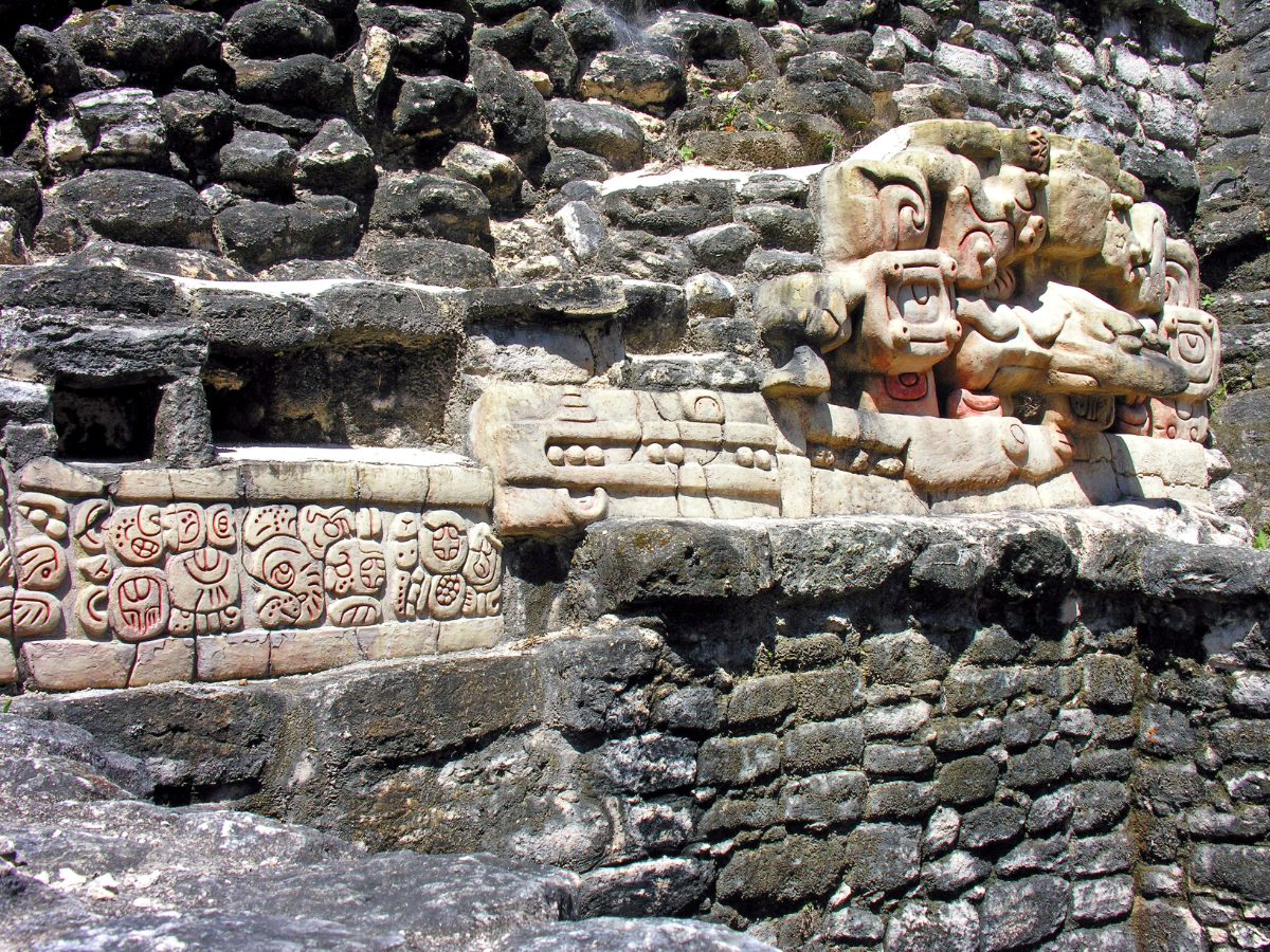
Stucco masks and glyphic panels decorating structures like Caana blended portraiture, mythology, and political messaging, presenting rulers as intermediaries between the human and supernatural worlds. Caches of jade, obsidian blades, and painted pottery recovered from these contexts point to ritual practices tied to bloodletting, ancestor communication, and calendar ceremonies typical of Classic Maya religious life.
Caches uncovered beneath residential platforms often include eccentric flints, worked into unusual shapes for ritual rather than practical use, alongside marine shell brought from the coast many days’ travel away. Such offerings point to trade networks reaching well beyond the immediate plateau, linking inland Caracol to coastal and riverine exchange routes that carried goods across the wider Maya world.
The persistence of household burial across so many excavated residential groups suggests that ancestor veneration at Caracol was not confined to royalty, unlike the impression given by many other Classic Maya sites where surviving evidence skews heavily toward palace and temple contexts simply because those are the structures most likely to be excavated first.
Stelae and the Written Record
Caracol has produced one of the richer collections of carved monuments in the southern Maya lowlands, including stelae, altars, and hieroglyphic stairways that record royal accessions, military victories, and dynastic genealogies stretching across centuries. Altar 21’s account of the Tikal war is the most famous, but it sits within a much larger body of texts documenting Caracol’s rivalries with cities like Naranjo and Ucanal.
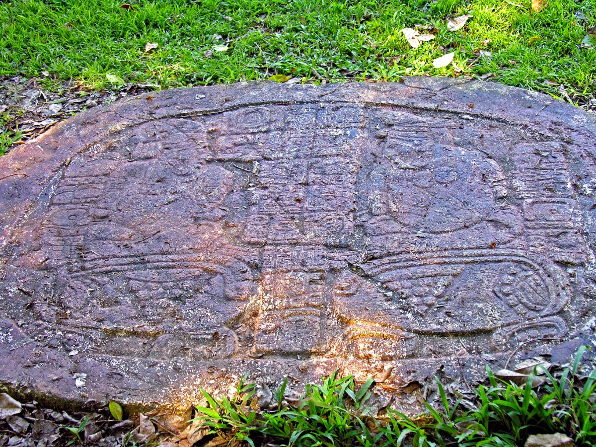
One carved altar shows bound captives labeled as coming from Bital and Ucanal, a visual record of military success meant to be read as much through imagery as through the accompanying glyphs. Monuments like this functioned as public propaganda, reminding residents and visiting dignitaries alike of the ruling dynasty’s power on the battlefield.
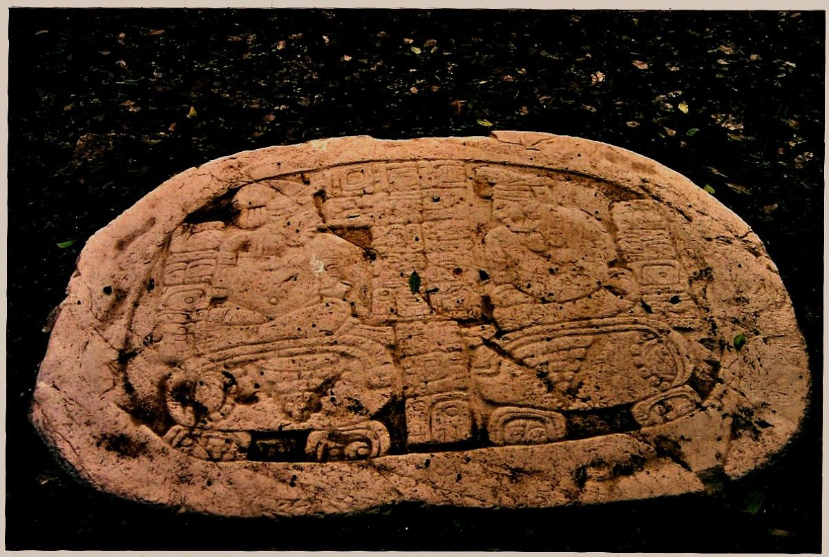
Later in its history, Caracol’s fortunes reversed. Texts and monuments at the rival city of Naranjo describe a defeat inflicted on Caracol around 680 CE, reportedly with Calakmul’s backing switched to the other side this time, a reminder that alliances among Classic Maya superpowers were transactional rather than permanent.
Reading these monuments requires piecing together fragmentary glyphic texts, damaged in places by centuries of weathering and, in some cases, by deliberate defacement carried out by rival cities after a military defeat, a practice epigraphers describe as a form of symbolic erasure aimed at a defeated dynasty’s legitimacy.
Comparing Caracol’s monument program to that of allies like Calakmul reveals a shared visual and textual vocabulary for describing conquest, one built around standardized verbs for capture and sacrifice that appear, with local variation, across the wider network of Classic Maya courts engaged in the same cycles of alliance and rivalry.
Collapse and Abandonment
Like most of the great lowland Maya cities, Caracol’s monumental construction and dated inscriptions trail off during the Terminal Classic period, roughly the ninth century CE, part of the broader collapse that emptied out much of the southern lowlands within a few generations. Drought cycles, agricultural strain, and the unraveling of long-distance trade and political alliances are all cited as contributing pressures, though no single explanation fully accounts for the timing everywhere it happened.
Excavation suggests some population lingered at Caracol into the Postclassic period in reduced form, reusing older structures rather than building new monumental architecture, before the site was effectively abandoned to the forest that eventually swallowed its causeways and reservoirs whole.
Some researchers link the timing of Caracol’s decline to a broader pattern of prolonged drought documented in lake sediment cores from across the Yucatan Peninsula, though the mechanism connecting climatic stress to political collapse likely varied from city to city depending on local agricultural resilience, water storage capacity, and how brittle each ruling dynasty’s authority had become by the ninth century.
Unlike some lowland cities that were essentially deserted within a generation, evidence from Caracol points to a slower unwinding, with smaller communities continuing to occupy parts of the site long after royal construction had stopped, adapting older elite architecture to more modest domestic purposes.
Trade goods recovered from late-phase contexts at the site, including obsidian sourced from highland Guatemala, suggest that even as monumental construction wound down, some regional exchange networks limped on in reduced form before fading entirely as the broader lowland political order dissolved.
Rediscovery and Visiting Caracol Today
After Rosa Mai’s 1937 report, the University of Pennsylvania’s Linton Satterthwaite carried out early mapping and monument recording in the 1950s, but it was the long-term project launched in 1985 by Arlen and Diane Chase that transformed Caracol from a curiosity into one of the best-documented Maya cities anywhere, an effort that continues in some form to this day.
Visitors now reach Caracol via the Chiquibul Forest Reserve, often combining the trip with stops at the Rio On Pools or Rio Frio Cave along the way, since the journey out from San Ignacio takes long enough that most people treat it as a full day excursion. Climbing Caana remains the highlight for most, offering a view over unbroken rainforest canopy that, for a few centuries, was instead a view over one of the ancient Americas’ largest cities.
The Chases’ long-running excavation has become a model for how modern archaeology approaches Maya urbanism more broadly, combining ground survey with airborne LiDAR to reveal structures invisible from the forest floor, work that has repeatedly forced upward revisions of how large and how densely populated Classic Maya cities like Caracol really were.
Ongoing research continues to revise basic figures about the site, including its total population and the full extent of its causeway network, meaning any summary of Caracol, including this one, should be read as a snapshot of current understanding rather than a final word on a city whose survey is still, in a real sense, unfinished.
Nearby Places to Explore
Caracol’s history is tightly bound up with its rivals and allies across the Maya lowlands, and a few nearby sites help fill out that picture.
- Tikal: The Maya Capital of Towering Jungle Temples
- Copan: The Maya City of Kings and Scribes
- Quirigua: The Vassal City That Beheaded Its Overlord’s King
Closing Thoughts
Caracol complicates any simple story about which Classic Maya city was ‘the biggest’ or ‘the most powerful,’ since for at least a century it held both titles against a rival most people have actually heard of. Its terraces, reservoirs, and sprawling causeway network describe a society that solved the hard problem of feeding a huge population on a plateau with no major river, an engineering achievement easy to overlook next to a pyramid as tall as Caana.
What survives at Caracol today is less a single monument than the outline of an entire functioning region, still being mapped and understood, with new terraces and structures identified every time archaeologists fly LiDAR over another stretch of the Chiquibul canopy.
You May Like
Mafra, the Palace a King Built From a Vow


One thought on “How Caracol, a Belize Maya City, Once Defeated Tikal”