Chaco Canyon in northwestern New Mexico holds the ruins of a society that raised multi-story stone buildings, engineered arrow-straight roads, and tracked the sun and moon with startling precision, all without draft animals, wheeled carts, or a written script.
Between roughly 850 and 1150 CE, this shallow desert wash became the ceremonial and administrative center of the Ancestral Puebloan world, drawing people, timber, turquoise, and maize from a region larger than modern Ohio.
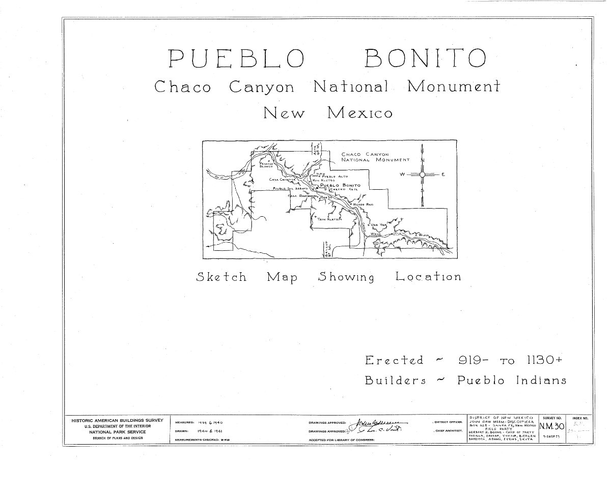
Table of Contents
- A Canyon in the High Desert
- The Rise of the Great Houses
- Pueblo Bonito: The Heart of Chaco
- Chetro Ketl and the Other Great Houses
- Roads That Led Nowhere and Everywhere
- Casa Rinconada and the Great Kivas
- The Sun Dagger of Fajada Butte
- What Language Did the People of Chaco Speak?
- Religion, Trade, and Daily Life in the Canyon
- Why the Canyon Was Emptied
- Nearby Places to Explore
A Canyon in the High Desert
Chaco Canyon sits at roughly 6,200 feet in the San Juan Basin, a landscape of sagebrush flats, sandstone cliffs, and washes that run dry most of the year. Rainfall averages under nine inches annually, and growing seasons are short and unpredictable, making the scale of construction here one of the enduring puzzles of North American archaeology.
The canyon itself stretches about nine miles, bounded by mesas of pale Cliff House sandstone that the builders quarried directly from the surrounding cliffs. Water arrived in violent, brief summer storms that the Chacoans learned to capture through carefully graded check dams, canals, and reservoirs cut into the bedrock above their great houses.
Long before the great houses rose, small pit-house hamlets already dotted the canyon floor by the sixth and seventh centuries CE, farming maize, beans, and squash on the floodplain. What changed after 850 was not the environment but the ambition of the people living in it, who began building on a scale unmatched anywhere else in the pre-Columbian Southwest.
The canyon’s builders also managed water with an engineering sophistication that rivals their masonry. Rock-cut check dams slowed flash floods just enough to let silt and moisture settle onto agricultural terraces below, while gridded garden plots bordered by small stone berms trapped runoff across otherwise unproductive slickrock surfaces, extending farmland into terrain that would otherwise have supported nothing at all.
Modern hydrological studies suggest this system could only support a fraction of the population needed to build Chaco’s largest structures, reinforcing the idea that much of the workforce, and much of the food that sustained it, was drawn in seasonally from surrounding communities rather than grown within the canyon year-round.
The Rise of the Great Houses
Archaeologists call Chaco’s largest structures great houses, a term that undersells buildings that stood four or five stories tall, contained hundreds of rooms, and were laid out with a geometric precision that suggests planning on paper, or at least in the mind of a single architect, long before the first stone was set.
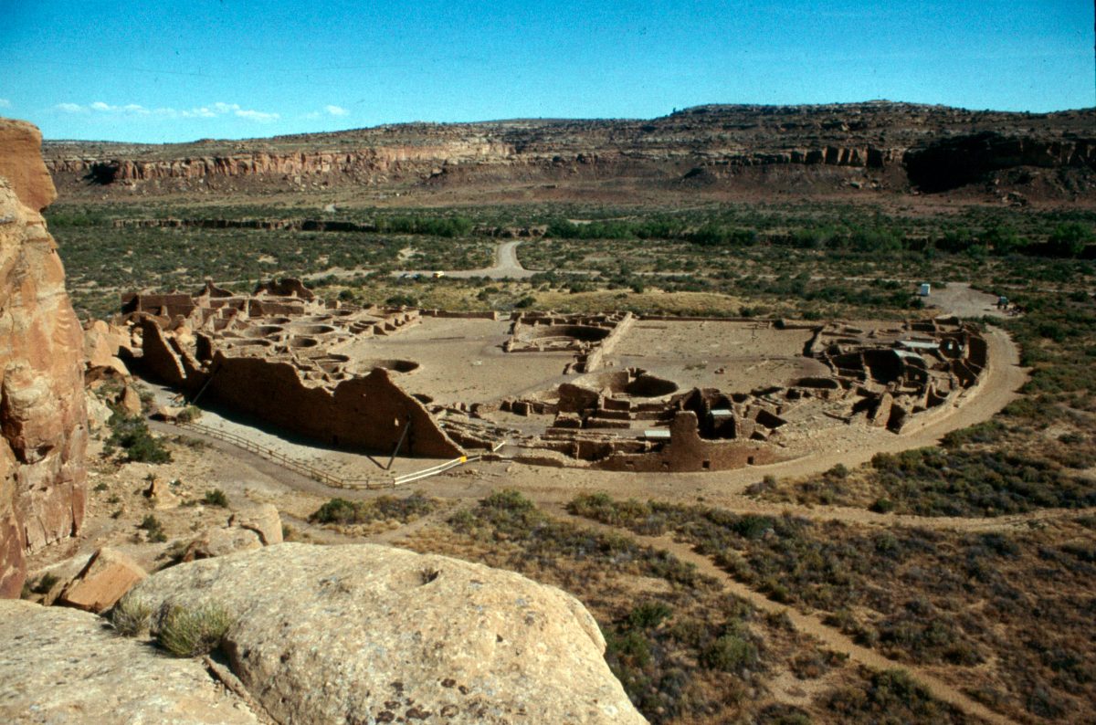
Construction unfolded in distinct phases rather than one continuous building boom. Tree-ring dating of roof beams shows that Pueblo Bonito grew in at least four major stages between roughly 850 and 1120, with quiet decades between bursts of intense labor. Each expansion added new wings, sealed off old rooms, and reoriented the building’s facade, as though each generation of Chacoans was renegotiating the site’s meaning rather than simply extending a floor plan.
The labor involved was immense. Estimates suggest that Chaco’s great houses collectively required over 200,000 trees, mostly ponderosa pine and Douglas fir, hauled from mountain ranges 50 miles or more away since the canyon itself never supported forests of that size. Analysis of beam chemistry and strontium isotopes indicates timber came from at least two distinct mountain source areas, meaning entire communities beyond the canyon were mobilized to supply construction material for a site many of them may never have lived in permanently.
Masonry style itself evolved visibly over time, and archaeologists use these changes to date construction phases even without tree-ring samples. Early walls used thick, roughly coursed sandstone blocks chinked with small stones, while later Chacoan masons developed a banded style alternating thin tablets of stone with larger blocks, a technique both structurally sound and visually deliberate, since the patterned banding would have been plastered over and was never meant to be seen.
That last detail troubled early researchers: builders invested enormous skill in stonework that was immediately hidden beneath mud plaster. The likely explanation is that the effort itself, not its visibility, mattered to the builders and to a community whose religious worldview placed high value on precise, correctly executed craftsmanship regardless of whether the result stayed on public view.
Pueblo Bonito: The Heart of Chaco
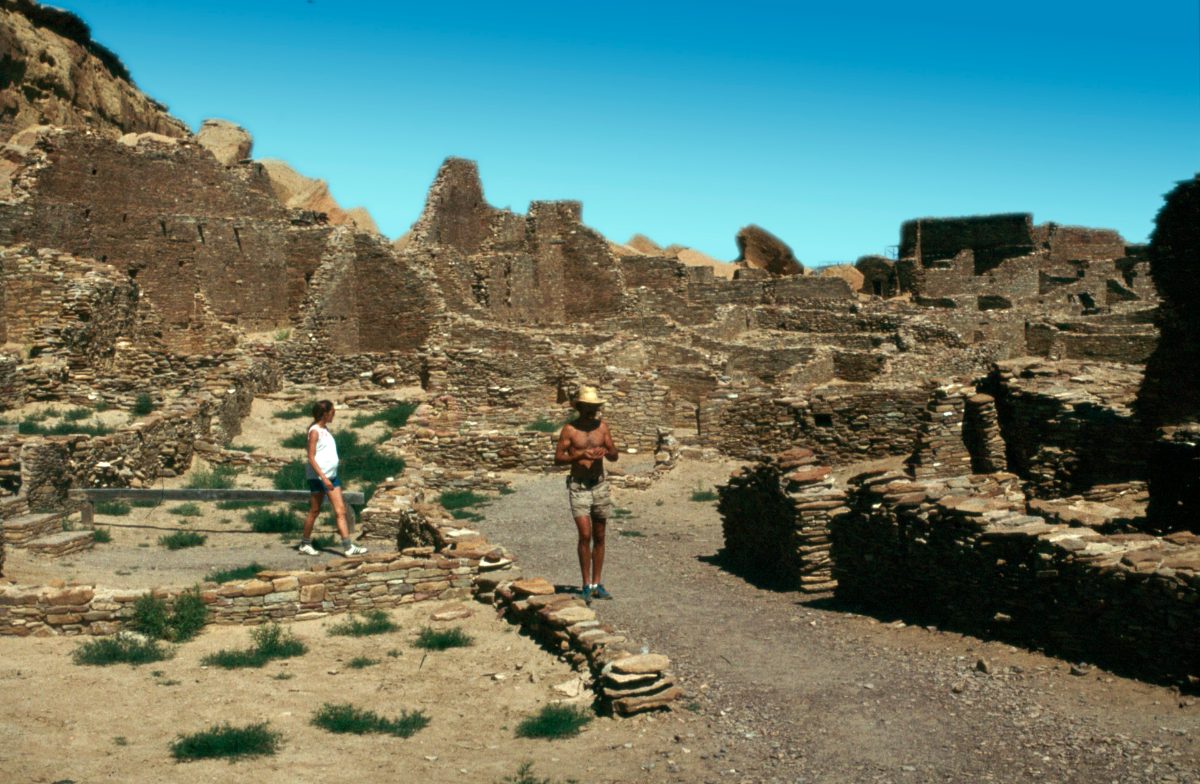
Pueblo Bonito, Spanish for ‘beautiful town,’ is the largest and best-studied of Chaco’s great houses. At its peak it enclosed roughly 600 rooms and 40 kivas within a D-shaped footprint oriented so precisely to the cardinal directions that its main wall runs almost exactly east to west.
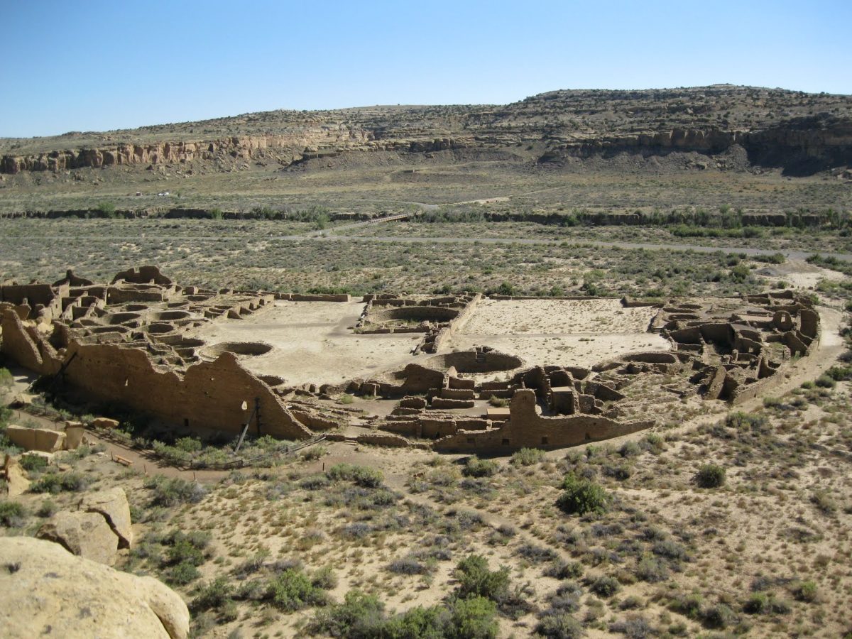
Excavations by the Smithsonian and the American Museum of Natural History in the early twentieth century, and later work by the National Park Service, revealed that most of Pueblo Bonito’s rooms show little evidence of everyday domestic use: few hearths, little trash, and remarkably few burials for a building of its size. This has led most archaeologists to conclude the building functioned primarily as a ceremonial, storage, and gathering complex rather than a densely populated residential town, with only a small resident population, likely religious specialists or caretakers, living there year-round.
Two of the most striking burials found anywhere in the canyon came from a small room beneath Pueblo Bonito’s northern wing, where the remains of an estimated 14 individuals were interred over generations along with more than 50,000 pieces of turquoise, shell trumpets, and macaw skeletons imported from Mesoamerica. Genetic analysis published in 2017 found that several of these individuals were related through the maternal line across centuries, hinting at a hereditary lineage or ruling matriline at the heart of Chacoan society, a rare direct genetic window into how power may have passed through this civilization.
Pueblo Bonito’s rooms were also linked internally by an unusually complex system of doorways, some later sealed with stone as the building’s function shifted over generations. T-shaped doorways, a signature Chacoan architectural feature, appear throughout the complex and later spread to outlying communities as far as 50 miles from the canyon, a detail archaeologists use to trace Chacoan cultural influence across the wider region.
A cylinder jar cache recovered from one Pueblo Bonito room contained traces of theobromine, the chemical signature of cacao, evidence that a delicacy grown only in Mesoamerica made its way north along exchange routes stretching well over a thousand miles, likely arriving as a prepared drink reserved for ceremonial occasions rather than everyday consumption.
Chetro Ketl and the Other Great Houses
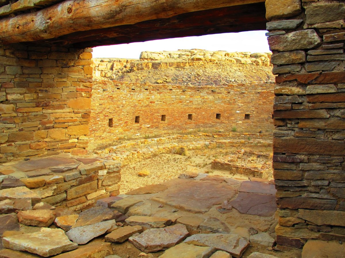
Pueblo Bonito was never alone. Within the nine-mile canyon at least a dozen great houses were raised, including Chetro Ketl, Pueblo del Arroyo, Una Vida, Hungo Pavi, and Pueblo Alto, each following the same broad template of massive core-and-veneer masonry walls, blocked rooms, enclosed plazas, and great kivas, yet each with its own distinct layout and orientation.
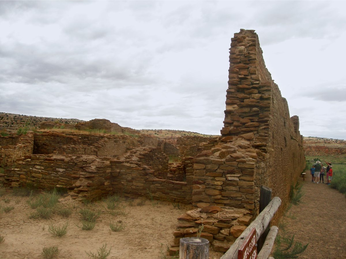
Chetro Ketl rivals Pueblo Bonito in scale, with an estimated 500 rooms arranged around a vast rectangular plaza. Excavations there uncovered a colonnade of wooden posts along its southern edge, a rare architectural feature in the ancient Southwest that some researchers have linked to contact with Mesoamerican building traditions further south, where colonnaded plazas were more common.
Pueblo Alto, perched on the mesa above the canyon rather than on its floor, appears to have served a different role entirely. Excavators found enormous quantities of broken pottery and animal bone deposited there in short, intense episodes, consistent with large periodic gatherings and feasting rather than ordinary household refuse, suggesting Pueblo Alto may have hosted seasonal ceremonies drawing visitors from across the wider Chacoan world.
Una Vida, one of the very first great houses begun in the canyon, sits closest to the modern visitor center and remains only partially excavated, its unexcavated rooms left deliberately buried to preserve them for future research using techniques not yet available today, a conservation choice the National Park Service applies across much of the canyon.
Hungo Pavi and Pueblo del Arroyo round out the canyon’s major great houses, the latter notable for a unique tri-wall structure attached to its western side, a circular masonry feature more commonly associated with sites far to the north, hinting at contact or shared ideas with communities well beyond the immediate San Juan Basin.
Roads That Led Nowhere and Everywhere
Radiating out from the canyon is a network of roads that puzzled surveyors from the moment aerial photography revealed them in the 1970s. Unlike a typical trail worn by repeated use, Chaco’s roads were deliberately engineered: up to 30 feet wide, cut through bedrock where necessary, and startlingly straight, sometimes running for miles without deviating for terrain that a footpath would naturally have avoided.
More than 180 miles of these roads have been identified linking Chaco to outlying communities as far as 50 miles away, in a region with no wheeled vehicles and no draft animals to justify a road built wider than any single traveler would need. Some roads appear to lead toward great kivas or shrine sites rather than to practical destinations at all, suggesting a ceremonial or symbolic purpose tied to pilgrimage and cosmology rather than simple transportation logistics.
Stairways were carved directly into cliff faces along several of these routes, cutting through solid sandstone rather than following an easier grade, a choice that only makes sense if maintaining the road’s straight alignment mattered more than the labor required to build it. Whatever their full purpose, the roads reveal a level of centralized planning and shared cosmological vision that extended across dozens of communities and hundreds of square miles of the San Juan Basin.
Some segments of these roads run in parallel pairs just a short distance apart, a redundancy that makes little practical sense for transportation but may reflect a symbolic duality embedded in Chacoan cosmology, possibly representing paired concepts such as day and night or male and female, themes that persist in the ritual life of present-day Pueblo communities.
Herraduras, small stone circles or shrines, appear periodically along several road segments, and large stacked masonry markers called herradura or ‘shrine’ features have been interpreted as waypoints for travelers on ceremonial pilgrimages between outlying great houses and the canyon itself.
Casa Rinconada and the Great Kivas
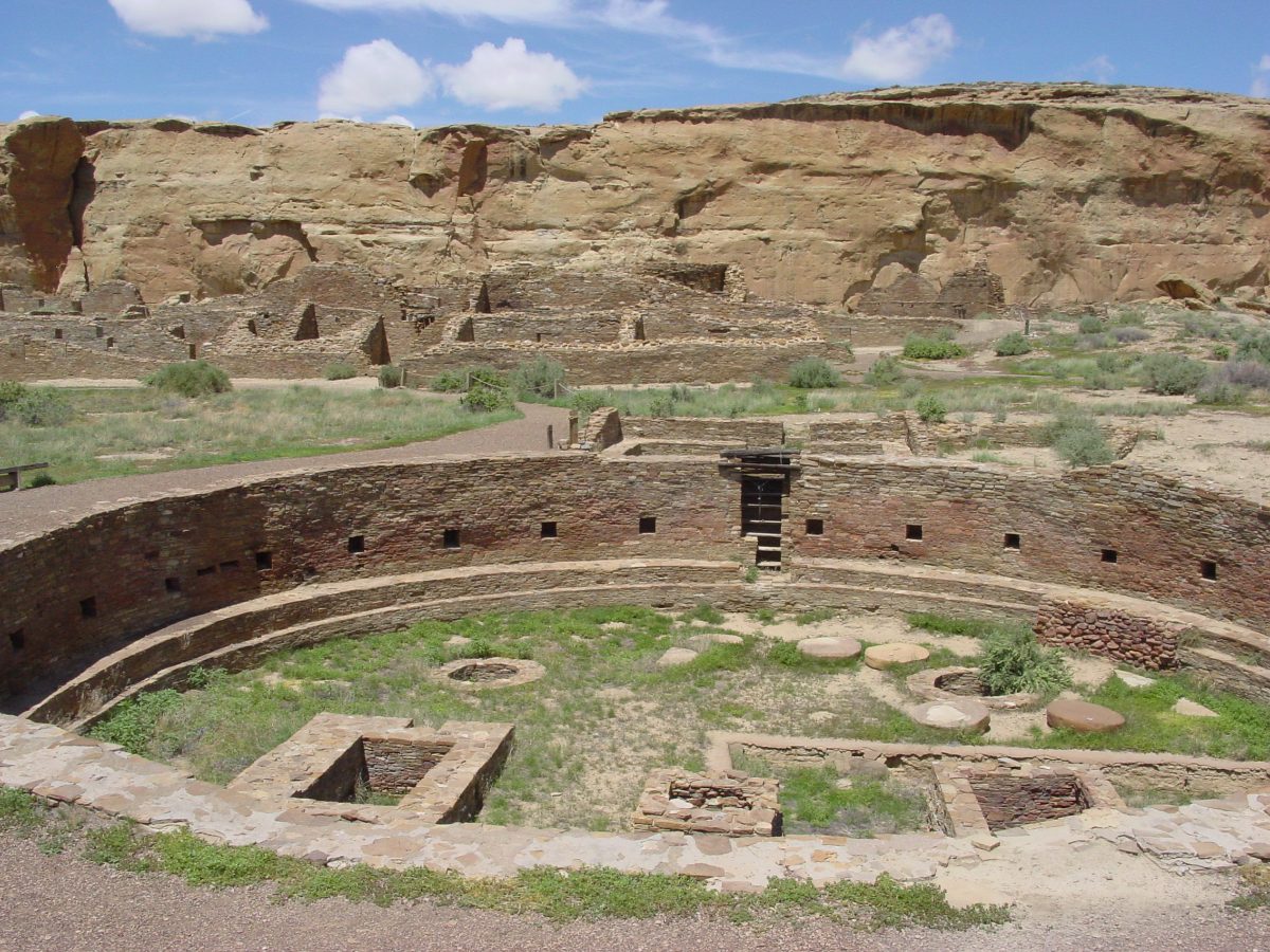
Away from the great houses, on the south side of the wash, stands Casa Rinconada, the largest great kiva in Chaco Canyon at nearly 63 feet across. Unlike the residential great houses, Casa Rinconada was not attached to any single building, standing alone as a purely ceremonial structure accessible to the wider community.
Great kivas like Casa Rinconada were circular, partly subterranean chambers used for communal ritual, likely including dances, initiations, and gatherings tied to the agricultural calendar. Casa Rinconada’s floor includes a sub-floor tunnel connecting an exterior antechamber to a hidden vault beneath the main floor, a passage some researchers believe allowed performers to emerge dramatically from beneath the floor during ceremonies, unseen by the gathered audience until the moment of their appearance.
Its wall openings are aligned with notable precision: on the summer solstice, a shaft of sunlight through a niche in the north wall strikes a corresponding niche on the opposite side, a detail unlikely to be coincidental given how consistently Chacoan builders incorporated solar and lunar alignments into structures across the canyon.
Beyond Casa Rinconada, more than two dozen smaller kivas are scattered throughout the great houses themselves, each typically serving a single residential room block or kin group rather than the wider community, suggesting a nested structure of ritual life: intimate household kivas for smaller ceremonies, and great kivas like Casa Rinconada reserved for gatherings that drew in the whole canyon population and outside visitors.
Postholes found in Casa Rinconada’s floor once held massive roof-support timbers, some measuring nearly two feet in diameter, requiring builders to fell, transport, and raise trees far larger than those used in ordinary room construction, another sign of the special status this structure held above the canyon’s more utilitarian buildings.
The Sun Dagger of Fajada Butte
Perhaps the single most famous discovery at Chaco is the so-called Sun Dagger, found in 1977 near the top of Fajada Butte, a freestanding sandstone formation south of the main canyon. Three large stone slabs lean against a cliff face there, casting shifting patterns of light and shadow across two spiral petroglyphs carved into the rock behind them.
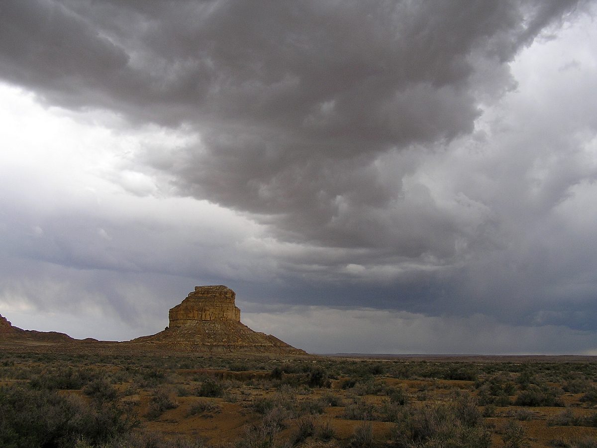
At solar noon on the summer solstice, a narrow dagger of sunlight passes precisely through the center of the larger spiral. At the winter solstice, two daggers of light frame the spiral’s edges. On the equinoxes, a smaller dagger bisects a second, smaller spiral nearby, and the site also appears to mark the 18.6-year cycle of the moon’s rising position, a far more subtle astronomical period that requires sustained observation across nearly two decades to detect.
The Sun Dagger site was closed to visitors and researchers in the 1980s after monitoring showed that increased foot traffic had shifted the slabs slightly, altering the very light patterns that made the site significant, a reminder of how delicately balanced the Chacoans’ solar markers were and how much precision their builders originally achieved.
The spirals themselves were carved before the slabs shifted into their light-casting position, and some archaeologists argue the petroglyphs may originally have served a separate purpose, with the precise solar alignment emerging later, either intentionally engineered by moving the slabs into place or discovered opportunistically once natural rockfall created the effect.
Whichever came first, the Sun Dagger was almost certainly not an isolated curiosity. Chacoan buildings elsewhere in the canyon, including windows at Pueblo Bonito and Casa Rinconada’s own wall niches, also track solstice and equinox sunrises, suggesting the Sun Dagger was one especially refined expression of a much broader Chacoan preoccupation with tracking celestial cycles.
What Language Did the People of Chaco Speak?
The people who built Chaco Canyon left no written texts, so their spoken language cannot be read directly from any surviving inscription the way Old Assyrian cuneiform or Maya glyphs can be. What linguists and archaeologists can do is trace the region’s likely language history forward and backward from the languages spoken by Chaco’s probable descendants.
Most researchers connect the Chacoans to the ancestors of today’s Pueblo peoples, whose modern languages belong to several unrelated families rather than one single Chacoan tongue: Keresan, spoken at Acoma and Laguna pueblos and unrelated to any other known language family; Tewa, Tiwa, and Towa, part of the Kiowa-Tanoan family also spoken at pueblos such as San Ildefonso and Jemez; and Zuni, a linguistic isolate with no confirmed relatives anywhere in the world.
This diversity is itself informative. Oral traditions from Acoma, Hopi, and Zuni communities all describe ancestral ties to Chaco, and it is plausible that the canyon, as a pilgrimage and ceremonial center, drew speakers of several already-distinct languages together for shared ritual life rather than representing a single ethnic or linguistic nation. If that reconstruction holds, Chaco may have functioned something like a multilingual capital, similar in spirit to a pilgrimage city where diverse communities converged for ceremony while retaining their own separate tongues at home. No confirmed written script existed at Chaco, so this remains an informed inference built from later oral history, geography, and linguistics rather than a certainty.
Some linguists have proposed even deeper connections, suggesting Kiowa-Tanoan languages may share a distant ancestral relationship with the Kiowa language spoken today on the Great Plains, implying that groups connected to Chaco’s cultural sphere eventually split, with some remaining as Pueblo farmers and others adopting a mobile Plains lifestyle far from the canyon, though this proposed relationship remains debated among specialists.
What is certain is that Chacoan society, whatever language or languages its people spoke day to day, communicated complex information, astronomical knowledge, architectural planning, and religious symbolism, through means that did not require writing: oral tradition, ritual performance, and the built environment itself, which functioned almost as a text encoded in stone, alignment, and space.
Religion, Trade, and Daily Life in the Canyon
Religious life at Chaco appears to have centered on cycles of the sun, moon, and agricultural seasons, reflected physically in the solar alignments of Casa Rinconada, the Sun Dagger, and even the cardinal orientation of Pueblo Bonito’s main wall. Modern Pueblo communities, who regard Chaco as an ancestral homeland, describe similar cosmological themes in their own ceremonial calendars today, including katsina traditions, kiva-based ritual societies, and a deep integration of astronomical observation with religious practice.

Trade connected Chaco to a strikingly wide world. Archaeologists have recovered scarlet macaw skeletons and cacao residue in Chacoan pottery, both sourced from Mesoamerica well over 1,000 miles to the south, alongside marine shell from the Gulf of California and turquoise mined locally in the Cerrillos Hills near modern Santa Fe, then worked into beads and pendants traded outward across the Southwest and likely into Mexico in return.
Daily life for most Chacoans, however, was governed less by grand ceremony and more by the demands of dry farming in a punishing climate. Households grew maize, beans, and squash on floodplain plots irrigated by diverted rainwater, supplemented their diet with turkey, rabbit, and wild plants, and produced fine corrugated and black-on-white painted pottery, some of it traded across hundreds of miles, that remains one of the most distinctive artistic signatures of the Chacoan world.
Social organization remains debated. Some archaeologists argue for a hierarchical society led by an elite class, pointing to the rich burials beneath Pueblo Bonito and the immense labor invested in ceremonial architecture; others argue Chaco operated more through consensus and ritual obligation than coercive political power, since there is little direct evidence of a standing administrative bureaucracy, taxation, or military force of the kind seen in contemporary state societies elsewhere in the world.
Turquoise held special significance beyond mere ornamentation. Workshops within Pueblo Bonito produced thousands of turquoise beads and pendants, and the sheer volume recovered, more than 200,000 pieces across the canyon’s excavated sites, suggests turquoise functioned as both a religious material and a form of wealth used to cement social and political relationships across the wider Chacoan world.
Skeletal analysis of Chacoan burials shows evidence of a physically demanding lifestyle, including arthritis and healed fractures consistent with heavy labor, alongside signs of periodic dietary stress, suggesting that despite the grandeur of its ceremonial architecture, life in and around Chaco could be as physically taxing as it was ritually rich.
Why the Canyon Was Emptied
Construction of new great houses slowed sharply after 1140 and had largely ceased by 1200. Tree-ring records show a severe, prolonged drought gripping the San Juan Basin beginning around 1130, coinciding closely with the decline in building activity and suggesting that the agricultural base supporting Chaco’s population and its visiting pilgrims became increasingly unreliable.
Drought alone likely was not the whole story. Some researchers point to social strain, overextension of the road and exchange networks, or a gradual shift in religious authority toward new centers, particularly at Aztec Ruins to the north and later at sites in the Mesa Verde region, as contributing causes. Rather than a sudden catastrophic collapse, the evidence points to a slow migration of people and ceremonial focus away from the canyon over several generations.
The descendants of Chaco’s builders did not vanish. Oral histories from the Hopi, Zuni, Acoma, and Rio Grande Pueblo communities all describe migrations from Chaco and other ancestral sites toward their present-day villages, a continuity that modern Pueblo peoples describe not as an ending but as one stage in a much longer story that continues in their communities today.
Aztec Ruins, roughly 55 miles north of Chaco Canyon, shows clear architectural continuity with Chacoan building styles, including a great kiva and great house complex built using recognizably Chacoan techniques, suggesting that as Chaco itself declined, its architectural and ceremonial traditions did not disappear but relocated with the people who carried them northward.
Modern Pueblo communities today actively participate in the interpretation and stewardship of Chaco Culture National Historical Park, ensuring the site is understood not as an abandoned ruin frozen in the past but as a living ancestral place still woven into ceremony, oral history, and identity for the descendant communities who trace their lineage there.
Nearby Places to Explore
Chaco Canyon belongs to a wider story of ancient settlement across North America, and several other sites help place its achievements in a broader context of the continent’s early urban and ceremonial centers.
- Cahokia: The Largest Ancient City North of Mexico
- Two Thousand Years Before Its Famous Neighbor, Hunter-Gatherers Built This: The Story of Watson Brake
- The Oldest Colossal Heads in the Americas Were Carved Here: The Story of San Lorenzo
A Canyon Still Speaking
Chaco Canyon endures as one of the clearest demonstrations that scale, precision, and cosmological ambition were never limited to societies with metal tools, wheeled transport, or a written language. Its builders moved mountains of timber, carved roads through solid rock, and tracked the heavens with an accuracy modern astronomers still find impressive, all through sustained collective effort across many generations.
Today the canyon is a UNESCO World Heritage Site and a place of active pilgrimage for the Pueblo, Navajo, and Hopi communities who trace their ancestry there, a reminder that Chaco’s story did not end with its abandonment but continues in the oral traditions and living cultures descended from it.
You May Like
Mafra, the Palace a King Built From a Vow


2 thoughts on “Chaco Canyon: The Ancient Center of the Southwest”