In northeastern Louisiana, along a bend of a former channel of the Mississippi River, sits one of the most important and least understood earthworks in North America. Poverty Point was built more than 3,300 years ago by people who had no farming, no permanent villages in the way archaeologists usually define them, and no pottery, yet they somehow organized enough labor to move an estimated 750,000 cubic meters of soil, all carried basket by basket, without wheels or draft animals.
For decades, the scale of Poverty Point puzzled archaeologists specifically because it broke a rule many assumed was nearly universal: that monumental construction requires agriculture first. Poverty Point’s builders were hunter-gatherers, and the site remains one of the strongest pieces of evidence that complex societies capable of massive engineering projects could emerge without ever adopting farming at all.
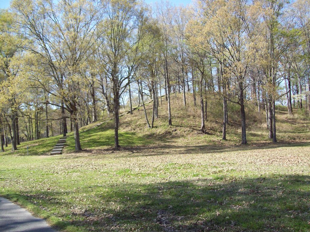
Table of Contents
- Built by Hunter-Gatherers Who Never Farmed
- Six Ridges in the Shape of a Half-Circle
- Mound A and the Bird That Faces the Sun
- A Trade Network Stretching Halfway Across a Continent
- No Farming, No Pottery, No Name We Know
- Little Clay Balls That Cooked Without Pottery
- Why This Culture Built Monuments Without Agriculture
- The Mystery of Poverty Point’s Decline
- Rediscovery Beneath a Cotton Plantation
- UNESCO Recognition and Visiting the Site Today
- Nearby Places
Built by Hunter-Gatherers Who Never Farmed
Construction at Poverty Point began around 1700 BCE and continued for several centuries, making it substantially older than the Mississippian mound-building tradition that would later produce sites like Cahokia and Etowah more than 2,000 years afterward. Unlike those later cultures, however, Poverty Point’s builders relied entirely on hunting, fishing, and gathering wild plant foods, never adopting large-scale agriculture during the period the site was actively used.
This makes Poverty Point part of a small but significant group of pre-agricultural monumental sites in North America, alongside the even older mounds at Watson Brake, located less than 100 kilometers away and predating Poverty Point by roughly 2,000 years. Together, these sites have forced archaeologists to reconsider longstanding assumptions about what kind of social organization hunter-gatherer societies were actually capable of achieving.
Radiocarbon dating and careful excavation over the past several decades have confirmed that Poverty Point’s builders sustained a level of labor coordination, likely involving hundreds or even thousands of participants at different points, that rivals or exceeds many far better known agricultural societies elsewhere in the ancient world.
The Mississippi Valley’s exceptionally rich natural environment likely played a central role in making this achievement possible, offering seasonal abundances of fish, migratory waterfowl, nuts, and other wild foods substantial enough to support periods of large-scale communal activity without the population needing to develop agriculture to sustain itself.
Poverty Point’s location along a natural bayou channel, since altered by changes in the Mississippi River’s course over the following millennia, would have placed it at a strategically valuable point for both local resource access and long-distance river-based trade and travel.
Six Ridges in the Shape of a Half-Circle

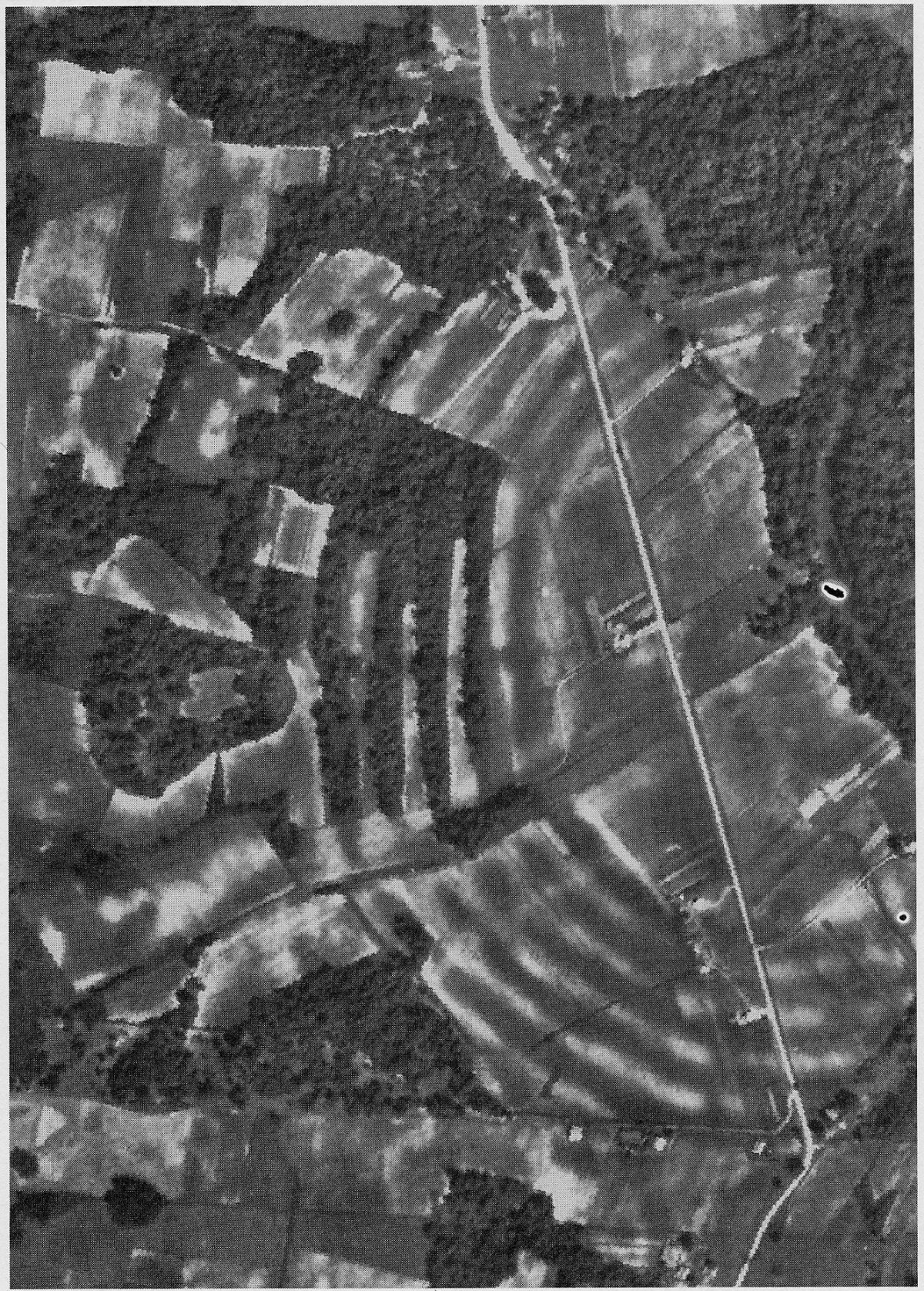
The heart of Poverty Point consists of six concentric, C-shaped earthen ridges arranged around a central plaza, opening toward the nearby bayou. Each ridge was originally built to a height of one to two meters, though centuries of erosion and agricultural plowing have reduced their visible profile considerably by the time archaeologists began seriously studying the site.
Excavations have revealed that these ridges were not simply decorative or ceremonial in function. Postholes and other evidence indicate that people built houses directly on top of the ridges, suggesting they served as a residential foundation for a substantial resident or seasonal population, arranged in a deliberate, organized pattern around the central open space.
The sheer geometric precision of the ridge system, forming nearly perfect arcs across a distance of more than a kilometer, has led some researchers to propose that its builders used sophisticated surveying techniques, possibly involving sighting alignments to celestial events, though this remains a topic of ongoing research and debate.
Estimates of the total labor required to construct the full ridge and mound system at Poverty Point vary, but most researchers agree it would have required a sustained, coordinated effort from a very large workforce, whether that workforce lived at the site permanently or gathered there periodically over an extended construction period spanning generations.
Modern archaeological mapping using LiDAR and other remote sensing technology has helped researchers visualize the full extent of the ridge system far more clearly than was possible through ground-level observation alone, revealing subtle features that centuries of plowing and erosion had made nearly invisible to the naked eye.
Mound A and the Bird That Faces the Sun
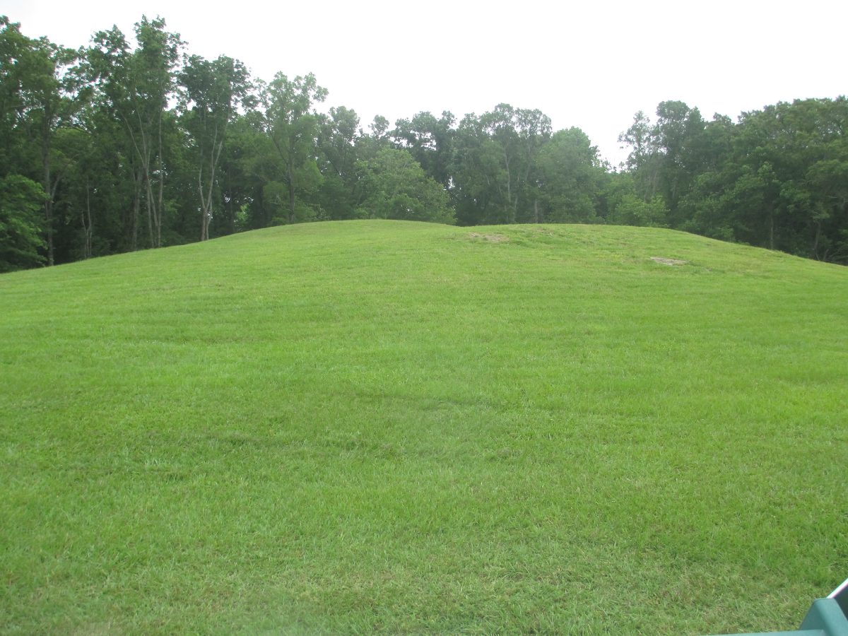
Mound A, the largest structure at Poverty Point, rises about 22 meters and contains an estimated 238,000 cubic meters of earth, making it one of the largest earthen constructions built anywhere in the pre-Columbian Americas outside of Mesoamerica and the Andes. Remarkably, evidence suggests much of this enormous structure was built in a single, relatively brief construction episode rather than through gradual accumulation over generations.
Some researchers have proposed that Mound A was designed in the shape of a bird, based on aerial analysis of its silhouette, an interpretation that, if correct, would place it among the earliest known effigy mounds in North America, a tradition that continued much later and further north at sites like the Effigy Mounds of Iowa and Wisconsin.
The mound’s construction has been estimated to have required an enormous, coordinated labor effort completed in a remarkably short period, possibly just a few months, a scale and speed of construction that implies significant organizational capacity, communal motivation, or both, among a society not otherwise associated with centralized political authority.
Excavations into Mound A have found remarkably little evidence of gradual construction stages, supporting the theory of a rapid, large-scale building event rather than slow accumulation, a finding that continues to generate significant scholarly interest regarding exactly how such a labor force was mobilized and coordinated in a society without clear evidence of centralized political leadership.
The absence of significant midden deposits, or the accumulated refuse typically associated with long-term permanent habitation, around Mound A has led some archaeologists to suggest it may have served primarily ceremonial or symbolic functions rather than any practical residential or defensive purpose.
A Trade Network Stretching Halfway Across a Continent
Archaeological excavations at Poverty Point have recovered stone materials, including copper, galena, and steatite, sourced from locations as distant as the Great Lakes region, the Appalachian Mountains, and the Ozark Plateau, evidence of an extensive trade network reaching across much of what is now the eastern and central United States.
This trade network is especially remarkable given that Poverty Point’s inhabitants had no wheeled transportation and likely relied primarily on river travel and human portage to move goods across such vast distances, underscoring both the value placed on these exotic materials and the sophistication of the exchange relationships that made their acquisition possible.
The presence of these imported materials at Poverty Point, often reworked into finished tools and ornaments found in significant quantities at the site, suggests it functioned as a major regional hub, possibly attracting visitors and traders from across a large portion of the eastern half of the continent during its centuries of active use.
Copper artifacts recovered at the site likely originated from sources in the Great Lakes region, more than 1,300 kilometers to the north, while other stone materials point to trade connections reaching into the Ozarks, the Appalachians, and even areas near the Gulf Coast, illustrating just how extensive pre-agricultural trade networks in North America could become.
No Farming, No Pottery, No Name We Know
As with so many of the oldest sites explored in this series, we do not know what language the people who built Poverty Point spoke, nor do we know what they called themselves or their monumental earthworks. No writing system, no oral tradition specifically connected to the site, and no confirmed direct descendant culture survives to bridge that gap.
Some archaeologists have speculated about possible cultural or linguistic connections between Poverty Point’s builders and later indigenous groups of the lower Mississippi Valley, but more than 3,000 years of subsequent population movement, cultural change, and colonial-era disruption make any confident linguistic reconstruction effectively impossible with current evidence.
This absence of a living linguistic thread places Poverty Point alongside Teotihuacan and the Nazca Lines among ancient American sites whose builders remain identified only by the archaeological label given to their material culture, rather than by any name they might have used for themselves.
Archaeologists studying the broader lower Mississippi Valley region have identified a range of later indigenous cultures whose territories overlapped with the area around Poverty Point, though establishing any direct cultural or genetic continuity between these later groups and the original mound builders remains speculative given the enormous time gap involved.
Little Clay Balls That Cooked Without Pottery

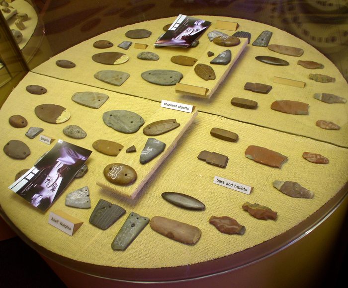
Among the most distinctive artifacts recovered at Poverty Point are small, hand-shaped baked clay objects, informally called Poverty Point objects, used as substitutes for stones in earth ovens. Heated in a fire and then buried alongside food in a pit, these objects retained heat efficiently, allowing for slow cooking in an environment where naturally occurring cooking stones were scarce.
This adaptation reflects considerable ingenuity given the local geology of the Mississippi Valley, which offers very little naturally occurring stone suitable for traditional earth-oven cooking, forcing Poverty Point’s inhabitants to manufacture an artificial substitute at a truly enormous scale, with millions of these objects estimated to have been produced and used across the site’s history.
Excavations have also recovered finely crafted stone tools, beads, and small clay and stone figurines, including simple representations of the human female form, suggesting a material culture considerably more developed than the term ‘hunter-gatherer’ might initially suggest to someone unfamiliar with the site.
Despite the ingenuity of the Poverty Point objects, actual ceramic pottery appears only in very limited quantities at the site and seems to have developed relatively late in its occupation history, suggesting the culture had not yet widely adopted true ceramic technology even while demonstrating clear sophistication in other areas of craft production.
Why This Culture Built Monuments Without Agriculture
Poverty Point challenges a longstanding assumption in archaeology sometimes called the ‘agricultural threshold,’ the idea that monumental construction and complex social organization require a stable agricultural food surplus to free up sufficient labor. Instead, the surrounding environment’s extraordinary natural abundance, including fish, waterfowl, nuts, and other wild food resources along the Mississippi floodplain, appears to have provided a sufficiently reliable and predictable food supply to support large seasonal or semi-permanent gatherings without farming.
Some researchers propose that construction at the site may have occurred during specific seasonal gatherings, when normally dispersed hunter-gatherer groups converged temporarily at Poverty Point for trade, ceremony, and, apparently, large-scale communal building projects, rather than being built continuously by a single, permanently resident population.
This model, if correct, would mean Poverty Point functioned similarly in some respects to later ceremonial gathering sites elsewhere in the world, combining periodic large-scale social and religious activity with monument-building in a way not fundamentally dependent on year-round centralized settlement.
Some researchers have drawn comparisons between Poverty Point’s seasonal gathering model and similar patterns documented among hunter-gatherer societies in other parts of the world, where temporary large-scale aggregation for ceremonial, trade, or construction purposes did not require permanent year-round settlement to achieve genuinely monumental results.
The scale of Poverty Point’s earthworks, compared against far smaller and more scattered contemporary sites elsewhere in North America, suggests the location held particular ecological or symbolic importance that drew people from unusually far away, reinforcing its likely role as a regionally, if not continentally, significant gathering place.
The Mystery of Poverty Point’s Decline
Construction activity at Poverty Point appears to have declined significantly by around 1100 BCE, and the site was effectively abandoned as a major center within a few centuries after that, though the exact causes of this decline remain genuinely unclear, unlike the drought-linked explanations proposed for some later Mesoamerican and Andean sites in this series.
Some researchers have proposed environmental changes affecting the Mississippi River’s course or the surrounding floodplain’s resource abundance as a possible contributing factor, while others point to shifting social or trade relationships that may have reduced the site’s regional importance as a gathering and exchange hub over time.
Whatever the cause, no later culture in the region matched Poverty Point’s scale of earthwork construction for well over 2,000 years, until the rise of the Mississippian mound-building tradition much further north and east, making Poverty Point something of an isolated peak of pre-agricultural monumental achievement in North American prehistory.
Pollen and sediment analysis from the surrounding region has provided some insight into environmental conditions during the site’s decline, though researchers caution against drawing overly simple causal conclusions given the many overlapping social, environmental, and economic factors likely at play.
Rediscovery Beneath a Cotton Plantation
Poverty Point sat largely unrecognized as an archaeological site for generations, its ridges gradually flattened by decades of cotton cultivation on land that had been converted to agricultural use during the 19th and early 20th centuries, obscuring the geometric precision of the earthworks from casual observation at ground level.
Serious scientific interest in the site began in the 1950s, when archaeologist James Ford recognized the significance of aerial photographs showing the faint outlines of the ridge system, a discovery method echoing how the Nazca Lines in Peru were also first properly identified through aerial observation decades earlier.

Subsequent decades of excavation, radiocarbon dating, and geophysical survey work gradually revealed the true scale and age of the site, overturning earlier assumptions that dismissed such sophisticated construction as impossible for a pre-agricultural society in North America.
Ford’s aerial photography breakthrough was followed by decades of additional fieldwork led by various archaeological teams, gradually refining the chronology and interpretation of the site through improved radiocarbon dating techniques and more systematic excavation methods than had been available to early 20th-century researchers.
UNESCO Recognition and Visiting the Site Today
Poverty Point was designated a UNESCO World Heritage Site in 2014, recognizing it as an outstanding example of prehistoric hunter-gatherer monumental construction with few, if any, direct parallels anywhere else in the world at a comparable scale and date.

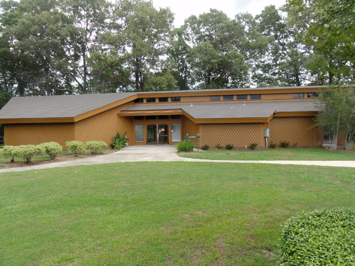
Today, visitors can explore the site through an on-site museum displaying artifacts recovered during decades of excavation, alongside walking trails that trace the outline of the ridges and mounds, though much of the earthwork’s original height and definition remains difficult to fully appreciate without the aid of aerial photography or interpretive signage.
Ongoing archaeological research continues at Poverty Point, including geophysical survey techniques that allow researchers to study buried features without disturbing the ground surface, gradually adding further detail to a site whose scale and sophistication continue to challenge assumptions about what pre-agricultural societies were capable of achieving.
The Poverty Point World Heritage Site designation places it alongside a relatively small number of UNESCO-recognized locations in the United States, reflecting its status as an internationally significant example of prehistoric human achievement rather than merely a site of regional or national importance.
Nearby Places
Poverty Point belongs to a broader tradition of North American earthwork construction that continued, in different forms, for thousands of years after its builders moved on.
- Watson Brake, the even older Louisiana mound complex built roughly 2,000 years before Poverty Point
- Cahokia, the much later Mississippian city that eventually surpassed Poverty Point in scale
- Etowah, the Mississippian mound city of Georgia built by a culture descended from the same broader mound-building tradition
Closing Thoughts
Poverty Point stands as one of the clearest reminders that monumental ambition is not the exclusive product of agriculture, kings, or writing. A society that hunted, fished, and gathered its food still found the coordination, the motivation, and the sheer physical will to move three-quarters of a million cubic meters of earth into precise geometric form, leaving behind a puzzle that continues to reshape how archaeologists think about complexity in the ancient world.
You May Like

Mafra, the Palace a King Built From a Vow


One thought on “Hunter-Gatherers Moved 750,000 Cubic Meters of Earth at Poverty Point”