Etowah Indian Mounds, on the banks of the Etowah River in northwestern Georgia, was one of the largest and most powerful Mississippian culture centers in the American Southeast, home to a ruling elite who commanded a network of villages, built earthen platform mounds rivaling those of Cahokia in ambition, and commissioned some of the finest marble sculpture and copper artwork found anywhere in ancient North America.
Occupied from roughly 1000 to 1550 CE, Etowah reached its political and artistic peak in the thirteenth and fourteenth centuries, when its rulers presided over six earthen mounds, a fortified town, and a wide-reaching exchange network connecting the site to communities as distant as the Great Lakes and the Gulf Coast.

Table of Contents
- A Mississippian City on the Etowah River
- Rise of a Ceremonial and Political Center
- Mound A: The Great Platform Mound
- Mound B and Mound C: Palaces and Burials
- The Marble Effigies of Etowah
- Copper, Shell, and the Southeastern Ceremonial Complex
- Village Life Beyond the Mounds
- What Language Did the People of Etowah Speak?
- Religion, Warfare, and Society
- The Decline of Etowah
- Nearby Places to Explore
A Mississippian City on the Etowah River
Etowah sits on a bend of the Etowah River, a location that provided fertile floodplain soil for maize agriculture, a reliable water source, and a natural transportation corridor linking the site to the wider Mississippian world stretching from the Gulf Coast to the Ohio and Mississippi River valleys.
The town itself was enclosed by a defensive ditch and palisade wall on its landward side, with the river protecting the remaining perimeter, an arrangement that speaks to the genuine military concerns facing Mississippian centers competing for regional power and access to fertile bottomland across the Southeast.
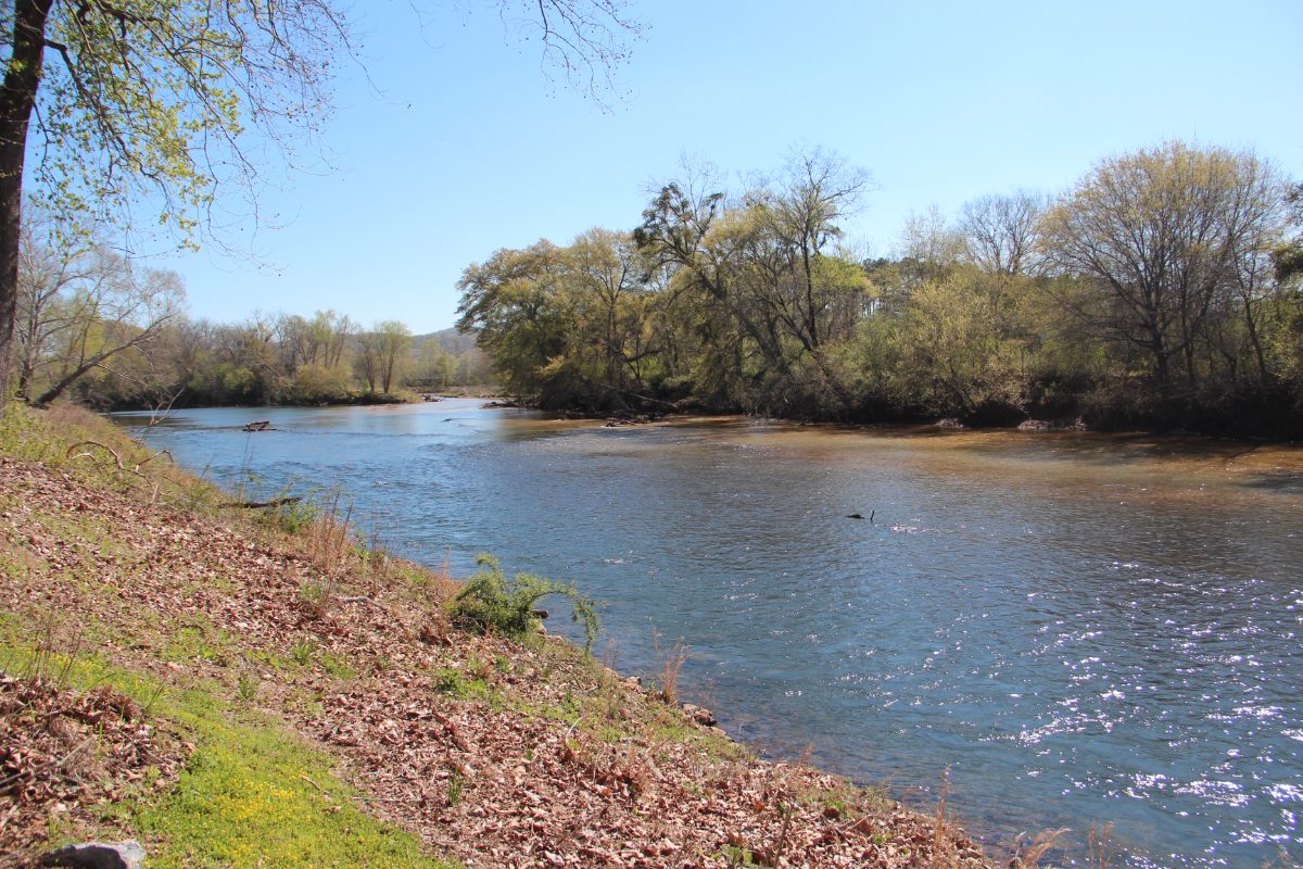
The surrounding floodplain, enriched by periodic flooding of the Etowah River, provided some of the most productive farmland in the region, and paleobotanical studies of preserved plant remains show a diet dominated by maize but supplemented with a wide range of native cultivated and wild plants, reflecting a flexible agricultural strategy well adapted to occasional flood damage or crop failure.
Modern excavation and geophysical survey have revealed that the palisade wall enclosing Etowah’s landward side was rebuilt at least twice during the site’s occupation, each version incorporating bastions, projecting sections allowing defenders to fire along the wall’s length, a level of military engineering sophistication comparable to fortifications found at other major Mississippian centers such as Cahokia and Moundville.
Geoarchaeological coring of the surrounding valley has documented centuries of intensive floodplain farming at Etowah, with soil chemistry showing sustained nutrient depletion over time, a pattern that likely required the community to periodically fallow fields or expand cultivation into new areas as the population grew across the site’s several centuries of occupation.
Rise of a Ceremonial and Political Center
Etowah’s earliest mound construction began around 1000 CE, but the site’s power and population grew substantially between 1200 and 1375 CE, a period archaeologists call the Wilbanks phase, during which most of the site’s largest mounds reached their final monumental scale.
A significant, still-debated event occurred sometime in the fourteenth century when the site appears to have been abruptly abandoned or violently disrupted, only to be reoccupied later by a related but somewhat different Mississippian population, whose presence is documented archaeologically through changes in pottery style and mound use during Etowah’s final occupation phase before European contact.
Radiocarbon dates and stratigraphic analysis show that Mound A grew through at least seven distinct construction stages, each adding a new layer of clay and soil capped by a fresh clay surface, a building technique requiring careful engineering to prevent the growing mound from collapsing under its own increasing weight and height.
Population estimates for Etowah at its height range from several hundred to as many as a thousand people living within the palisade itself, with a considerably larger number residing in satellite farming hamlets scattered along the Etowah River valley and paying tribute, likely in maize and labor, to the chiefly authority based at the main mound center.
The reoccupation phase following Etowah’s mid-fourteenth-century disruption saw a somewhat different material culture emerge at the site, including changes in pottery decoration and a scaling back of monumental construction, evidence archaeologists interpret as either a new, related group settling the site or the original community rebuilding on a reduced scale after whatever crisis had disrupted it.
Mound A: The Great Platform Mound
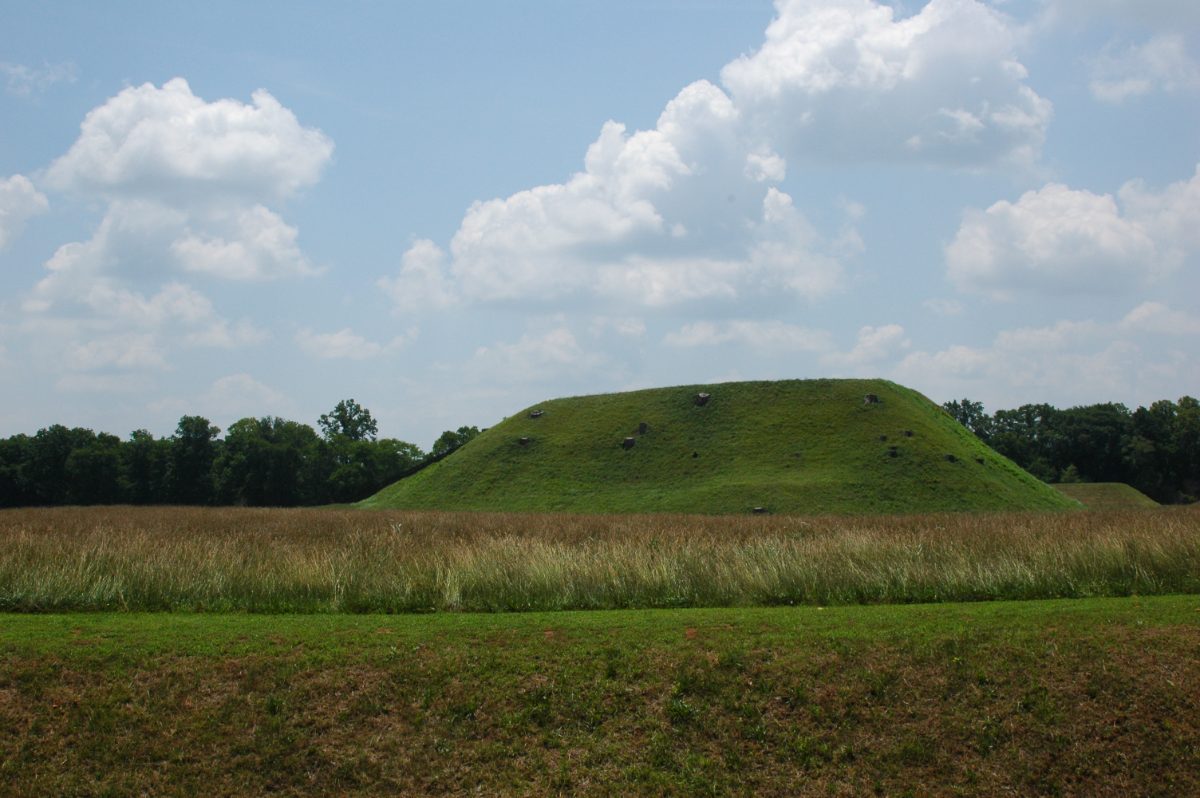
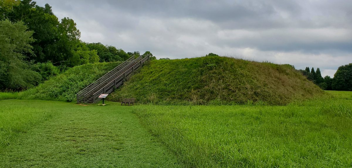
Mound A, the largest structure at Etowah, rises 63 feet, making it one of the tallest surviving Mississippian mounds in North America, second in overall scale only to Monks Mound at Cahokia. Its flat summit once supported a wooden temple or elite residence, rebuilt multiple times across generations as each new construction phase added another layer of earth atop the last.
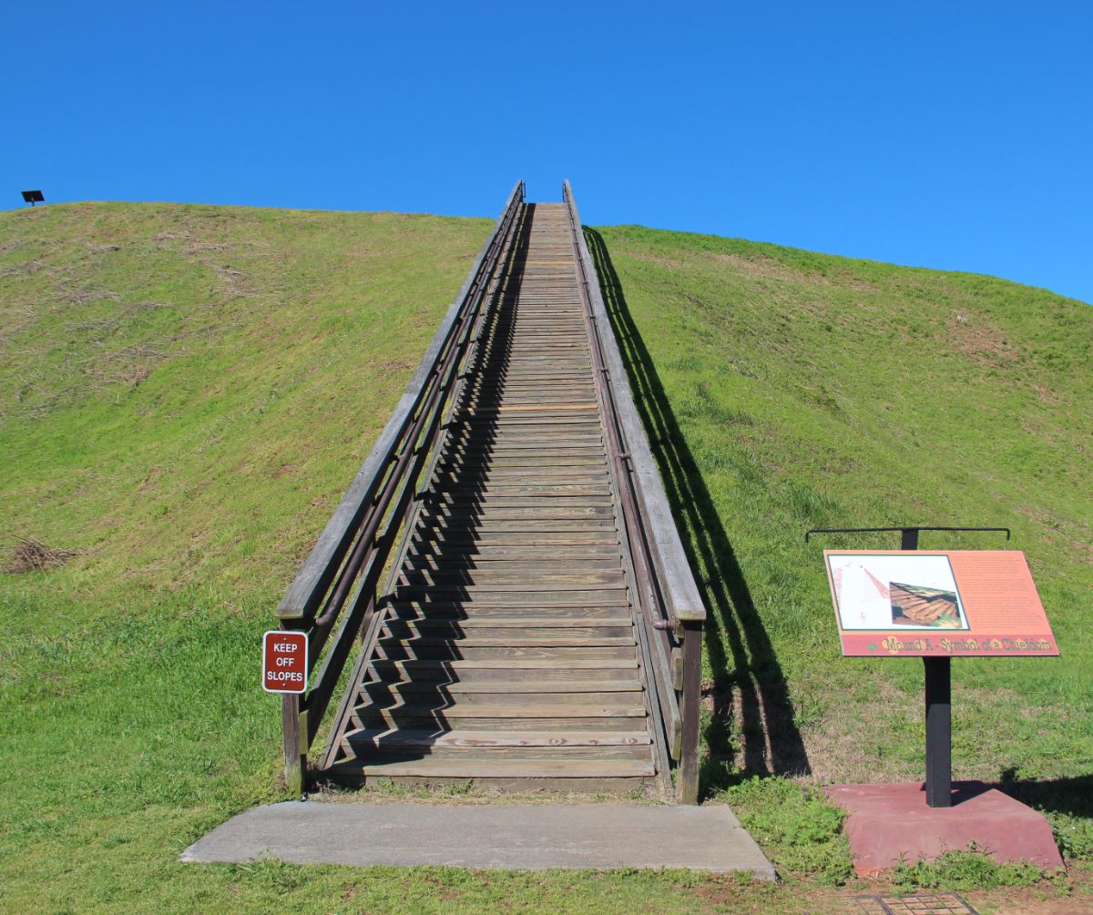
A wide earthen ramp and staircase led to Mound A’s summit, a route almost certainly reserved for the chiefly elite and religious specialists who used the structure, physically separating the ruling class from the rest of the population in a way that mirrored their separated social and religious status within Mississippian society.
Excavations along Mound A’s flanks have recovered postholes indicating a sequence of large rectangular buildings on its summit, interpreted as either the residence of the paramount chief or a temple housing sacred objects and possibly the remains of deceased rulers, consistent with practices documented among related Mississippian and later historic Southeastern societies.
The labor required to build Mound A, an estimated 200,000 cubic feet of soil moved basket by basket without wheeled carts or draft animals, represents a similar organizational achievement to earthworks like Cahokia’s Monks Mound, requiring coordinated labor drawn from Etowah’s subject population over multiple building episodes across generations.
Comparative studies of Mound A’s construction sequence against similar platform mounds at Moundville in Alabama and Cahokia in Illinois show broadly similar building techniques, basket-loading of earth in defined layers, suggesting these distant Mississippian centers, while politically independent, shared not only symbolic art styles but also practical engineering knowledge about monumental earthwork construction.
Visitors climbing the reconstructed staircase to Mound A’s summit today can see the layout of the Etowah valley much as its ancient chiefs once did, with Mound B and Mound C visible below and the river curving around the site’s perimeter, a vantage point that likely reinforced the mound’s role as both a physical and symbolic seat of authority over the surrounding landscape.
Mound B and Mound C: Palaces and Burials
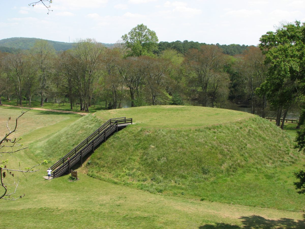
Mound B, smaller than Mound A but still substantial, is believed to have supported an elite residence or administrative structure, while Mound C served primarily as a burial mound, and excavations there in the 1950s and again more recently recovered some of the richest Mississippian-era burials ever documented in North America.
Mound C burials included copper-covered wooden ear ornaments, shell gorgets carved with intricate mythological imagery, and the famous marble statues, all placed with high-status individuals in a manner suggesting Etowah’s rulers were buried with deliberate visual reminders of both their political authority and their connection to the wider Mississippian religious cosmos.
Mound C was excavated more extensively than any other structure at Etowah, first by antiquarian researchers in the nineteenth century and later by professional archaeologists in the 1950s, work that recovered hundreds of burials spanning the site’s occupation and revealing a clear stratification in grave goods between high-status individuals buried with copper, shell, and marble objects and more modest burials containing few or no artifacts.
Shell gorgets recovered from Mound C burials, carved from marine conch shell traded from the Gulf Coast, depict spiders, rattlesnakes, human figures in elaborate costume, and geometric designs associated with Mississippian cosmology, each gorget likely carrying specific religious or clan significance for the individual who wore it in life and was buried with it in death.
Beyond Mound C, smaller mounds designated D, E, and F at Etowah remain less thoroughly excavated, and current park management deliberately leaves portions of the site unexcavated, preserving them for future research using archaeological methods, such as ground-penetrating radar and refined dating techniques, not yet available to earlier generations of investigators.
The Marble Effigies of Etowah
Among Etowah’s most celebrated discoveries are two seated marble statues, a man and a woman, found buried together in Mound C, carved from Georgia marble with careful attention to posture, facial features, and ornamentation, and widely regarded as among the finest examples of Mississippian sculpture ever recovered.
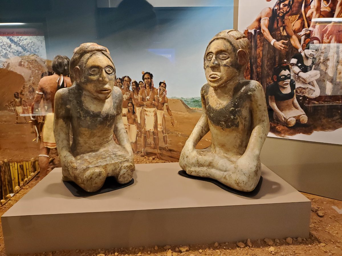
Scholars interpret the paired statues variously as ancestor effigies, representations of important deceased rulers, or images tied to origin myths describing a founding male and female pair, a common theme in Southeastern Indigenous oral tradition recorded much later by European and American ethnographers among descendant communities.
The Etowah marble statues were discovered in 1884 buried in a stone box within Mound C, positioned facing east, and their remarkable preservation, retaining traces of original paint in some crevices, has made them among the most reproduced and studied examples of Mississippian art in American museums and archaeological literature.
Comparable marble and stone effigy figures have been found at other Mississippian sites across Georgia and Tennessee, suggesting a shared regional tradition of ancestor or deity representation in stone, though the Etowah pair remains distinguished by its unusually fine craftsmanship and the rare survival of both a male and female figure found together.
Conservation of the two marble statues has required careful climate control since their removal from burial, as the marble is sensitive to humidity fluctuations that can cause surface flaking, and the figures are now displayed at the site’s museum rather than left in their original burial context, balancing public educational access against the statues’ long-term physical preservation.
Copper, Shell, and the Southeastern Ceremonial Complex
Etowah was a major participant in what archaeologists call the Southeastern Ceremonial Complex, a shared set of religious symbols, motifs, and prestige goods, including raptor imagery, weeping-eye designs, and cross-in-circle symbols, that circulated among Mississippian elites across a huge area of the Southeast during the thirteenth and fourteenth centuries.
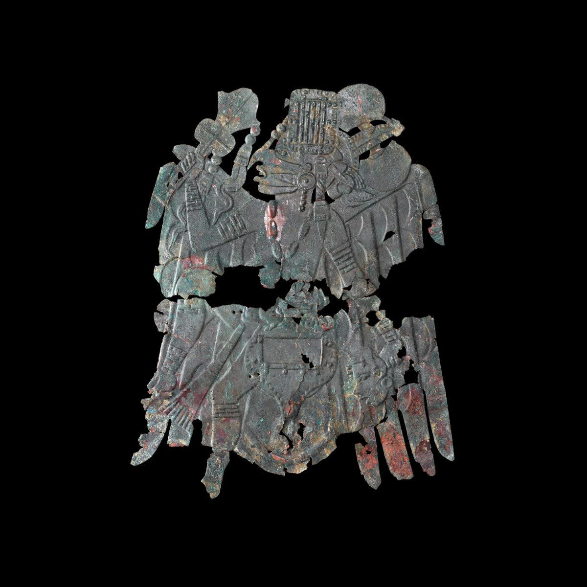
A copper repousse plate recovered from Etowah, depicting a costumed dancer or warrior figure associated with falcon imagery, closely resembles similar plates found at Cahokia and other distant Mississippian centers, direct physical evidence of long-distance trade or gift exchange networks linking elite communities across hundreds of miles.
Marine shell from the Gulf Coast, copper likely originating from sources in the Great Lakes region, and mica from the southern Appalachians all made their way to Etowah, worked by local artisans into ornaments and ceremonial objects that reinforced the authority of the ruling elite who controlled access to these exotic, symbolically potent materials.
The broader Southeastern Ceremonial Complex, sometimes called the Southern Cult by earlier generations of archaeologists, linked elite communities from Spiro in Oklahoma to Moundville in Alabama and Cahokia in Illinois through shared symbolic vocabulary even as each individual center maintained its own distinct architectural style, pottery tradition, and local political structure.
Etowah’s artisans were not merely passive recipients of exotic materials and outside styles; the site’s own workshops produced finished ornaments and sculpture traded outward to other Mississippian centers, positioning Etowah as both a consumer and a producer within this wide-reaching network of prestige goods and shared religious symbolism.
A cache of ceremonial flint blades known as ‘Duck River swords,’ recovered from Etowah and named for a similar find near the Duck River in Tennessee, represent some of the finest chipped stone work in the Mississippian world, objects too fragile and finely made for practical use as weapons and almost certainly reserved for ceremonial display or ritual deposit.
Researchers have used stylistic analysis of engraved shell and copper objects to identify what appear to be distinct artistic workshops or traditions active at Etowah across different phases of its occupation, suggesting the transmission of specialized craft knowledge through generations of local artisans rather than a single unchanging style maintained throughout the site’s history.
Village Life Beyond the Mounds
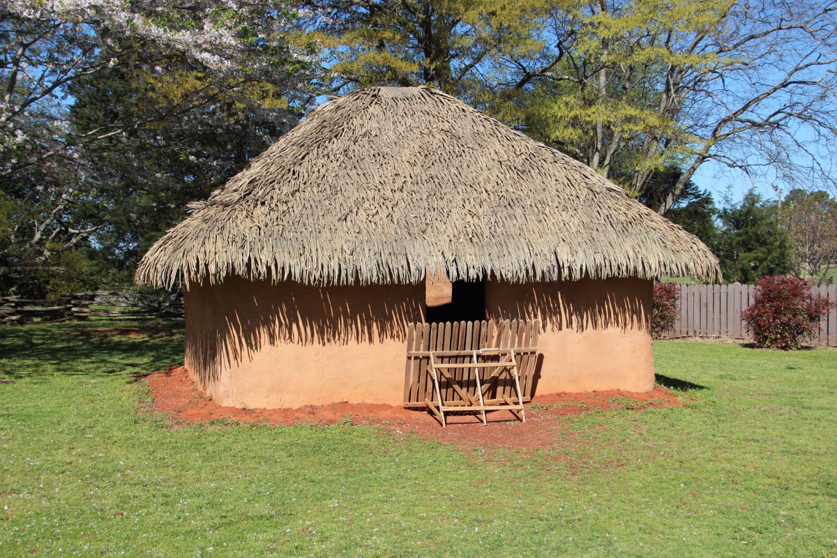
Most of Etowah’s population lived not atop the mounds but in wattle and daub houses clustered around the site’s central plaza and along the surrounding floodplain, structures built from a woven wooden frame plastered with mud, providing solid insulation against both summer heat and winter cold in the Georgia piedmont climate.
Maize, beans, and squash grown on the fertile floodplain surrounding the site formed the dietary foundation for Etowah’s population, supplemented by deer, turkey, fish from the river, and a wide variety of wild plants gathered seasonally, a diet broadly consistent with Mississippian farming communities across the wider Southeast.
Archaeological excavation of residential areas beyond the mounds has revealed storage pits, hearths, and refuse middens containing broken pottery, animal bone, and plant remains that together allow researchers to reconstruct the daily diet and material culture of Etowah’s ordinary farming families, a population whose lives, while less visible in the archaeological record than the elite burials in Mound C, made up the overwhelming majority of the site’s population.
Pottery produced at Etowah included both plain utilitarian jars for cooking and storage and finely made, sometimes painted or incised vessels reserved for ceremonial use, a distinction in craftsmanship and function that mirrors similar patterns documented at other major Mississippian sites throughout the Southeast.
Children at Etowah likely began learning agricultural, craft, and household skills from an early age within extended family households, a pattern inferred from ethnographic analogy with historic Southeastern tribes and from the consistent, generationally stable craft traditions, particularly in pottery decoration, visible in the archaeological record across Etowah’s centuries of occupation.
What Language Did the People of Etowah Speak?
Etowah’s residents left no written texts, so their spoken language cannot be read directly, but archaeological and linguistic evidence points strongly toward an early Muscogean language, part of the language family that includes modern Muscogee (Creek), Hitchiti, and related tongues once spoken across much of the Mississippian Southeast.
The Muscogee (Creek) Nation, along with related southeastern tribes now largely located in Oklahoma following forced removal in the nineteenth century, maintains oral traditions describing ancestral towns and mound centers in present-day Georgia and Alabama, and many scholars and Muscogee community members alike regard Etowah as an ancestral site connected to this broader Mississippian and Muscogean heritage.
As with many Mississippian sites, certainty is limited by the absence of a deciphered writing system contemporary with Etowah’s occupation; the language connection rests on continuity of material culture, geography, and living oral tradition rather than any surviving inscription that names the language its builders actually spoke.
Linguists classify Muscogean as a distinct language family native to the Southeast, encompassing Muscogee proper along with related but separate languages such as Choctaw, Chickasaw, and Alabama, and while it remains impossible to say with certainty which specific Muscogean language, if any single one, was spoken at Etowah itself, the broader linguistic landscape of the pre-contact Southeast was clearly Muscogean in this region.
Some archaeologists have also proposed that Etowah’s population, or at least a component of it, may have spoken a form of Hitchiti or a related but now-extinct Muscogean language rather than Muscogee proper, since historic-era Creek confederacies included multiple distinct language communities that later merged politically without merging linguistically, a reminder that Mississippian-era linguistic diversity in the Southeast was likely at least as complex as the political landscape suggests.
By the time sustained European documentation of Southeastern Indigenous languages began in the eighteenth century, the historic Creek Confederacy occupying much of the former Mississippian heartland in Georgia and Alabama included speakers of Muscogee alongside speakers of several related but distinct languages, a linguistic patchwork many researchers believe reflects the complex merging and political consolidation of formerly separate Mississippian-era communities, potentially including descendants of Etowah itself.
Religion, Warfare, and Society
Mississippian religion at Etowah centered on a cosmology dividing the world into an Upper World associated with order, the sun, and birds of prey, and an Under World associated with chaos, water, and serpents, a duality reflected repeatedly in the site’s shell gorgets, copper plates, and marble sculpture.
Chiefly authority at Etowah appears to have combined political and religious power in a single office, likely inherited through specific elite lineages, with the ruling chief serving simultaneously as military leader, religious intermediary, and manager of tribute and redistribution from surrounding subject villages.
Warfare was a genuine concern for Etowah’s rulers, evidenced by the site’s palisade and ditch fortifications and by the martial imagery, including weapons and warrior figures, appearing throughout its ceremonial art, suggesting competition and conflict between rival Mississippian centers for territory, tribute, and prestige.
Bird imagery, particularly falcons and other raptors, recurs throughout Etowah’s ceremonial art and is generally associated with Upper World symbolism, warrior status, and elite authority, while serpent and underworld imagery on other objects reflects the complementary, sometimes dangerous forces Mississippian cosmology associated with water, the earth, and chaos.
Captives taken in warfare between rival Mississippian towns may have faced enslavement, ritual sacrifice, or incorporation into the victorious community, practices inferred partly from skeletal evidence of traumatic injury found in some burials and partly from later historical accounts of warfare customs among Southeastern tribes recorded after European contact.
The chunkey game, played across much of the Mississippian world including at Etowah, involved rolling a carved stone disc across a smoothed playing field while competitors threw spears to land closest to where the disc would stop, a sport carrying both recreational and ceremonial significance and requiring specially prepared chunkey yards likely located near the site’s central plaza.
The Decline of Etowah
Etowah’s population and mound-building activity declined sharply after roughly 1375 CE, and archaeological evidence suggests the site may have been at least partially destroyed by rival groups before being reoccupied on a smaller scale in its final pre-contact phase.
When Spanish explorer Hernando de Soto passed through the region in 1540, chroniclers described populous, powerful towns in the area, though it remains uncertain whether Etowah itself was still occupied at full strength by that point or had already entered a period of reduced population and political significance.
European contact brought devastating epidemic disease and, later, forced displacement that scattered the Mississippian Southeast’s descendant communities, but the Muscogee (Creek) Nation and related tribes maintain living cultural and, for some, direct ancestral connections to sites like Etowah, preserving oral traditions that keep this history from being purely archaeological.
Some archaeologists link Etowah’s mid-fourteenth-century disruption to conflict with the rising Mississippian center at nearby Little Egypt or other regional rivals competing for control of the fertile Etowah valley, though the precise sequence of events remains difficult to reconstruct with certainty from the archaeological record alone.
Etowah Indian Mounds today is preserved as a Georgia state historic site, and ongoing collaboration between archaeologists and the Muscogee (Creek) Nation has shaped how the site’s history and human remains are studied, interpreted, and, in some cases, respectfully reburied, reflecting a broader shift toward Indigenous involvement in the stewardship of Mississippian heritage sites across the Southeast.
European trade goods, including glass beads and metal objects, occasionally appear in the uppermost, latest archaeological layers at Mississippian sites in the region, providing physical evidence of the earliest indirect contact between Southeastern Indigenous communities and European colonizers even before direct, sustained contact events like de Soto’s expedition are documented in written records.
Nearby Places to Explore
Etowah belongs to the wider Mississippian world that stretched across much of the American Southeast and Midwest, and comparing it with other major centers helps place its mounds and artistry in a broader regional context.
- Cahokia: The Largest Ancient City North of Mexico
- Chaco Canyon: The Ancient Center of the Southwest
- Mesa Verde: The Ancestral Puebloan Cliff City
A Mound-Builder Legacy on the River
Etowah stands as one of the clearest windows into the political ambition and artistic achievement of the Mississippian Southeast, a society that built enormous earthen monuments, carved marble effigies rivaling any ancient sculpture in North America, and maintained exchange networks stretching across a huge swath of the continent.
Its story, pieced together from mounds, burials, and the oral traditions of the Muscogee (Creek) Nation and related descendant communities, continues to be refined by ongoing archaeological research, a reminder that this chapter of American history remains very much alive rather than sealed away in the past.
Etowah Mounds was designated a National Historic Landmark, reflecting its significance as one of the best-preserved and most thoroughly documented Mississippian mound centers in the United States, and the site continues to serve as a touchstone for understanding the political complexity, artistic achievement, and enduring descendant connections of the Mississippian Southeast.


One thought on “Etowah: The Mississippian Mound City of Georgia”