Here is a puzzle that stumped archaeologists for decades. In the flat lowlands of northeastern Louisiana, along a bayou near the Mississippi River, there is a set of gigantic earthworks: six enormous ridges laid out in concentric half-circles, and alongside them a mound so large it may have been the second-biggest earthen structure in all of ancient North America. Someone moved hundreds of thousands of cubic metres of soil, basket by basket, to build all this more than three thousand years ago. And the truly astonishing part? The people who did it were not farmers. They were hunters, fishers, and gatherers.
That single fact upends one of the most cherished assumptions in the story of human civilisation. We are usually taught a tidy sequence: first people invent agriculture, then farming produces surplus food, then surplus lets some people stop farming and organise big projects, and only then do you get monuments, social complexity, and the beginnings of what we call civilisation. Poverty Point did not read the script. Here, foragers who lived off the wild abundance of the rivers and forests built one of the greatest monumental complexes of the ancient Americas, and they did it without a single planted field of maize.
Poverty Point is one of those sites that quietly rewrites what you thought you knew. It is a UNESCO World Heritage Site today, and yet it remains far less famous than it deserves to be. Its story is a story of ambition without agriculture, of trade networks spanning half a continent, of engineering achieved by people we too often underestimate. Let’s walk its great curving ridges and try to understand who built this place, how, and above all why.
- What is Poverty Point?
- Monuments without farming
- The great curving ridges
- Mound A and the bird in the earth
- Moving mountains by basket
- A crossroads of the ancient continent
- The mystery of the clay balls
- Why did they build it?
- Living on the bayou
- Circles in the plaza
- The end, and the rediscovery
- Rewriting the timeline
- Why Poverty Point matters
What is Poverty Point?
Poverty Point is the name of an archaeological site in West Carroll Parish, Louisiana, and also the name of the culture that built it, which flourished across a wide region of the lower Mississippi Valley. The name itself is modern and a little unfortunate, taken from a nineteenth-century plantation that once occupied the land. It has nothing to do with the ancient people or how they lived, which, as we will see, was anything but impoverished in ambition or reach.
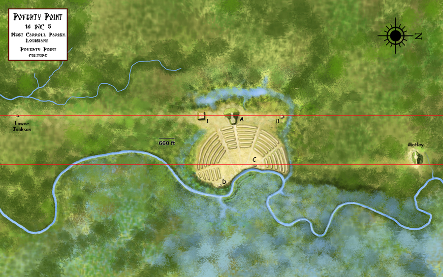
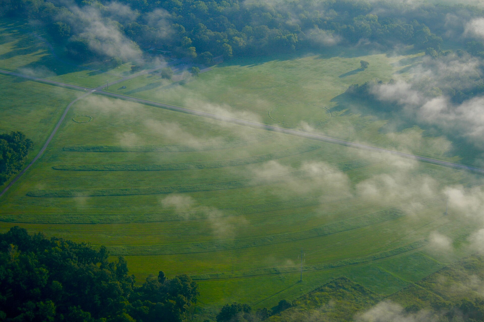
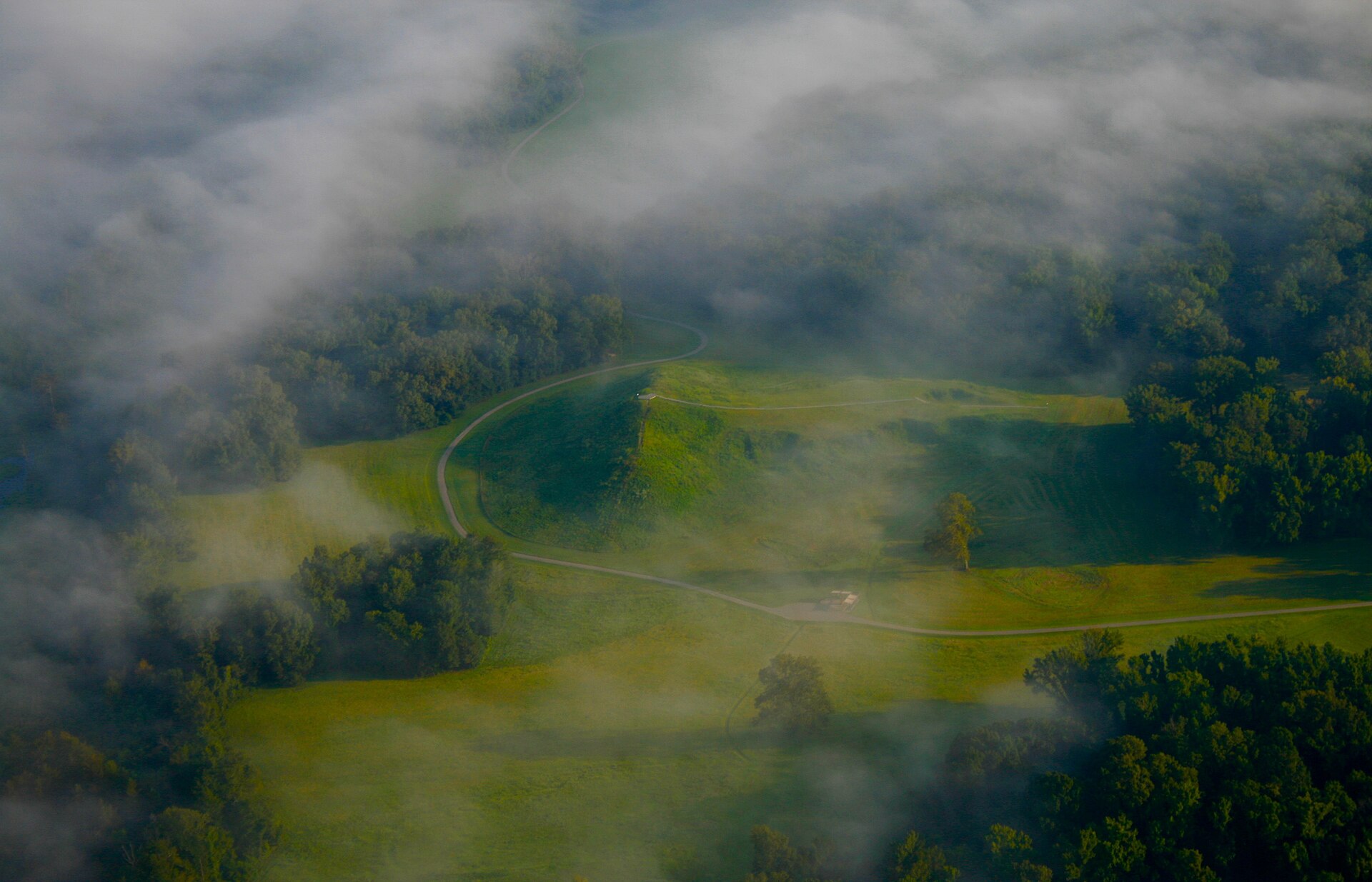
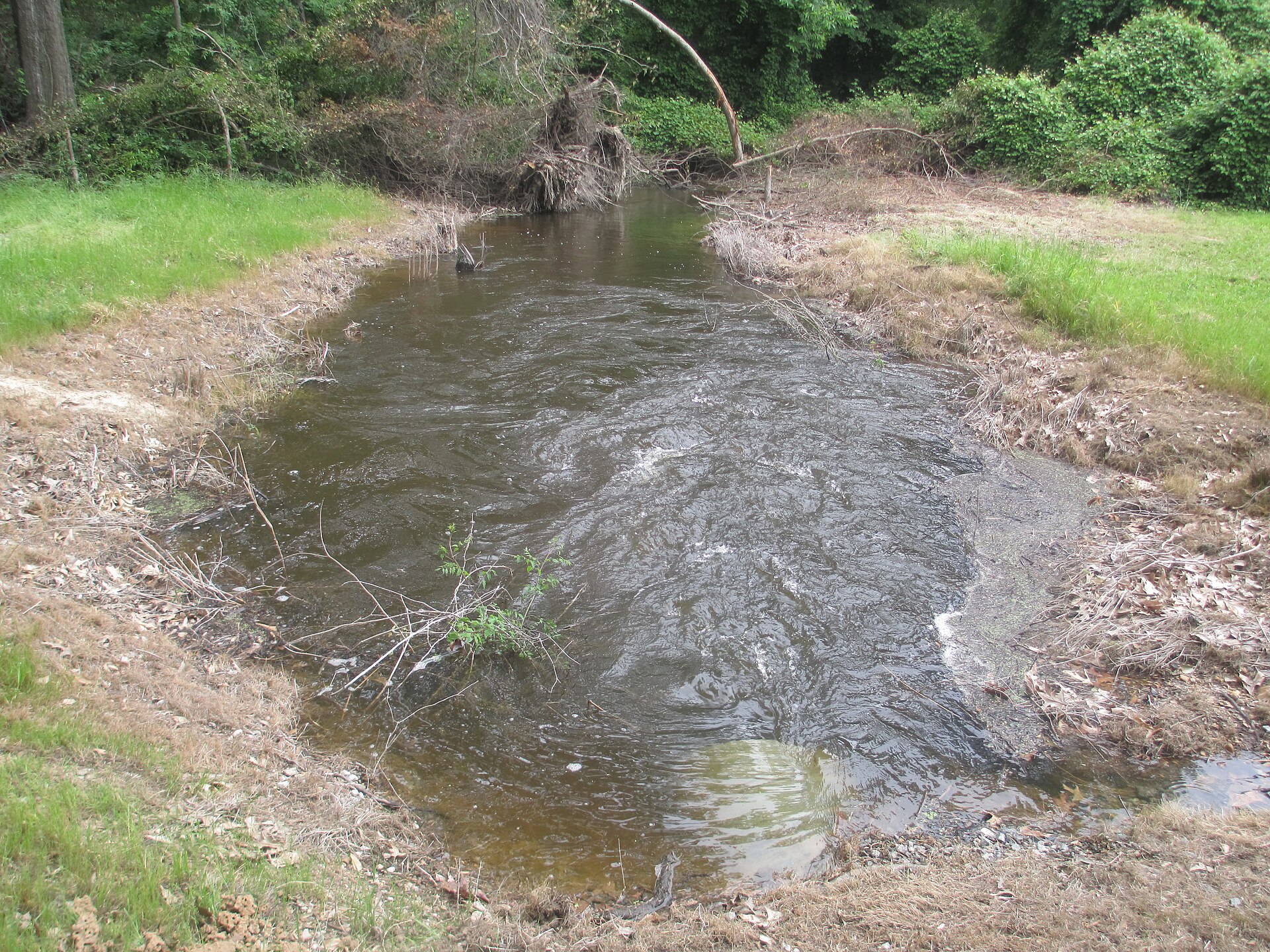
The site sits on a low ridge overlooking Bayou Macon, near the floodplain of the Mississippi, in a landscape rich in fish, game, birds, and wild plant foods. The heart of the complex is a huge set of earthworks: a series of concentric, curved earthen ridges enclosing a large open plaza, together with several mounds, the largest of which is a massive structure known as Mound A. The whole layout covers a substantial area, and its scale only really becomes clear when you see it from above.
Poverty Point was built and used over a span of centuries, roughly from around 1700 to 1100 BCE, placing it firmly in a period when, elsewhere in the world, Bronze Age civilisations were flourishing. In North America, though, this was long before the famous later mound-building cultures, and very long before any European contact. For its time and place, Poverty Point was extraordinary, arguably the largest and most complex settlement in North America during its heyday.
Monuments without farming
Let’s dwell on the point that makes Poverty Point so important, because it really is remarkable. The people who built these earthworks were fundamentally hunter-gatherers, or more precisely hunter-fisher-gatherers. They did not rely on agriculture. Instead, they thrived by exploiting the extraordinary natural richness of their environment: the rivers and bayous teeming with fish, the forests full of deer and nuts, the skies full of migratory birds, and the wetlands offering a constant, reliable bounty.
For a long time, scholars assumed that only farming societies could produce the food surplus and settled life needed to build monuments. Hunter-gatherers were imagined as small, mobile bands, forever on the move, too busy finding their next meal to organise anything grand. Poverty Point demolishes that stereotype. It shows that in an especially rich environment, foragers could settle in large numbers, stay put long enough to raise enormous earthworks, and sustain a complex society, all without planting crops.
This matters far beyond Louisiana. Poverty Point is one of the world’s clearest examples of monumental construction by non-agricultural people, joining a small but growing list of sites that force us to rethink the supposed link between farming and complexity. The lesson is that there was never a single, universal path to building great things. Given the right conditions, ingenuity, and social will, people found many different routes to ambition, and some of them ran straight through the world of the hunter-gatherer.
The great curving ridges
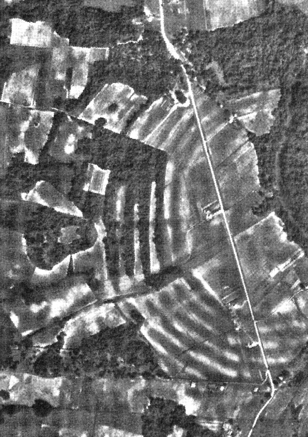
The most distinctive feature of Poverty Point is its set of concentric earthen ridges. There are six of them, arranged as nested, C-shaped arcs, like a series of half-circles one inside the other, opening toward the bayou. Together they enclose a large, flat central plaza. From ground level, the ridges are low and easy to miss, gentle rises in the grass. From the air, they resolve into a breathtaking piece of deliberate design, a giant bullseye pattern etched into the land.
The ridges were not just abstract art. People lived on them. Archaeologists believe the raised ridges served as foundations for dwellings, keeping homes above the damp ground and arranging the community in this grand, ordered pattern. Walking the arcs, families would have lived in rows of houses curving around the central plaza, a layout that speaks of planning and shared intent rather than haphazard growth. Excavation of the ridges has turned up abundant traces of domestic life: tools, cooking debris, and the remains of the activities of daily living.
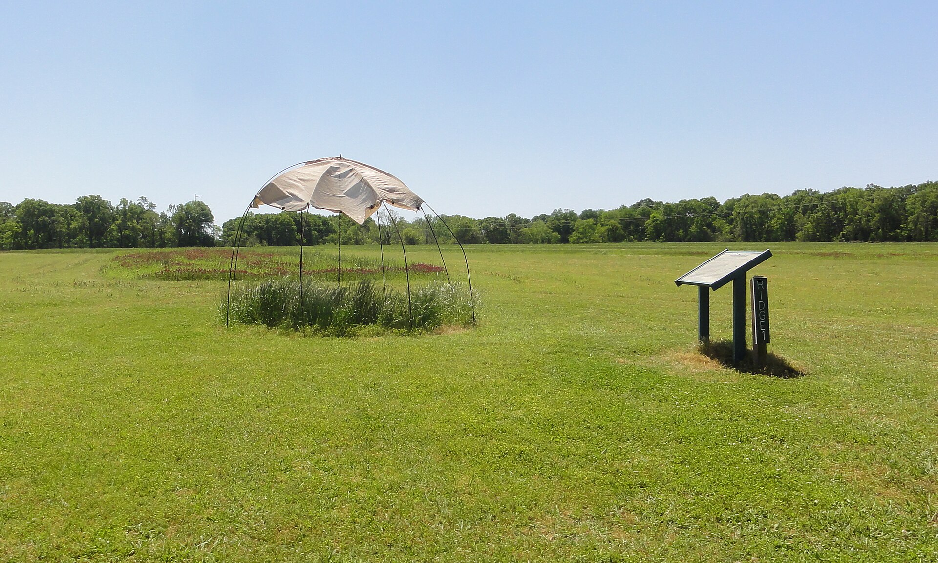
The central plaza enclosed by the ridges was kept open, and it clearly mattered. Such plazas in ancient societies were typically stages for communal life: for gatherings, ceremonies, feasts, trade, games, and rituals. Recent research has even found evidence of large post structures, circles of massive wooden posts, set within the plaza, hinting at ceremonial architecture and perhaps at tracking the movements of the sun or other celestial events. The plaza was the beating social heart of the whole complex.
Mound A and the bird in the earth
Beyond the ridges rise the mounds, and the greatest of them is Mound A, a truly colossal earthen structure. It stands around twenty metres high and stretches wide at its base, containing an immense volume of soil. In its day it ranked among the largest earthen mounds ever built in North America, a genuine artificial hill raised by human hands on the flat Louisiana plain.
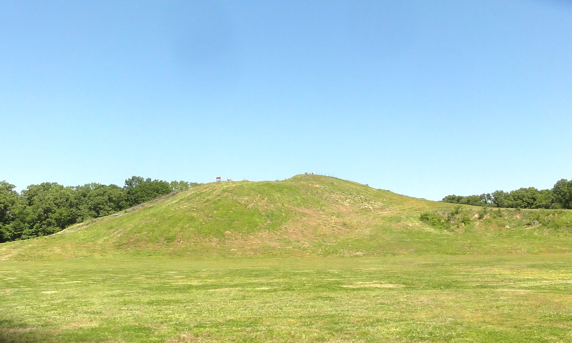
Mound A is often described as being shaped like a bird, or like a bird in flight, with a wider body and an extending ramp read as a tail or outstretched form. Whether the builders truly intended a bird effigy is debated, but the possibility is tantalising, linking Poverty Point to the deep and widespread importance of birds in the symbolism of many Native American cultures. Standing at its foot and looking up, you feel the sheer physical labour embodied in it, an entire hill conjured out of countless individual loads of earth.
What has stunned researchers most about Mound A is the evidence for how quickly it went up. Careful study of its layers suggests that this enormous mound was built in a remarkably short span of time, possibly within a matter of months, with little sign of the weathering you would expect if construction had paused for long periods. That implies a huge, coordinated, concentrated effort: large numbers of people converging to raise the mound in a sustained burst of collective labour. For a society without bulldozers, wheelbarrows, or draft animals, that is an astonishing feat of organisation.
Moving mountains by basket
To grasp what the builders of Poverty Point accomplished, you have to picture the actual work. There were no metal tools, no wheeled carts, no animals to haul loads. The soil for the ridges and mounds was dug by hand, using tools of wood, stone, and shell, then carried to where it was needed, most likely in woven baskets balanced on shoulders or carried by hand, one load at a time. Multiply a single basket of dirt by the millions of loads required, and the scale of human effort becomes almost dizzying.
Archaeologists can sometimes even see traces of this basket-by-basket construction in the layered soils of the mounds, subtle differences in colour and texture marking individual loads and work episodes. The earth itself was carefully chosen and sometimes brought from different sources, showing that the builders were not just piling up random dirt but constructing with intent, selecting materials and shaping the structures deliberately.
All of this raises the question of labour. Building on this scale required either a large resident population or the periodic gathering of many people from across the region, or both. Feeding those workers, coordinating their efforts, and sustaining the vision over the time it took to complete the earthworks all point to a society with real organisational capacity. Whether that coordination came from respected leaders, from shared religious devotion, from communal tradition, or from some combination, it was clearly powerful enough to move an astonishing quantity of earth.
A crossroads of the ancient continent
One of the most eye-opening things about Poverty Point is how connected it was to the wider continent. The local environment, for all its richness in food, was poor in one crucial material, namely stone. The Louisiana lowlands are built of soft sediments, with little of the hard rock needed for tools. And yet excavations at Poverty Point have uncovered enormous quantities of stone, and much of it came from far away, sometimes hundreds of kilometres distant.
Archaeologists have traced materials at the site to sources across a vast swathe of what is now the United States: stone from the Ozarks and the Ouachita mountains, from the Ohio and Tennessee river valleys, from the Appalachians, and from other distant regions. Copper from the Great Lakes area has been found there too. This scatter of exotic materials reveals Poverty Point as a great hub in a continent-spanning web of exchange, drawing in raw materials and goods from an immense hinterland.
How exactly these materials moved, whether through long-distance trade, down-the-line exchange from group to group, or people travelling to the site to bring offerings, is still studied and debated. But the sheer volume and variety of imported stone make it clear that Poverty Point was no isolated backwater. It was a central place, a destination, a node where the products and perhaps the peoples of a huge region came together. Its builders were plugged into a network that reached across much of the continent, an astonishing degree of connectedness for its time.
The mystery of the clay balls
Among the most abundant and curious finds at Poverty Point are small objects made of baked clay, so characteristic of the site that archaeologists simply call them Poverty Point objects. They come in a variety of shapes, balls, bicones, cylinders, and other forms, often with grooved or twisted surfaces, and they turn up by the thousands. For a long time their purpose was a genuine puzzle, and they remain one of the site’s most charming enigmas.
The leading explanation is delightfully practical: these baked clay objects were a cooking technology. In a region with little stone, you cannot easily use hot rocks to cook, the classic technique of dropping fire-heated stones into a pit or container to cook food. So the people of Poverty Point apparently made their own substitute, moulding clay into these objects and firing them, then heating them and using them to cook food in earth ovens. The different shapes may have controlled how fast they heated and cooled, a kind of prehistoric temperature management.
It is a wonderful example of human ingenuity adapting to local conditions. Lacking cooking stones, the community simply invented an artificial equivalent from the abundant clay at hand, and made it in vast quantities. The huge numbers of these objects also hint at large-scale food preparation, perhaps the communal cooking that would have fed the crowds gathering to build the earthworks or attend ceremonies. In their humble way, the clay balls tell us as much about daily life at Poverty Point as the great mounds do about its ambitions.
The site has yielded other artifacts too: finely made stone tools and blades, spear-thrower weights, beads, and small carved objects, including tiny figurines and stylised images of owls and other creatures. Together these finds paint a picture of a skilled, artistically inclined people with a rich material culture, trading for exotic stone, crafting tools and ornaments, and cooking with their ingenious clay objects, all while raising some of the largest earthworks their continent had ever seen.
Why did they build it?
The deepest question about Poverty Point is also the hardest: why? Why would a society of hunter-gatherers pour such staggering effort into building these ridges and mounds? Without written records, we can only interpret, but several ideas help us imagine the possibilities.
One likely answer is that Poverty Point was a great ceremonial and gathering centre, a place where people came together, perhaps periodically, for rituals, feasts, trade, and social bonding. The huge plaza, the exotic materials arriving from across the continent, and the evidence of large-scale cooking all fit a picture of Poverty Point as a magnet that drew people in from a wide region. The act of building together, of collectively raising these monuments, may itself have been a powerful social glue, binding communities through shared labour and shared meaning.
The earthworks may also have held cosmological or symbolic significance, their forms and orientations expressing beliefs about the world, the sky, or the sacred. The possible bird shape of Mound A, the great post circles in the plaza, the careful geometry of the concentric ridges, all suggest that these constructions were meaningful, not merely practical. For the people who made them, the mounds and ridges were probably statements about who they were, how their world was ordered, and what they held sacred. That we cannot fully read those statements only deepens their mystery.
Living on the bayou
To understand why Poverty Point could exist at all, you have to appreciate the landscape that made it possible. The lower Mississippi Valley, with its bayous, oxbow lakes, swamps, and forests, was one of the most productive environments in ancient North America. For a society that knew how to read it, this was a land of plenty. Rivers and wetlands offered fish, mussels, turtles, and waterfowl in abundance. The forests provided deer, small game, and vast quantities of nuts, especially the oil-rich acorns and hickory nuts that could be gathered and stored.
This natural richness is the key to the whole Poverty Point phenomenon. Because the environment was so generous, the people did not need to farm to secure a reliable food supply. They could stay in one place, or return to the same place season after season, without exhausting the land the way a purely hunting economy in a poorer setting might. That reliability of wild food is what allowed a large population to gather and remain, and a settled, well-fed population is exactly what you need to undertake monumental construction.
In a sense, Poverty Point is a monument to a particular relationship between people and a place. The builders had mastered their environment so thoroughly, understood its rhythms and resources so well, that they could wring from it not just survival but surplus, leisure, and the collective energy to build. It is a powerful reminder that the wealth of a society is not measured only in fields and herds. A river valley, deeply known and skilfully used, could underwrite wonders.
Circles in the plaza
For a long time the great central plaza at Poverty Point was thought to be simply an empty ceremonial space, kept clear for gatherings. But modern archaeological techniques, especially remote sensing that can detect buried features without excavation, have revealed something more. Beneath the plaza lie the traces of large circular arrangements of postholes, the footprints of substantial timber structures or standing post circles that once stood in this open ground.
These post circles are intriguing. Circles of large upright posts appear at a number of ancient sites around the world, and they often seem connected to ceremony and to the tracking of time and the heavens. Some researchers have suggested that the Poverty Point post circles may have been aligned with significant solar events, such as the solstices, functioning as a kind of calendar or ritual observatory as well as ceremonial architecture. If so, they would join the great tradition of ancient monuments that married astronomy, ritual, and social gathering.
Whether or not they precisely tracked the sun, the post circles tell us that the plaza was a purposefully built and rebuilt ceremonial stage, not just a gap between the ridges. People raised, used, and replaced these structures, investing effort and meaning in the very centre of their great earthwork. It deepens the impression of Poverty Point as a carefully planned sacred landscape, every part of it, from the outer ridges to the inner circles, shaped with intent.
The end, and the rediscovery
Like every great center, Poverty Point eventually declined. After centuries as a hub of activity, the site was gradually abandoned as a major gathering place, its earthworks left to the grass and the seasons. The reasons are not fully understood, and they may involve environmental shifts, changes in the rivers and resources that sustained the population, or transformations in the social and religious life that had drawn people together. As with so many ancient centres, the fading was probably gradual rather than a sudden collapse.
What followed in the region was a long succession of other Native American cultures, including later and even more famous mound-building traditions that would raise great earthworks across eastern North America over the following millennia. Poverty Point stands near the beginning of that long tradition, an early and spectacular expression of the mound-building impulse that would echo through North American history for thousands of years.
For centuries the site’s true nature was not understood. The full extent of the earthworks, especially the concentric ridges, is genuinely difficult to appreciate from the ground, and it took aerial photography in the twentieth century to reveal the astonishing geometric plan hidden in the Louisiana fields. Once archaeologists could see the site from above, the scale and sophistication of Poverty Point snapped into focus, and its importance began to be properly recognised.
That recognition culminated in 2014, when Poverty Point was inscribed as a UNESCO World Heritage Site, placing it among the most significant cultural landmarks on Earth. The designation acknowledged what the evidence had made clear: that this was a monument of world importance, a masterpiece of ancient engineering and social achievement created by a people whose accomplishments had long been underestimated.
Rewriting the timeline
It is worth stepping back to appreciate just how much Poverty Point has changed the scholarly conversation. For generations, textbooks presented the rise of complex society as a straightforward ladder, with agriculture on the bottom rung and monuments and cities near the top, each step depending on the one below. Sites like Poverty Point, along with a handful of others around the world, have forced a rewrite. They show that the ladder was never so simple, and that people climbed toward complexity by many different routes.
What is especially striking is that Poverty Point was not even the earliest mound-building in the region. Older, smaller mound complexes in the lower Mississippi Valley predate it by many centuries, pushing the tradition of earthwork construction by hunter-gatherers back even further in time. Poverty Point represents a spectacular high point of a practice with deep local roots, a culmination rather than a sudden invention. The impulse to gather and build, it turns out, ran very deep in this landscape.
All of this should make us humble about how much of the human past remains to be properly understood. Poverty Point sat in plain sight in the Louisiana fields for a very long time before its true significance was grasped, and its full story is still being pieced together with each new season of research and each new technique. If a monument of this scale could be so long underestimated, we can only wonder what else remains under-appreciated, waiting for us to look again with fresh eyes and better questions.
Why Poverty Point matters
Poverty Point deserves a place in any honest telling of the human story, and for reasons that go well beyond its impressive size. Its greatest significance is what it reveals about the flexibility and creativity of human societies. Here, people who did not farm nonetheless settled in large numbers, organised themselves, connected with a continent-wide network, and built monuments that rival those of contemporary agricultural civilisations. That combination was long thought impossible, and Poverty Point proves it was not.
The site also matters as a corrective to how the ancient inhabitants of North America have too often been portrayed. Far from being simple or static, the people of Poverty Point were sophisticated engineers, long-distance traders, skilled craftspeople, and ambitious builders. Their achievement stands alongside the great works of the ancient world, and it belongs to the deep and often overlooked history of Indigenous North America, a history of extraordinary accomplishment stretching back thousands of years.
Stand today on the great curving ridges of Poverty Point, look across the plaza toward the bird-shaped bulk of Mound A, and try to imagine the crowds who once gathered here, the baskets of earth passing hand to hand, the exotic stone arriving from distant mountains, the smell of food cooking over heated clay. It was a place of gathering, of building, of connection, raised by people who refused to fit our neat categories. More than three thousand years later, their earthworks still curve across the Louisiana land, quietly insisting that we expand our sense of what was possible, and of who made the ancient world.
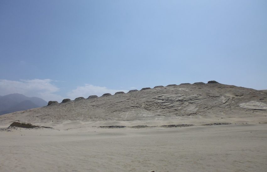
If Poverty Point has widened your sense of what early people could do, there are plenty more places that will keep stretching it. For other monuments raised by determined communities, wander to Stonehenge on Salisbury Plain, the tomb of Newgrange in Ireland, and the The Megalithic Temples of Malta. If it’s astonishing age you want, few things rival Göbekli Tepe and Karahan Tepe in Turkey, carved before farming began, or the painted caves that hold The World’s Oldest Art. For the birth of cities, visit Uruk and Sumer in Mesopotamia, Jericho in the Jordan Valley, the water-planned streets of Mohenjo-daro and Dholavira in the Indus Valley, and the giant Neolithic towns of Cucuteni-Trypillia in eastern Europe. For settled Neolithic life like the ridge-dwellers’ own, there’s Çatalhöyük in Anatolia and Skara Brae in Orkney. And for the deep past of the Americas and beyond, meet the desert pyramids of Caral, the eerie temple of Chavin de Huantar, the carved warriors of Cerro Sechin, the jade-carvers of Liangzhu, the palace of Knossos on Crete, and Nan Madol, a city built on a Pacific reef. Each one, like Poverty Point, is a reminder that the past is stranger and richer than we expect.
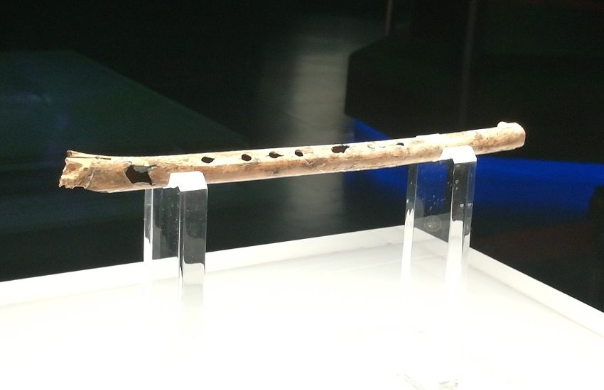
The same urge to build, trade, and connect turns up thousands of miles away at Sarazm in the Zravshan valley. If origins fascinate you, take a detour to Mehrgarh, a 9,000-year-old farming village near the Bolan Pass. If early cities fascinate you, take a detour to Tell Brak, a rival to Uruk in the Mesopotamian north. It is well worth visiting Aşıklı Höyük, the Anatolian village that pioneered a whole way of life, too. It is well worth visiting Jiahu, the Neolithic Chinese village of flutes, rice and mysterious symbols, too. It is well worth visiting Chankillo, the ancient Peruvian calendar written in stone and sunlight, too.